Published: February 20,2016
As the storm moves into the East, there should be enough cold air on the northwest side of the system for snow across parts of the Great Lakes, Ohio Valley and Appalachians.
(MORE: Next Winter Storm Ahead)
The ingredients are coming together for multiple rounds of thunderstorms from the Gulf Coast into Florida and the Southeast early in the week ahead, but there are key details still to be determined that will ultimately determine the extent and severity of such an event.
 The ingredients may come together for some severe thunderstorms early next week.
Severe Weather Outlook
Tuesday- A powerful jet-stream disturbance surges into the southern Plains
- Severe storms may flare up in parts of central and east Texas, spreading into Louisiana, Mississippi and possibly southern Arkansas.
- Damaging winds, hail and tornadoes are possible.
- A line of severe thunderstorms may continue surging east ahead of the advancing cold front across the Deep South from Mississippi and Alabama to the Carolinas.
- Damaging thunderstorm winds would be the biggest threat, however, tornadoes are also a possibility, if instability is high enough, both within the squall line and in any individual thunderstorms ahead of the line.
(MORE: View National Interactive Radar Map | Difference Between a Watch and a Warning)
The 2016 Severe Season So Far
Severe thunderstorm activity, including tornadoes, has been off to a quicker start in 2016 than what we had seen over the prior two years.(RECAPS: Groundhog Day Outbreak | Mid-February Severe Storms)
The month of February has already witnessed two tornado outbreaks across the Gulf Coast states, bringing the preliminary tornado count for the year to at least 74. This is actually near or slightly below the 2005-15 average about just over 80 tornadoes through mid-February.
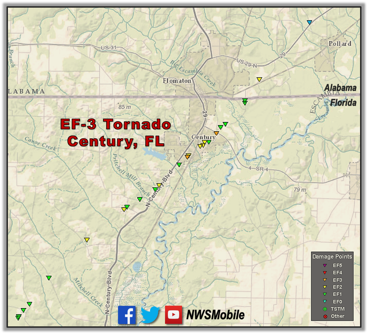
DETAILS from our damage survey of the February 15 EF-3 Tornado in Century, FL: http://weather.gov/mob/?n=20160215_tornado … #alwx #flwx
(MORE: President's Day Severe Weather Event)
There have also been multiple other damaging tornadoes to the south and east across the Florida peninsula since January.
The ongoing El Niño may be an factor in the onslaught of severe weather across the Sunshine State. The National Weather Service has said that El Niño creates favorable conditions for winter tornadoes in Florida.
(MORE: El Niño Means More Florida Tornadoes?)
El Niño has been gradually weakening, but it is difficult to speculate how this may influence the spring severe weather season with much certainty.
Stay tuned to weather.com for the latest severe weather and tornado information.
(MORE: Tornado Central)
Snapped An Awesome Shot? Share Your Photo!
If you crave pictures of severe weather, you've found your home here. Upload your photos or video (taking care to only take photos and videos from a safe location) to us and share your experience!(PHOTO/VIDEO GALLERIES: Severe | Storms)


No comments:
Post a Comment