Tuesday, May 31, 2016

Strong storms to take aim at Chicago, Minneapolis and St. Louis into midweek

By , AccuWeather.com Senior Meteorologist
May 31,2016; 9:44PM,EDT
 
 
The potential for locally dangerous and disruptive thunderstorms will exist over the Midwest into Wednesday evening.
A storm spinning southeastward from Canada will allow a sweep of cool, dry air to collide with warm, moist air from the Gulf of Mexico through midweek.
Following locally damaging thunderstorms over parts of the central and northern Plains on Monday night, severe weather will shift farther east over the North Central United States.
Severe thunderstorms will erupt over a more densely populated and heavily traveled part of the nation through Wednesday.

"The greatest threat from the storms through Wednesday will be for damaging wind gusts and sudden, blinding downpours," according to AccuWeather Lead Storm Warning Meteorologist Eddie Walker.
Small hail is also possible.
"While the threat for tornadoes is minimal, a couple of the strongest storms could produce a short-lived tornado either day," Walker said.
RELATED:
AccuWeather severe weather center
North Central United States interactive radar
2016 US summer forecast

Into Tuesday night, the risk of locally severe storms will extend from Wisconsin to Iowa and northern Missouri.
During Wednesday, the potential for strong to locally severe storms will extend from much of the Lower Peninsula of Michigan to southeastern Missouri.

On Wednesday, the storms could affect the metro areas of Chicago, Milwaukee and St. Louis. Storms could survive the trip to Detroit and Indianapolis during Wednesday night.
People should be prepared for travel delays, especially where storms approach major airports during their peak intensity, during the late afternoon and evening hours.

Tropical system may form in northwestern Caribbean, eastern Gulf of Mexico next week

By , AccuWeather.com Senior Meteorologist
May 31,2016; 9:42PM,EDT
 
 Bonnie unleashed tropical downpours across the Carolinas on Memorial Day weekend, leading to flooding.
Areas from Central America to southeastern Mexico, western Cuba and southern Florida will be on alert into next week as a tropical system may form.
The window for tropical development will reopen about a week after the formation of Tropical Depression 2, which went on to become Tropical Storm Bonnie, near the Carolina coast over Memorial Day weekend.
"We are suspicious about the area near Central America because it is in a region where we often see tropical development during June," according to AccuWeather Hurricane Expert Dan Kottlowski.

Water temperatures in the vicinity are in the lower to middle 80s F (27 to 30 C), which are warm enough to sustain a tropical system.
Warm waters alone are not enough to cause a tropical system to form.
An area of showers and thunderstorms associated with a weak system is forecast to form and drift westward across the Caribbean Sea later this week.

Provided winds aloft remain light over the region, a slow spin could take shape with the showers and thunderstorms.
As a front sags into the Gulf of Mexico and Florida during next week, steering winds could guide that disturbed area toward the northeast, perhaps over western Cuba, southern Florida and the Bahamas.
"Development can sometimes occur in the vicinity of a front that sags into or near the tropics," Kottlowski said.
RELATED:
AccuWeather hurricane weather center
'Cold blob' to be a wild card in the 2016 Atlantic hurricane season
Atlantic basin satellite loop

"However, because the system has not formed yet and it is likely to remain weak into early next week, a definitive track cannot be ascertained just yet," Kottlowski said. "It is merely something to keep an eye on."
Torrential downpours, gusty squalls and rough seas would be the initial concerns for a tropical system in the early stages of development. Downpours associated with the area of disturbed weather could soak Florida by early next week.
In addition to the potential formation of a tropical system within a few hundred-mile radius of Havana, Cuba, early next week, a weak system forecast over the central Caribbean will also be monitored into this weekend.
"The central Caribbean feature is likely to travel northward near Puerto Rico and Hispaniola but turn northeastward over the Atlantic Ocean and away from land from Saturday to Sunday," according to AccuWeather Senior Meteorologist Andrew Mussoline.
The system could enhance downpours in parts of Puerto Rico and Hispaniola late this week.
The situation in the tropical Atlantic basin does not warrant changes to travel itinerary at this time. However, interests in the region should continue to monitor the area for potential adverse weather conditions beginning this weekend.
Should either area of disturbed weather become organized and gather enough strength, the next name on the list of tropical storms and hurricanes for the 2016 Atlantic season is Colin, following Tropical Storm Bonnie.
"While Hurricane Alex formed during January 2016, it is probably more accurate to consider the system as the tail end of the 2015 season, rather than an early storm for the 2016 season," Kottlowski said. "We are not figuring Alex into the AccuWeather 2016 Atlantic hurricane season forecast as a result."
 

Multiple-day deluge to instigate flooding across Texas this week

By Renee Duff, AccuWeather.com Meteorologist
May 31,2016; 9:36PM,EDT
 
 
Rounds of heavy thunderstorms will raise the risk of flooding across the south-central United States into Friday.
A system crawling eastward will induce daily doses of flooding rain and storms across Texas and Oklahoma throughout the week.
Texas, an area that has been inundated with heavy rain over the past several weeks, could be at risk for major flooding from these storms, AccuWeather Meteorologist Brett Rathbun warned.
"Some parts of Texas have received between 150 and 200 percent of their normal rainfall since the start of the year," Rathbun explained.

Any rainfall during this week's deluge will struggle to soak into the water-logged soil.
The heaviest storms are expected to impact Oklahoma and central and western Texas through Wednesday night, before shifting into eastern Texas, including Houston, by Thursday.
A few of the strongest storms could produce large hail and locally damaging winds.
While the threat for flooding will shift south and east of Oklahoma City on Thursday, lingering pop-up thunderstorms could delay the opening games of the 2016 Women's College World Series.
A couple of inches of rain could fall in as many hours under the heaviest storms.
Under 2 inches of rain in one hour will be enough to cause flash flooding in most of central Texas.
RELATED:
AccuWeather severe weather center
South Central United States interactive radar
2016 US summer forecast

Total rainfall amounts could exceed half a foot in some locations by the end of the week.
Residents and travelers should prepare for delays on the roads and in the air throughout the week.
Already swollen streams and rivers can quickly overflow their banks and flood neighboring roads and lands. Road closures are possible.
Motorists are reminded to turn around and find an alternate route whenever a flooded roadway is encountered to avoid a potentially life-threatening situation.
Rain may not be in a hurry to leave, even as the weather pattern changes a bit beyond this week.
"Dry air will push southward over a large part of the southern Plains next week," according to AccuWeather Senior Meteorologist Alex Sosnowski.
"However, air moist enough to produce daily showers and thunderstorms may linger over central and southeastern Texas during much of next week," Sosnowski said.

Election 2016: Low humidity to boost California voter turnout; Cool weather to increase turnout in New Jersey

By Randi Ivler, AccuWeather Staff Writer
May 31,2016; 9:33PM,EDT
 
 
The next round of primary elections will take place on June 7 with six states heading to the polls.
New Jersey, California, New Mexico, Montana and South Dakota will hold primaries throughout the day. North Dakota will hold a Democratic caucus.
While dry weather is in store for most of New Jersey, a shower or two can't be ruled out for northern parts of the state. Highs will be in the mid-70s F, according to AccuWeather Meteorologist Evan Duffey.

Based on past weather and voting trends, lower temperatures as forecast for the primary are proportional to a higher voting turnout for the state, according to AccuWeather Business Intelligence Analyst Tim Loftus. The research Loftus conducted utilized voting data from L2.
On the West Coast, California will remain seasonable and quiet for the primary.
Highs are expected to hover in the 60s near Los Angeles and San Francisco.
Spanning the state inland, however, heat will persist. Highs in the 80s, 90s and 100s are in store for interior areas.
According to Loftus, past trends indicate that the expected lack of humidity is favorable for voters in the state.

In New Mexico, temperatures are forecast to range from the 70s to the 90s.
In Santa Fe and other northern, mountainous areas of the state, temperatures will rise into the 80s. Thunderstorms are possible in the region.
The southern deserts will be the hottest, with isolated storms.
RELATED:
Northeast regional radar
Southwest regional radar
North central regional radar

Montana will experience humid weather with temperatures in the 80s and the chance for scattered showers. Storms may erupt across the western part of the state, including in Helena, during voting hours.

Temperatures will reach into the 90s in the eastern part of the state.
Storms in both North and South Dakota are possible, but mostly dry conditions are expected. Temperatures will range in the middle to high 80s from Sioux Falls, South Dakota, to Bismarck, North Dakota.
Voters in the northernmost corner of North Dakota will see temperatures in the 70s, right around average for this time of year.

Rain suspends French Open on Tuesday following first wash-out since 2000

By , Senior Meteorologist
May 31,2016; 9:24PM,EDT
 
 
See larger image below.
Rain suspended play at the French Open on Tuesday, one day after rain caused the first complete cancellation of matches since 2000.
Rain on Tuesday morning forced officials to delay the start of the day's matches. Play resumed shortly after 12:00 CEST, but more rain and delays followed with an eventual suspension was announced at around 19:00.
The match between Serena Williams and Elina Svitolina are among those that have been postponed until Wednesday.

Court covers were removed at the French Open on Tuesday, May 31, 2016, after rain delayed the start of the day's matches until shortly after 12:00 CEST. Another delay followed within the next hour. (Twitter Photo/@rolandgarros)
Wednesday will not be as wet, and the potential for rain delays will dramatically lessen. It will still be mostly cloudy with another shower or two, but most of the showers will occur during the morning. Any shower in the afternoon will be brief and light before more numerous showers will return in the evening.
Matches will go on if it's raining, as long as it's light rain, AccuWeather Senior Meteorologist Bernie Rayno said.

"If the court is damp and cool, the court plays slower. Tennis balls get heavier and the overall conditions slow down," Rayno said.
After a cool end to May, temperatures will return to a more seasonable high of 20 C (68 F) on Wednesday.
RELATED:
11 people hit by lightning in Paris park
MinuteCast® for your location
Interactive France weather radar

The threat for delays will remain low into Thursday as showers in the morning should clear Paris for the afternoon.
A stubborn storm system will keep northern France unsettled with a couple of showers into this weekend. There could be a brief delay, but any interruptions to play would be less than what the tournament faced earlier this week.
Spectators wait for matches to start for the French Open Tennis tournament at the Roland Garros stadium, Monday, May 23,2016, in Paris. Showers over Paris on Monday have forced the organizers to delay the start of play. (AP Photo/Alastair Grant)
The rain that washed out play on Monday brought the monthly total in Paris to 170.2 mm (6.70 inches). According to data obtained from Météo France, May 2016 has surpassed May 1922 and its 132.7 mm (5.22 inches) as the wettest May on record.
Monday was the wettest day of the month with a total of 52.9 mm (2.08 inches) of rain.
"Monday's rain came from the thunderstorms in southwestern Germany on Sunday that rotated around an area of low pressure over Luxembourg," AccuWeather Meteorologist Tyler Roys said. The thunderstorms triggered devastating flooding in Germany.
While the heaviest rain has left Paris, Roys is concerned about river levels continuing to rise in the coming days.
"With the amount of rain that fell over the Paris region over the last 24-36 hours, rivers levels rose," he said. "And in areas that saw some of the heaviest rain between Orléans and Auxerre, rivers reached over their banks. This will travel northward towards Paris over the next couple of days."
Content contributed by meteorologists Eric Leister and Adam Douty.

National Temperature and Rainfall Extremes for May 31,2016 from accuweather.com

As of 11PM,EDT/8PM,PDT


Daily U.S. Extremes

past 24 hours

  Extreme Location
High 113° Death Valley, CA
Low 25° West Yellowstone, MT
Precip 2.95" Llano, TX

World Weather Hot Spot for May 31-June 1,2016 from accuweather.com

Castro County,Texas,USA: Severe weather;received hail that was up to 2.75 inches in diameter during severe storms on Memorial Day Monday (May 30,2016)

WeatherWhys for May 31,2016 from accuweather.com

On this date back in 1889, heavy rainfall from persistent thunderstorms caused the South Fork Dam to collapse, sending a 40-foot wall of water down into the city of Johnstown, Pennsylvania. This massive flood ended up killing over 2,200 people.

At Least 4 Dead as Heavy Rains Trigger Severe Flooding in Germany

Eric Chaney
Published: May 31,2016


At least 4 people are likely dead as a result of heavy rains in Germany that triggered severe flooding.
In Schwaebisch Gmuend, a firefighter and a man he was trying to rescue were sucked into a flooded underpass. Both men were presumed dead, though their bodies hadn't yet been recovered Monday, police said.
"As far as we can humanly judge, both are dead," a spokesman for the state interior ministry in Stuttgart told the Sydney Morning Herald.
"In the last week southern Germany has seen 400+ percent of its average rainfall," said weather.com meteorologist Jonathan Belles. "It appears that Schwaebisch Gmuend is in a valley, so that may have played a roll in that water may have pooled in the valley."
(MORE: 35 Injured After Lightning Strikes Children's Soccer Match in Germany)
The body of a third victim was found in a flooded garage in Weissbach near the city of Heilbronn. And in Schorndorf, near Stuttgart, a train fatally struck a 13-year-old girl as she sheltered from the rain under a railway bridge Sunday evening.
A 12-year-old boy who was with her was unharmed, but is receiving psychiatric support after the incident, the Morning Herald reported.
In the small town of Braunsbach, two streams burst their banks, unleashing floodwaters that destroyed one house, damaged several others and left streets strewn with debris.
Much of Germany experienced heavy rainstorms over the weekend. The heavy downpours also affected the state of Bavaria in the southeast, causing severe damage to properties in the area of Mittelfranken, where Nuremberg is situated.
Several residents in the Bavarian town of Frankenhoehe described the scenes to the Morning Herald as "like after the war".
Martin Jonas, a meteorologist at the German Weather Service, told the paper the unusually slow movement of the rainstorms had led to the severe flooding.
"The unusual thing about yesterday was that we were in a situation of relatively low pressure," Jonas said. "For that reason, the intensive downpours stayed above the same areas for a relatively long time.

6 Dead, At Least 3 Missing as Flooding Soaks the Plains; Rivers Still Rising Toward Historic Crests

Eric Chaney
Published: May 31,2016

Six people have died and possibly four more are missing as the Plains states continue to deal with flooding brought on by severe storms that repeatedly pounded the region last week.  Rivers in the region are cresting at historic highs, prompting numerous rescues and closures of area waterways.
The two latest flooding victims were found on Sunday. Florida Molima was riding in a car with two others near Comfort, Texas, when the vehicle was swept from the street by a flooded creek. The 23-year-old was missing until her body was found around 11 a.m. Sunday about 8 miles downstream.
(FORECAST: Severe Weather Outbreak Possible, Including Tornadoes, Thursday in the Plains States)
A body was found also in Travis County, Texas, by a crew conducting an aerial search. It is unclear whether the victim is one of the two motorists still reported missing in the area. They were reported missing early Friday after their vehicle was washed away by flash flooding. A 10-year-old boy in Parker County, Texas, who was swept into the Brazos River remains missing.
/
Saturday officials in Washington County, Texas, announced that the bodies of two missing motorists had been found in separate parts of the county located between Austin and Houston. One was identified as Darren Mitchell, who posted a photo from inside of his flooding vehicle to Facebook.
The Brenham Fire Department told ABC 13 that one person died in a trailer home in Chappell Hill, Texas. The home was flooded as storms stalled over the Brenham area Thursday night. Another person died of a heart attack after their vehicle was swept away by the flood waters on Gayhill Road in Brenham, Texas.
High waters covered roadways and prompted evacuations across the region Thursday, Friday and Saturday. Tornadoes that caused damage were also reported in the Lone Star State and Kansas, where twisters had been spotted for three consecutive days.
Here are the latest impacts from these storms.

Texas

The Kingdom Heights community west of Houston was completely cut off by floodwater Tuesday morning. The Fort Bend County Sheriff's office reported that there is no way in or out of the community until the water recedes.
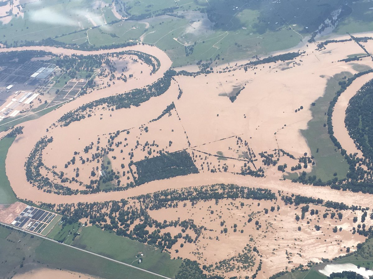
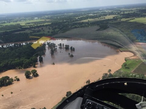
The Brazos River was expected to crest at 53.5 feet on Tuesday in Fort Bend County, three feet above the previous record and topping a 1994 flood that caused extensive damage. The river's continued rise after four days of torrential rain has filled all 11 of the reservoirs fed by the Brazos at 95 to 100 percent capacity.
Rain rain go away- the Brazos River, just northwest of

Rising water on the Colorado River led authorities to close Lake Austin, Lady Bird Lake, and the rest of the river downstream of Longhorn Dam.
"We apologize for the timing and inconvenience but this is beyond our control," the Austin Fire Department said in a statement. "Obviously, safety comes first."
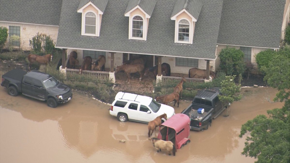
In Simonton, the Brazos flooded one home so badly that the residents were forced to bring their horses to the front porch of the house, to keep them out of the floodwaters, KHOU reports.
Flooding forces horses to the house. The front porch is now the corral in Simonton, TX.

Sunday a crew aboard a county STAR Flight helicopter discovered a body in Travis County.
The body was found on the north end of a retention pond near the Circuit of the Americas auto racing track, near where two people were reported to have been washed away by flooding early Friday, the Associated Press reports. It's unclear whether the victim is one of the missing.
The exact details of the incident are still unclear, but reports to police said the individual's car had been swept off the road and one person was seen hanging onto a pole around 2:30 a.m, according to KXAN. There may have been another person with them.
The bodies of two missing motorists were found Saturday in separate parts of Washington County, located between Austin and Houston.
Washington County Judge John Brieden told the Associated Press that the body of Pyarali Rajebhi Umatiya, 59, of College Station, was found in a submerged vehicle. The body of Darren Charles Mitchell, 21, a National Guardsman from Navasota, was found downstream from where his overturned truck had been located earlier.
Prior to his vehicle being found, Mitchell posted to Facebook when his car was in flood water, "And all I wanted to do was go home." Friday morning, officials found his truck overturned in water near 105.
Earlier in the week, one person was found dead in a mobile home that was swamped with floodwaters and a second person was found in a vehicle that had gone off of a road was submerged in a ditch.
Saturday officials in Parker County searched for a 10-year-old boy that went missing after being swept into the Brazos River, CBS DFW reports. The boy had been fishing with friends when he fell into the water.
Texas prison officials had to evacuate about 2,600 inmates from two prisons along the rain-swollen Brazos River due to expected flooding Sunday, the Associated Press reports. A brawl between inmates and correctional officers broke out Saturday after flooding at a facility about 70 miles northwest of Houston caused a power outage.
The incident occurred around 10 p.m. Saturday at the Luther Unit prison in Navasota. Flooding caused the prison to switch to its emergency power generator, which malfunctioned and caused the outage. Correctional officers ordered inmates back to their cells, but some refused to comply. Texas Department of Criminal Justice spokesman Jason Clark estimated as many as 50 inmates in the 1,300-inmate prison were involved. Three were sent to a hospital; one for stitches and two for unrelated medical issues.
Inmates at the Terrell and Stringfellow Units in Rosharon were moved Sunday morning to other prisons with available space.
Flooded rivers and creeks throughout the state prompted officials to ask for mandatory and voluntary evacuations of homes. Most of the 800 residents of Simonton were ordered to evacuate Saturday due to the rising levels of the Brazos, AP also reports. In the Houston-area Northwood Pines subdivision, families were asked to voluntarily evacuate their homes and apartments Saturday due to rising levels of a nearby creek.
Simonton area of the . Pics from FBCSO helicopter. OK to use/share.

@KHOU @NWSHouston @KPRC2 Rescue complete. 2 adults & 4 dogs

Five people were rescued from the roof of a home by helicopter near Austin. Several Austin neighborhoods were evacuated early Friday morning, KXAN reports, and drivers were asked to stay off roads in Bastrop County due to the dangerous situation of rising waters along the Colorado River.
Highway 71 was closed at the Travis/Bastrop County Line due to water over the roadway, KXAN reported. Washington County saw 36 high water rescues Thursday and State Highway 36 and U.S. 290 became flooded and impassable, NWS reports.

Kansas

An 11-year-old boy is missing after falling into a creek on Friday night, the Wichita Eagle reports. He fell into the rushing waters of Gypsum Creek and was swept away as his friends tried to rescue him, Wichita Fire Battalion Chief John Turner said. Dozens of fire crews and policemen searched into the night until the waters of the creek receded too far for boats to enter it, and searches resumed on Saturday morning. Turner said it is now considered a body recovery mission.
Several roads are closed in the area due to the flooding, the Kansas City Star reports.
A tornado was reported in Wamego Thursday, and photos and videos of damage surfaced online.
Trees were uprooted and cars were destroyed by the downed timbers, reports KSNT News. A tree also collapsed on top of a home.
This is a developing story; please check back for frequent updates.

Landspout Tornado Caught on Camera in Plains

Eric Chaney
Published: May 31,2016


A towering landspout tornado hit Colorado Monday afternoon near the small town of Peetz, before crossing the border into Nebraska and passing by the town of Sidney.
"A landspout tornado differs from most tornadoes in that it is not associated with the main rotation in the thunderstorm," said weather.com meteorologist Brian Donegan. "They most often occur in drier areas with a lot of low-level instability."
Though typically smaller and weaker than most tornadoes, they can still produce major damage if they run into a highly-populated area, said Donegan.  In this case, the tornado struck an area with a very low population with not much infrastructure around, but the National Weather Service did report some damage to a farm near Peetz.
According to the National Weather Service, there were three landspout tornadoes reported in that area. The largest was impressive, tearing up dirt at its base and towering high into the clouds. Numerous people stepped out to capture the twister in still photos and video.
Landspouts occur most often on the High Plains, the NWS said and are almost always manifested as a narrow, rope-like funnel of condensation. They are difficult to forecast and detect using radar because the rotation is usually small and short-lived. 

Half of Thailand's Weather Sites Break All-time Heat Records in 42 Days

By: Christopher C. Burt , 9:09PM,GMT on May 30,2016


Half of Thailand's Weather Sites Break All-time Heat records in 42 Days

All-time national heat records have been set this past April and May in India, Thailand, Laos, Cambodia, and the Republic of Maldives. The unprecedented heat has killed hundreds in India and dozens in Thailand so far. But nothing in the record books can compare to what has recently occurred in Thailand: a large country with over 120 meteorological sites that has seen half of its official weather stations break their all-time heat records. Here are the details.

We knew the ‘super’ El Nino this past year would have a big affect on the world’s climate. It did not produce the hoped for big rains in California but it did produce the heat and drought in Southeast Asia as forecast. Of all the countries effected the most by this event Thailand has proven to see something exceptional weather-wise: more than half of all the country’s official weather sites reported their all-time heat records during the months of April and May. Thailand’s meteorological service only dates back to 1951 but it is a large country with over 120 official observation sites and a sophisticated observation network. Thus it is truly amazing that at least 66 of these 120 sites measured their hottest temperature on record during the brief period of April 10-May 22.

Before I go into the details about Thailand, here is a brief recap of the new national all-time heat records set since April 1st (you will recognize some of the information below from my previous blog):

India

On May 19th a weather site in Phalodi, Rajasthan registered a 51.0°C (123.8°F) temperature, the highest temperature ever measured in India. The previous record was an unofficial 50.6°C (123.1°F) at Pachpadra, Rajasthan on May 25, 1886. A similar reading was reported from Alwar on May 10, 1956 and considered official by the Indian Meteorological Department however, according to climatologist Maximiliano Herrera, this figure was inflated by over exposure of the instruments and was not consistent with other sites in the surrounding area. The highest reliably measured temperature previous to the Phalodi record was 50.0°C (122.0°F) at Ganganagar on June 14, 1934 and also at Dholpur on June 8, 1995. Many cities in India broke their all-time heat records this past May including 50.2°C (122.4°F) at Churu, 49.5°C (121.1°F) at Bikaner, 48.8°C (119.8°F) at Jodhpur, 48.0°C (118.4°F) at Ahmedabad, and 46.7°C (116.1°F) at Bhopal. For a complete list of all the records see Maximiliano Herrera’s web site.

Temperatures in India have moderated a bit recently as the monsoon season approaches, which appears to be on schedule this year.


A map illustrating the dates of the normal onset of the monsoon in India (red-dashed lines) and where the actual advance lines have been so far this season (green solid lines). Map courtesy of IMD (Indian Meteorological Department).

The warmest reading so far observed anywhere in Asia this spring has been a 52.2°C (126.0°F) at Larkana in Pakistan on May 19th.

Cambodia

National all-time record high of 42.6°C (108.7°F) set at Preah Vihea on April 15th. This surpassed the record set just two days previously at Bantey Ampil (42.2°C/108.0°F on April 13th). Prior to this year, the maximum measured temperature in Cambodia was 41.4°C (106.5°F) at Stoeng Treng in 1960. The capital city of Phnom Penh also measured its highest temperature on record with a 41.0°C (105.8°F) reading and about half a dozen other cities and towns saw temperatures peak above the previous national record of 1960!

Laos

National all-time record high of 42.3°C (108.1°F) set at Seno on April 13th. This surpassed the former record of 42.0°C (107.6°F) record at Savannakhet in March 1933. An all-time national record high minimum temperature was measured at Takhek on April 13th when the low fell to only 30.5°C (86.9°F).

Republic of Maldives

In the Maldives a national record high of 35.0°C (95.0°F) was observed at Hanimadhoo on April 30th edging out the previous record of 34.8° (94.6°F) set at Kadhdhoo on March 27, 1999 (actually, earlier in the month, Hanimadhoo reached 34.9°C on April 16th).

Thailand

Of all the nations affected by the heat waves over the past two months Thailand has probably experienced the most widespread anomalous temperature departures. Never before in modern history has the country (at least since the establishment of its meteorological department in 1951) experienced such a widespread and prolonged heat event. Every region of the country experienced all-time record high temperatures: from Hat Yai in the far south to Mae Hong Son in the far north and Ubon Ratchathani in the far east. Every region and province saw sites exceed previous observed record maximum temperatures and every type of environment was affected: high mountains (as represented by Doi Ang Kang at 1530 m/5000’) and islands, such as the iconic beach resorts of Phuket and Ko Samui.


A simplified map of Thailand showing the location of some of its major towns and cities. As you can see from the table below, most of these sites broke their all-time heat records. Thailand is approximately 513,000 sq. kl (200,000 sq. miles), considerably larger than Germany and has a population of 68 million. It extends over 1600 kl (1000 miles) north to south between 5°N to 21°N latitude.


A list of all the sites that observed or tied all-time record high temperatures in Thailand between April 10th and May 22nd. The towns with a ‘2’ next to them mean these sites have two observation sites in the TDM (Thai Meteorological Department) database: one the official town or airport site and one an ‘agro-meteorological’ site. There appears to be a total of 120 sites represented in the TMD database.

66 sites out of the 120 appear to have set or tied their all-time heat records during the April 10-May 22 time frame: that is 55% of all the weather stations in the country. I know of no other nation the size of Thailand and with the extensive network of weather sites, that has ever seen this large a proportion of their weather stations observe all-time heat records over such a brief span of time. A caveat is that many of the sites listed in the table above have relatively short PORs (periods of record) in some cases dating back to just the 1990s or 2000. Curiously, Bangkok, Thailand’s largest city and one of the hottest metropolises in the world (in terms of average annual temperature) failed to top its record of 40.8°C (105.4°F) set back on May 22, 1983 (at its Don Muang Airport site). The warmest reading this spring has been a modest 39.9°C (103.8°F) on April 23rd. The heat wave has subsided somewhat now as the rainy season gets underway. Hopefully, the rains this summer will make a dent in the serious drought that has been affecting the country and much of Southeast Asia.

KUDOS: To Maximiliano Herrera for much of the above information. For a more comprehensive look at all the temperature records broken so far this year see his web site here.

Christopher C. Burt
Weather Historian

Haboob, Sandstorm, Dirt Storm? The Answer’s Blowing in the Texas Wind

By: Bob Henson , 3:02PM,GMT on May 31,2016
Just as people come to America from around the world, so do the terms we use to describe wind--although some would prefer that the nation stick to homegrown meteorological verbiage. A good case of this linguistic angst emerged on Sunday evening with the arrival of a dramatic haboob in Lubbock, TX. Rain-cooled outflow from strong thunderstorms over the Texas Panhandle pushed across the Lubbock area from the northeast, plowing up a wall of dust that was captured on video from Lubbock’s National Weather Service office (see bottom of this post). The temperature at the Lubbock NWS office dropped from 82°F at 7:03 pm CDT to 64°F at 7:10 pm CDT, with winds gusting to 56 mph and visibility down to 0.5 mile in rain and blowing dust.

Haboobs are distinct from ordinary blowing dust because of the thick dust shoveled upward--sometimes more than half a mile--by the relatively cool, dense air at the leading edge. After a haboob’s front edge moves past a given location, the airborne dust quickly abates. In contrast, blowing dust refers more generally to the situation where hours of strong wind can kick up broad areas of reduced visibility, often for hours at a time during dry, hot water. Extreme blowing dust episodes, or duststorms, typically cover a large area, as opposed to the narrow zone of a haboob. Sandstorms occur when sand grains are blown across the lowest few feet of the landscape, usually in true deserts rather than semiarid regions.


Figure 1. Intense thunderstorms located north of Lubbock at 6:15 pm CDT Sunday, May 29, 2016, pushed an outflow boundary (the faint line south of the storms) and associated haboob (not visible on radar image) toward the Lubbock area. Image credit: NWS/Lubbock.


Figure 2. Screenshot of the NWS/Lubbock Facebook entry noting that a haboob was approaching Lubbock International Airport from the north at 6:57 pm CDT Sunday, May 29, 2016. Image credit: NWS/Lubbock.


“Haboob” is derived from the Arabic word “habb” (wind), according to the AMS Glossary (American Meteorological Society). That fact has led to unrest on social media more than once over the last few years. The use of the term in media to (correctly) describe a massive haboob that plowed from southeast Arizona to Phoenix on July 18, 2011, caused enough of a local outcry to prompt an article about the controversy in the New York Times. When the NWS Lubbock office posted warnings on its Facebook page about an approaching haboob on March 11, 2014, many readers protested; when the warning was shared on a local TV station’s Facebook page, there were calls for the broadcast meteorologist to be fired. History repeated itself last Sunday when the approaching haboob was mentioned on the NWS Lubbock webpage. One commentor asked the NWS to “use the American term please.” Another said “I’ll find another weather service.”

What’s kicked up the haboob storm?
Why did it take until recently for residents of the Southwest U.S. to get excited about a once-obscure term? For one thing, intense, recurring drought over the last few years, coupled with record-warm, landscape-drying temperatures, could be making the region more prone to haboob formation at times, although this would be a difficult thing to quantify. Another factor: with their adoption of Twitter and Facebook, NWS offices now have a direct line to the public, together with the ability to introduce semi-technical terms that otherwise might not have made it through the filter of mass media. The ascent of online media has also made it more tempting for journalists and pundits to coin or promulgate terms that have a chance of going viral. Already, the age of social and online media has popularized “polar vortex,” “derecho,” and several others. It’s easy to see why a sensitized layperson might feel that certain foreign-sounding terms are being suddenly foisted on them.

Of course, there is Arabic influence throughout the world of scientific terminology. Every time you use 3, 5, or 8, you’re using an Arabic numeral. And though it’s only recently made it into public discourse, “haboob” is hardly a new term in the meteorological literature. As noted by Maryland weathercaster and AGU blogger Dan Satterfield, a 1925 paper in the Quarterly Journal of the Royal Meteorological Society was titled “Haboobs.”


Figure 3. The spectacular haboob that slammed into the Phoenix area on July 18, 2011, photographed in Maricopa. Image credit: wunderphotographer nukegm.

Other sources of wind names
Like the weather itself, weather words transcend national borders. The names we use in the United States for wind-related phenomena come from a wide array of sources. “Tornado” and “derecho” are both derived from Spanish (“thunder” and “straight,” respectively). The German-derived term “foehn wall” describes a wall of clouds that forms on the windward side of a mountain range, as seen from the leeward side; it’s often accompanied by a strong, mild “chinook” wind on the downwind side. “Chinook” is derived from the Native American term “Salishan”.

Even the all-American-sounding “downburst” and “microburst” were coined by a Japanese-American immigrant, the eminent meteorologist Theodore “Ted” Fujita (creator of the Fujita Tornado Damage Scale). First trained as a mechanical engineer, Fujita took a research flight in 1945 over the debris left by the bombs that struck Hiroshima and Nagasaki and observed starburst damage patterns emanating outward from the point of the bomb impact. Later, while surveying damage from the Super Outbreak of April 3, 1974, Fujita recognized similar starburst patterns, and he concluded that some of the damage must have resulted from descending wind bursts.

You’ll find a variety of haboob photos from around the world at the post filed by Jeff Masters on May 3, 2005. This was post #5 in this blog, out of 3317 posts to date!


Figure 4. Flooding at Lakeview Park in Humble, TX, on May 29, 2016. Image credit: wunderphotographer mcdsara1.

Continuing flood threat in southeast Texas this week
The National Hurricane Center issued its final advisory at 5:00 am EDT Tuesday on former Tropical Storm Bonnie, which had been declared post-tropical on Monday. High water resulting from more than 8 inches of rain in parts of South Carolina prompted the closure of Interstate 95 about 20 miles north of the Georgia border on Sunday, causing major traffic troubles. Flooding from a much larger area of heavy rain across Texas related to a stalled front and a slow-moving upper low has taken at least six lives since late last week. The Brazos River at Richmond, just west of Houston, was at a record-high flood stage of 53.19 feet at 7:15 am CDT Tuesday, and dozens of homes have been evacuated. More heavy rains are possible across southeast Texas later this week, which the Houston NWS office warns “will likely exacerbate flooding somewhere in our forecast area.”

Bob Henson

Weather Underground National Forecast for Tuesday,May 31,2016

By: nationalsummary , 10:00PM,GMT on May 30,2016


Weather Underground Forecast for Tuesday,May 31,2016

A cold frontal system will move across the Plains and the Midwest on Tuesday, while a warming trend occurs over the West Coast.

A low pressure system will shift eastward across the northern Plains and the upper Mississippi Valley. This system will usher showers and thunderstorms across the region on Tuesday. A cold frontal boundary associated with this system will stretch south southwestward from the upper Mississippi Valley to the Four Corners. Numerous clusters of rain and thunderstorms will fire up along and near this frontal boundary. Locally heavy rain is expected for parts of the upper Midwest, the Mississippi Valley and the southern Plains. Prolonged heavy rain will bring threats of flash flooding to northwest Michigan, Wisconsin, southeast Minnesota, northwest Illinois, eastern Iowa, southwest Missouri, southeast Kansas, northwest Arkansas, Oklahoma and Texas. A ridge of high pressure will park itself over the West Coast. This high pressure system will keep most areas west of the Continental Divide dry on Tuesday. Afternoon temperatures will spike 10 to 20 degrees above normal.

Back east, showers and thunderstorms will wind down as a cold front moves over the western Atlantic. The remnant low associated with Tropical Storm Bonnie will keep stormy weather in the picture for the Southeast. Flash flooding will remain a threat for eastern North Carolina.

This Date in Weather History for May 31,2016 from weatherforyou.com

Weather History
For Tuesday,May 31,2016


1889 - The Johnstown disaster occurred, the worst flood tragedy in U.S. history. Heavy rains collapsed the South Fork Dam sending a thirty foot wall of water rushing down the already flooded Conemaugh Valley. The wall of water, traveling as fast as twenty-two feet per second, swept away all structures, objects and people. 2100 persons perished in the flood. (David Ludlum)
1941 - Thunderstorms deluged Burlington KS with 12.59 inches of rain to establish a 24 hour rainfall record for the state. (The Weather Channel)
1985 - Severe thuunderstorms spawned forty-one tornadoes across the Lower Great Lakes Region and southeastern Ontario which killed 74 persons. (Storm Data)
1987 - Thunderstorms in New England produced wind gusts up to 90 mph at Worcester, MA, and Northboro, MA, and hail an inch and a half in diameter at Williston, VT. Unseasonably hot weather prevailed in the northeastern U.S. The afternoon high of 94 degrees at Portland, ME, was a record for the month of May. (Storm Data) (The National Weather Summary)
1988 - Hot and humid weather prevailed in the eastern U.S. Thirteen cities reported record high temperatures for the date. Cape Hatteras, NC, reported their first ninety degree day in May in 115 years of records. "Dust buster" thunderstorms in northwest Texas drenched Amarillo with more than three inches of rain. (The National Weather Summary)
1989 - Thunderstorms produced severe weather and torrential rains in northern Indiana, northern Ohio and southern Lower Michigan. Saint John IND was drenched with four inches of rain in two hours, and Woodland MI was deluged with two inches in twenty minutes. Pittsburgh PA reported a record 6.55 inches of rain for the month of May, with measurable rain reported on twenty-five days during the month. (The National Weather Summary)
1990 - Afternoon and evening thunderstorms developing along a warm front produced severe weather from northwest Texas to southeastern Louisiana. The thunderstorms spawned sixteen tornadoes, including thirteen in northwest Texas. One tornado hit the town of Spearman, TX, causing more than a million dollars damage, and seven other tornadoes were reported within twenty-five miles of Spearman. Thunderstorms over northwest Texas also produced baseball size hail at Monahans, and wind gusts to 80 mph at Paducah. (The National Weather Summary) (Storm Data)

Monday, May 30, 2016

National Temperature and Rainfall Extremes for May 30,2016 from accuweather.com

As of 11PM,EDT/8PM,PDT


Daily U.S. Extremes

past 24 hours

  Extreme Location
High 113° Death Valley, CA
Low 25° Antero Reservoir, CO
Precip 6.94" Hatteras, NC

New York City metro-area forecast for May 30-July 13,2016 from accuweather.com

Here's the 45-day weather forecast for the New York City metro-area for the period of the last 2 days of May,all of June,and the first 13 days of July (May 30-July 13),2016 from accuweather.com


Tonight,May 30-31: Remaining mostly cloudy,warm,and muggy with a chance for an evening shower or thunderstorm and a low temperature dropping to 65-70 degrees,overnight.As of 11PM,EDT,it's 70 degrees and cloudy,with 93% humidity,in White Plains,NY,and it's 74 degrees and partly cloudy,with 78% humidity,in New York City.

Tomorrow,May 31: May of 2016,one of the wettest,stormiest Mays on record,ends turning quite warm and less humid,once again,with morning cloudiness giving way to some afternoon sunshine and a near record high temperature of 85-90 degrees,the light,northwesterly winds and moderate humidity levels making it feel even hotter,like it's 90-95 degrees,at times.

Tomorrow night,May 31-June 1: Remaining warm with patchy clouds and a low temperature dropping to the lower and middle 60's,overnight.

Wednesday,June 1: June of 2016 begins turning cooler and less humid than recent days with ample sunshine and a high temperature of around 80 degrees.Turning cooler than recent nights with patchy clouds and a low temperature dropping to around 60 degrees,overnight.

Thursday,June 2: Becoming mostly sunny and seasonably warm for the beginning of June with a high temperature of 75-80 degrees.Remaining warm with increasing cloudiness and a chance for a spotty late-night rain shower and a low temperature dropping to the upper 50's to lower 60's,overnight.

Friday,June 3: Turning mostly cloudy,rainy,and cooler than recent days with a scattered shower or thunderstorm possible and a high temperature of 70-75 degrees.Remaining partly cloudy and seasonably warm for the beginning of June and the end of spring,with a low temperature dropping to the upper 50's to lower 60's,once again,overnight.

Saturday,June 4: Turning much warmer,as it turns very warm,once again,with periods of clouds and sun and a chance for a rain shower and a high temperature in the lower and middle 80's,the very light, southwesterly winds and high humidity levels making it feel even hotter,like it's in the upper 80's to lower 90's,at times.Remaining mostly cloudy and warm with a low temperature dropping to 60-65 degrees,overnight.

Sunday,June 5: Not as warm with mostly cloudy skies and a chance for a couple of showers and a thunderstorm possible and a high temperature of around 80 degrees.Becoming partly cloudy,but remaining warm with a low temperature dropping to 60-65 degrees,once again,overnight.

Monday,June 6: Remaining seasonably warm for early June with periods of clouds and sun and a chance for a shower or thunderstorm continuing and a high temperature of 75-80 degrees.Becoming partly cloudy with a low temperature dropping to the upper 50's to lower 60's,overnight.

Tuesday,June 7: Remaining partly sunny and seasonably warm for early June with a chance for a rain shower and a high temperature of around 80 degrees.Becoming clear and cooler than recent nights with a low temperature dropping to the middle and upper 50's,overnight.

Wednesday,June 8: Remaining seasonably warm and pleasant with plenty of sunshine and a high temperature of 75-80 degrees,the very light,westerly winds and moderate humidity levels making it feel even warmer,like it's in the middle and upper 80's,at times.Becoming mainly clear and cool with a low temperature dropping to the middle 50's,once again,overnight.

Thursday,June 9: Remaining mostly cloudy and seasonably warm for early June and the end of spring with a high temperature in the middle and upper 70's.Remaining seasonably mild to warm with plenty of clouds and a low temperature dropping,for the third straight night,down to the middle and upper 50's,overnight.

Friday,June 10: Remaining cloudy and seasonably warm,but dry with a high temperature in the middle and upper 70's,once again.Remaining cloudy,rainy,and seasonably warm with considerable cloudiness and a chance for some spotty evening rain showers followed by some late-night rain possible and a low temperature dropping to around 60 degrees,overnight.

Saturday,June 11: Remaining cloudy,but turning rainy,stormy,raw,and unseasonably cool for the end of spring with considerable cloudiness and a chance for a stray afternoon thunderstorm and a high temperature only in the upper 60's to lower 70's.Becoming clear,but remaining seasonably mild to warm with a low temperature dropping to 55-60 degrees,overnight.

Sunday,June 12: Not as cool with a mix of sunshine and some clouds and a chance for an afternoon rain shower and a high temperature in the middle and upper 70's.Remaining seasonably mild to warm with patchy clouds and a low temperature dropping to 55-60 degrees,once again,overnight.

Monday,June 13: Turning cloudy,rainy,warm and humid with occasional rain and a chance for a thunderstorm and a high temperature of around 80 degrees.Remaining cloudy and rainy with periods of rain and a low temperature dropping to the upper 50's to lower 60's,overnight.

Tuesday,June 14: Remaining cloudy and rainy,but turning raw and rather cool for mid-June and the end of spring with a chance for a couple of rain showers followed by a heavier,steadier rain and a high temperature only in the lower and middle 70's.Remaining cloudy and rainy,but turning raw and unseasonably cool to downright chilly for mid-June with a chance for a little rain and a near record low temperature dropping to 50-55 degrees,overnight.

Wednesday,June 15: Remaining raw and unseasonably cool for mid-June and the end of spring with early clouds giving way to some sun and a high temperature of just 70-75 degrees.Becoming clear and not as chilly with a low temperature dropping to 55-60 degrees,overnight.

Thursday,June 16: Becoming mostly sunny and warmer than recent days with a high temperature in the middle and upper 70's.Becoming partly cloudy and warmer than recent nights with a low temperature dropping to the upper 50's to lower 60's,overnight.

Friday,June 17: Remaining mostly sunny,but turning much warmer than recent days with a high temperature of 80-85 degrees.Becoming clear and seasonably warm for mid-to-late June with a low temperature dropping to 60-65 degrees,overnight.

Saturday,June 18: Remaining mostly sunny and very warm with a high temperature in the lower and middle 80's,the light,sultry,northwesterly winds and moderate-to-high humidity levels making it feel even warmer,like it's around 90 degrees,at times.Turning cloudy,but remaining warm with a low temperature dropping to the middle 60's,overnight.

Sunday,June 19: Father's Day 2016 will be remaining very warm with ample sunshine and a high temperature in the middle 80's.Becoming clear and cooler than recent nights with a low temperature dropping to around 60 degrees,overnight.

Monday,June 20: The last day of the 2016 spring season will be turning mostly cloudy and cooler than recent days with a high temperature in the upper 70's to lower 80's.Becoming clear and seasonably mild to warm for late June with a low temperature dropping to the upper 50's to lower and middle 60's,overnight.

Tuesday,June 21: The first (full) day of the 2016 summer season (the 2016 Summer Solstice),will be remaining seasonably warm and dry with a mix of clouds and sun and a high temperature in the upper 70's to lower 80's,once again.Becoming clear,but remaining seasonably mild to warm with a low temperature dropping to the upper 50's to lower 60's,once again,overnight.

Wednesday,June 22: Becoming mostly sunny,but remaining seasonably warm and pleasant for very late June and the beginning of summer with a high temperature,for the third straight day,in the upper 70's to lower 80's.Becoming partly cloudy,but remaining seasonably mild to warm with a low temperature dropping,for the third straight night,down to the upper 50's to lower 60's,overnight.

Thursday,June 23: Becoming partly sunny,very warm and humid with a chance for an afternoon shower and a high temperature of 80-85 degrees.Remaining mostly cloudy,but turning a bit warmer than recent nights with a low temperature dropping to the lower and middle 60's,overnight.

Friday,June 24: Remaining very warm and humid with morning clouds giving way to some sun and a high temperature in the middle 80's,the very light,northeasterly winds and high humidity levels making it feel even hotter,like it's 90-95 degrees,at times.Becoming mainly clear,but remaining seasonably warm for very late June and the beginning of summer,with a low temperature dropping to the lower and middle 60's,once again,overnight.

Saturday,June 25: Becoming partly sunny,but remaining seasonably very warm for the beginning of summer with a high temperature of 80-85 degrees.Remaining seasonably warm with increasing cloudiness and a low temperature dropping to 60-65 degrees,overnight.

Sunday,June 26: Becoming mostly cloudy,rainy,stormy,very warm and muggy with a chance for a couple of showers and a thunderstorm and a high temperature in the middle 80's.Becoming partly cloudy,warmer and more humid than recent nights with a low temperature dropping to 65-70 degrees,overnight.

Monday,June 27: Remaining mostly cloudy,rainy,stormy,very warm and sticky with a mix of clouds and sun and a chance for a scattered shower or thunderstorm possible and a high temperature in the middle 80's,once again,the light,sultry,southwesterly winds and high humidity levels making it feel even hotter,like it's in the lower and middle 90's,at times.Remaining mostly cloudy,rainy,stormy,warm and muggy with a scattered shower or thunderstorm possible and a low temperature dropping to 65-70 degrees,once again,overnight.

Tuesday,June 28: Remaining very warm,but turning less humid than recent days,with morning clouds giving way to afternoon sunshine and a high temperature in the middle and upper 80's.Becoming mainly clear and cooler than recent nights with a low temperature dropping to the upper 50's to lower 60's,overnight.

Wednesday,June 29: Becoming mostly sunny,but remaining seasonably very warm for the end of June and the beginning of summer with a high temperature in the middle 80's.Remaining mainly clear and seasonably warm with a low temperature dropping to 60-65 degrees,overnight.

Thursday,June 30: June of 2016 ends remaining mostly sunny and seasonably very warm and pleasant with a high temperature in the lower and middle 80's.Becoming partly cloudy with a low temperature dropping to 60-65 degrees,once again,overnight.

Friday,July 1: July of 2016 begins remaining mostly sunny and seasonably very warm for very early summer with a high temperature in the lower and middle 80's,once again.Remaining seasonably warm for early summer with patchy clouds and a chance for a scattered shower or thunderstorm possible and a low temperature dropping to the lower and middle 60's,overnight.

Saturday,July 2: Becoming quite warm and humid with a mix of blazing sunshine and some clouds and a chance for a scattered shower or thunderstorm possible and a high temperature in the middle and upper 80's.Remaining partly cloudy,warm and humid with a chance for more showers and thunderstorms possible and a low temperature dropping to the lower and middle 60's,once again, overnight.

Sunday,July 3: Becoming partly sunny,but remaining quite warm and humid with a high temperature of 85-90 degrees.Becoming clear,but remaining seasonably warm for the beginning of July with a low temperature dropping to 60-65 degrees,overnight.

Monday,July 4: Independence Day (the Fourth of July),2016 will be turning mostly sunny,but remaining seasonably very warm,perfect weather for barbecues,and a high temperature in the middle 80's,the light,sultry,southwesterly winds and moderate humidity levels making it feel even hotter,like it's around 90 degrees,at times.Becoming partly cloudy and warmer than recent nights with a low temperature dropping to 65-70 degrees,perfect weather for fireworks displays,overnight.

Tuesday,July 5: Turning quite warm to hot and sticky with periods of clouds and sun and a chance for a scattered shower or thunderstorm possible and a high temperature of 85-90 degrees,the light,sultry, southwesterly winds and high humidity levels making it feel even hotter,like it's 90-95 degrees,at times.Remaining partly cloudy,seasonably warm and muggy for very early July and early summer with a chance for a spotty shower or thunderstorm possible and a low temperature dropping to 60-65 degrees,overnight.

Wednesday,July 6: Becoming mostly sunny,but remaining very warm and toasty with a high temperature in the middle 80's.Remaining clear and seasonably warm for early July with a low temperature dropping to 60-65 degrees,once again,overnight.

Thursday,July 7: Remaining sunny,seasonably very warm and pleasant for early July and early summer with a high temperature in the middle 80's,once again.Becoming clear and warmer with a low temperature dropping to around 70 degrees,overnight.

Friday,July 8: Remaining mostly sunny and quite warm and toasty with a high temperature of 85-90 degrees.Becoming partly cloudy,but remaining seasonably warm with a low temperature dropping to 65-70 degrees,overnight.

Saturday,July 9: Turning hot with a blend of sun and clouds and a high temperature of around 90 degrees.Remaining partly cloudy,but not as warm as recent nights with a low temperature dropping to the lower and middle 60's,overnight.

Sunday,July 10: Becoming mostly sunny,but remaining hot with a high temperature of around 90 degrees,once again.Remaining clear and seasonably warm for early July and early summer with a low temperature dropping to the middle 60's,once again,overnight.

Monday,July 11: Remaining very warm to hot with abundant,blazing sunshine and a high temperature of 85-90 degrees.Remaining clear and seasonably,reasonably,comfortably warm for early July and early summer with a low temperature dropping to 60-65 degrees,overnight.

Tuesday,July 12: Remaining mostly sunny,seasonably very warm and pleasant for early-to-mid July with a high temperature in the middle 80's.Remaining seasonably warm with patchy clouds and a low temperature dropping to 60-65 degrees,once again,overnight.

Wednesday,July 13: Remaining mostly sunny and seasonably,reasonably very warm for early-to-mid July and early summer with a high temperature in the middle 80's,once again.Remaining mainly clear and seasonably warm with a low temperature dropping to the middle 60's,overnight.

Severe storms eye US northern Plains into Memorial Day evening

By Renee Duff, AccuWeather.com Meteorologist
May 30,2016; 8:59PM,EDT
 
 
Potent thunderstorms will target part of the Plains during a time when many will be outdoors celebrating Memorial Day into the evening hours.
Storms are expected across western portions of North Dakota, South Dakota and Nebraska into Monday night.
The severe weather threat zone includes cities such as Bismarck, North Dakota, and Rapid City, South Dakota.

AccuWeather Meteorologist Michael Doll said that any storm that erupts will quickly become severe and produce large hail, damaging winds and torrential downpours. An isolated tornado or two cannot be ruled out.
"Winds from these storms can be strong enough to knock down trees and power lines," Doll added.
RELATED:
AccuWeather severe weather center
Strong storms to take aim at Chicago, Detroit and St. Louis into midweek
INFOGRAPHIC: How to avoid sunburn

Any tents that are being used for outdoor holiday celebrations should be firmly secured to the ground.
A more localized area of severe thunderstorms will target areas from western Kansas to west-central Texas into Monday night.
A tornado near Sydney, Nebraska on Monday afternoon. (Twitter Photo/@Tre_Fehringer12).
Flash flooding will remain a concern in areas that have been hit hard recently by heavy thunderstorms.
Travelers on the highway may encounter thunderstorms that can drastically change roadway conditions and visibilities.
The threat for damaging thunderstorms will shift eastward on Tuesday and Wednesday.
A large part of the central United States may finally get a break from severe weather during the early part of June.