By Eric Leister, Meteorologist
October 24,2015; 9:57PM,EDT
Patricia continues to weaken after barreling onshore with catastrophic force, which the major cities in southwestern Mexico escaped.
The rugged terrain of Mexico has forced Patricia to rapidly weaken since it made landfall on Friday evening. It is now a tropical rainstorm.
Despite weakening, the danger of life-threatening flooding will expand and worsen across Texas and Louisiana in the United States as Patricia's moisture surges northward.
Maximum-sustained winds were estimated to be 270 km/h (165 mph), making Patricia only the second Category 5 hurricane to originate in the Eastern Pacific Ocean and make landfall in Mexico. The other was an unnamed hurricane in 1959 that also made landfall near Manzanillo.
RELATED:
Mexico Weather Center
Detailed Forecast for Monterrey, Mexico
AccuWeather East Pacific Hurricane Center
Earlier Friday, Patricia became the strongest hurricane on record, passing both Linda in the eastern Pacific and Wilma in the Atlantic.
Despite the catastrophic force that Patricia slammed onshore with, the Associated Press reports there is no word of deaths or major damage as of Saturday afternoon. Officials are still attempting to reach some of the hardest-hit areas, which are blocked by downed trees.
Widespread tree damage and waves crashing into resort hotels were reported in Barra de Navidad, located just south of where Patricia came onshore.
The worst of the dangerous hurricane bypassed the major cities of Manzanillo, Puerto Vallarta and Guadalajara. The most destructive winds of Patricia extended only 56 km (35 miles) away from its center, which passed in between these cities.

Heavy rain still targeted Manzanillo as 201 mm (nearly 8 inches) poured down in the 24 hours ending Saturday morning.
As crews further assess the damage from Patricia in southwestern Mexico, there will be lingering showers and thunderstorms around this weekend.
AccuWeather Senior Meteorologist Rob Miller expects "popup shower and thunderstorm activity in the afternoon and evening hours the rest of this weekend with Saturday night being dry."
Seas are still rough for swimmers and small craft but will gradually subside as the weekend progresses.
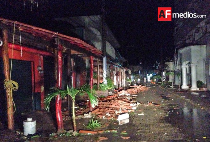
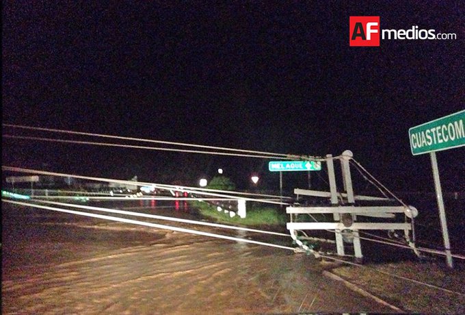
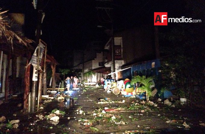
Some of the first damage pictures from #Patricia near/in San Patricio, Jalisco, Mexico (via http://AFmedios.com )
Patricia became the strongest hurricane on record on Friday morning. The estimated central pressure of Patricia dropped to 879 mb, breaking the record of 894 mb from Hurricane Linda in the eastern Pacific set in 1997 and also surpassing the 882 mb pressure of Hurricane Wilma in the Atlantic from 2005.
The maximum sustained winds of 200 mph (160 knots) breaks the previous wind speed record of 185 mph (160 knots) from Linda and Wilma for the strongest surface winds ever in the area of responsibility of the National Hurricane Center.
While Patricia is the strongest hurricane and tropical cyclone ever recorded in the Western Hemisphere, Typhoon Tip and several other Western Pacific typhoons obtained a lower central pressure.
AccuWeather.com Meteorologists Courtney Spamer, Alex Sosnowski, Brett Rathbun and Kristina Pydynowski contributed content to this story.


No comments:
Post a Comment