By Mark Leberfinger, AccuWeather.com Staff Writer
October 26,2015; 12:28AM,EDT
Heavy rain will continue to stream into Louisiana and neighboring southwestern Mississippi on Sunday, threatening to trigger major flooding.
"Widespread rainfall totals of 4-8 inches are expected by Monday with localized higher amounts," stated AccuWeather Senior Meteorologist Kristina Pydynowski. "Motorists should prepare for potential road closures and are strongly reminded to never cross a flooded road."
In addition to the flooding rain, southern Louisiana will remain at risk for isolated tornadoes as occasional gale-force winds will create rough seas over the western Gulf of Mexico to end the weekend.
A tornado was confirmed by an NWS Storm Survey Team on Sunday afternoon in Destrehan, Louisiana, just outside of New Orleans. One woman was injured due to damage to her mobile home, according to local emergency management.

RELATED:
Texas, Louisiana Brace for More Life-Threatening Flooding as Patricia's Moisture Arrives
South Central Regional Radar
Map: Current Severe Weather Watches and Warnings
Click here to view flood reports from Friday through Sunday morning.
UPDATES: (All times are listed in Central Time)
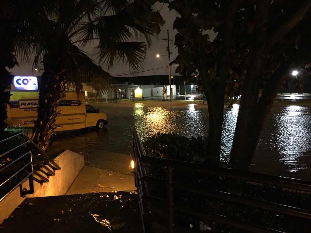
11:13 p.m. Sunday: More high water affects travel in the Baton Rouge area.
Flooding on Edwards ave. in front of cox Elmwood
10:07 p.m. Sunday: 63 mph gust clocked on an offshore drilling rig south of New Orleans, the National Data Buoy Center reports.

10:04 p.m. Sunday: 10.64 inches of rain fell in the last 48 hours at Baton Rouge, Louisiana, Mesonet reports.
9:50 p.m. Sunday:Restrictions for the Lake Pontchartrain Causeway Bridge.
9:15 p.m. Sunday:Part of the Acadian Thruway is closed in Baton Rouge.
8:24 p.m. Sunday: Emergency management reports of minor street flooding in the Shoreline Park area in Waveland, Mississippi, area as water levels have increased in the past several hours.
8:13 p.m. Sunday: 1.05 inches of rain fell within an hour in Baton Rouge, Louisiana. As of 8:00 p.m. CDT, the city has received 8.58 inches of rain.

8:02 p.m. Sunday: Two roads in Baton Rouge, Louisiana, are closed due to high water, the Baton Rouge Police Department reports.
7:22 p.m. Sunday: Floodwaters cover a parking lot in Houma, Louisiana.
Flooding in Houma! Pic by: Brandi Kramer. Water is inside Lowe's on MLK @MargaretOrr @KweilynWDSU @wdsu #lawx
6:52 p.m. Sunday: More than 20,000 Entergy customers are currently without power, the utility reports.
6:32 p.m. Sunday: A severe thunderstorm capable of producing a tornado was located 7 miles east of Cocodrie, Louisiana and moving north at 40 mph.
6:03 p.m. Sunday: Reports of streets flooded in the Gray, Louisiana area, the Amateur Radio Emergency Service in Louisiana reports.
4:47 p.m. Sunday: For the latest forecast information on the flooding rain, watch this video:
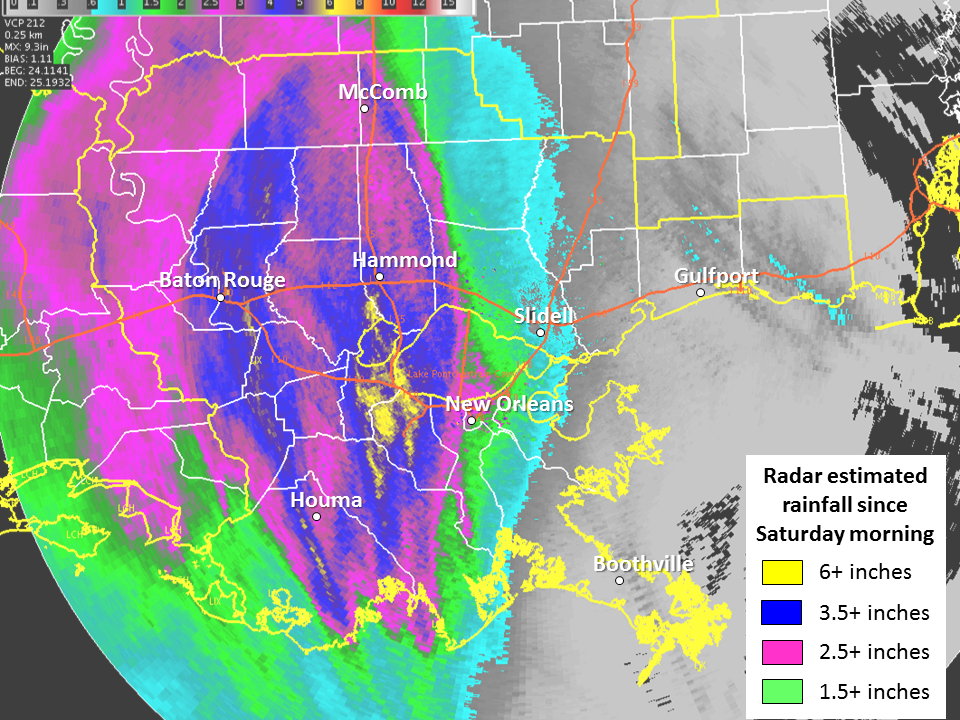
2:46 p.m. Sunday: Radar estimates of over six inches of rain has fallen in some areas in Louisiana.
Radar estimates over 6" of rain already for some places! Heaviest rain has been along/west of I-55. #lawx #mswx
NWS Fort Worth reports that several county roads are still flooded in Freestone and Limestone counties in Texas.
1:06 p.m. Sunday: Latest rainfall totals are 4.44 inches at New Orleans and 3.74 inches at Baton Rouge, Louisiana.
12:29 p.m. Sunday: Law enforcement reports that most roads are open in Hill County, Texas. However, some low water crossings still have water in them. A few roads were even washed out.
12:25 p.m. Sunday: Rain and wind creating slow travel for AccuWeather's Reed Timmer.
11:18 a.m. Sunday: An elderly woman was injured in her mobile home amid the possible tornado in Destrehan, Louisiana, local emergency management reports.
11:14 a.m. Sunday: A potential waterspout may move onshore as a tornado near Ruddock, Louisiana, near Interstate 55, AccuWeather Senior Meteorologist Krissy Pydynowski said.
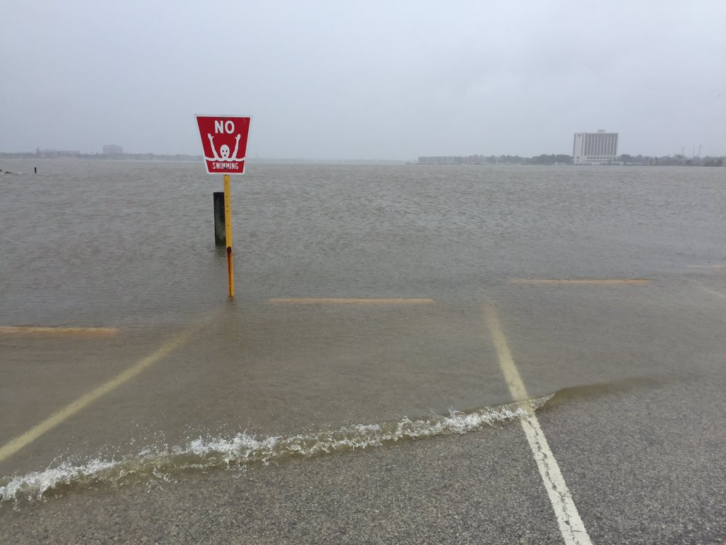
11:08 a.m. Sunday: High water washed across a parking lot near the Lyndon B. Johnson Space Center in Houston:
The edge of a parking lot near JSC. No flooding in our neighborhood, but this is well above normal water level.
A funnel cloud was reported in the official weather report at Louis Armstrong New Orleans International Airport between 10:33 and 10:38 a.m. CDT.
10:36 a.m. Sunday: Louis Armstrong New Orleans International Airport has recored 3.94 inches of rain from the start of the weekend into 10 a.m.

10:08 a.m. Sunday: More than 11,000 Entergy Louisiana customers are without power as rain washes across the state.
9:07 a.m. Sunday: As of 8 a.m. Sunday, 24 vehicles have been towed due to high water, Houston Emergency Management said.
In the past 24 hours, the Houston Fire Department and Houston Police Department responded to 28 weather-related rescues. Drivers are urged to use caution if driving in the area.
9:02 a.m. Sunday: "A band of extremely heavy rain will target far southeastern Texas and southwestern Louisiana during the midday hours," stated AccuWeather Senior Meteorologist Kristina Pydynowski. "Rainfall rates range from 2-3 inches in this band, which will easily cause flooding along streams and in poor drainage areas."
9:00 a.m. Sunday: Rainfall in the past hour at New Orleans' Louis Armstrong International Airport totaled nearly 2 inches.
8:51 a.m. Sunday: For the latest forecast information on the flooding rain, watch the video below:
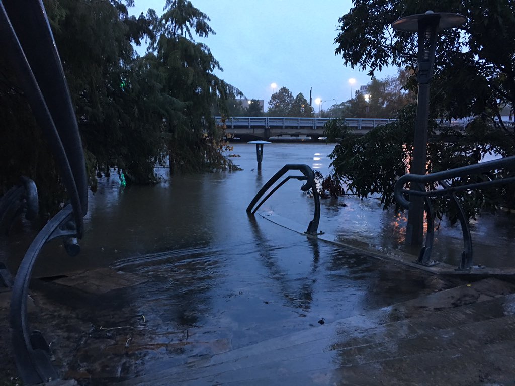
7:52 a.m. Sunday: Reports of Buffalo Bayou in Houston starting to recede.
Buffalo Bayou has crested and is starting to fall slowly. Still out of banks. Avoid downtown. @Fox26Houston

7:15 a.m. Sunday: Good news for motorists in eastern Texas.


No comments:
Post a Comment