Residents of the South Pacific island nation of Vanuatu are bracing for the impact of Category 5 Tropical Cyclone Pam,
one of the strongest tropical cyclones ever recorded in the waters east
of Australia. Pam has rapidly intensified over the past two days and
reached top sustained winds of 160 mph as of 2 pm EDT Thursday, making
it one of only ten Category 5 storms ever recorded in the basin since
satellite records began in 1970. The official tropical cyclone warning
center for the area, the Fiji Meteorological Service, estimated that Pam had a central pressure of 918 mb at 2 pm EDT Thursday.

Figure 1. The eye of Cyclone Pam as seen by the VIIRS instrument on the Suomi satellite at 10:11pm EDT March 11, 2015. At the time, Pam was a Category 4 storm with 135 mph winds. Image credit: @NOAASatellites.

Figure 2. Track of all Category 5 storms in the South Pacific (east of 135°E) since satellite records began in 1970. The strongest tropical cyclones in the Joint Typhoon Warning Center’s records are Zoe (2002/2003) and Monica (2006), which topped out with 180 mph winds (thanks go to Phil Klotzback of CSU for this stat.) Image credit: Michael Lowry, TWC.
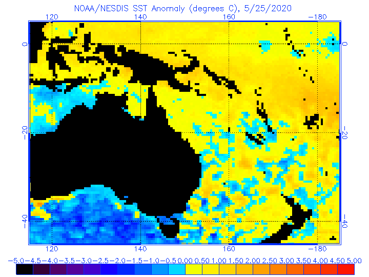
Satellite loops show that Pam is a huge and fearsome-looking storm, with a prominent 17-mile diameter eye and a very large area of intense eyewall thunderstorms with extremely cold cloud tops. These clouds have cold tops due to the fact that the strong updrafts in the eyewall are pushing the cloud tops to the base of the stratosphere. Sea surface temperatures are near 30°C (86°F), which is about 1°C (1.8°F) above average. Warm waters extend to great depth beneath the cyclone, giving Pam a huge amount of heat energy to draw upon. Wind shear is currently moderate, 10 - 15 knots, and is expected to be low to moderate though Friday morning, which may allow Pam to undergo additional intensification. The 2 pm EDT Thursday official intensity forecast from the Joint Typhoon Warning Center (JTWC) has Pam topping out with 175 mph winds, which would make it the 3rd strongest storm on record in the waters east of Australia. Intense tropical cyclones like Pam typically undergo one or more eyewall replacement cycles, during which a second, outer eyewall forms and contracts inward toward the eye, choking off the old, inner eyewall. During this time, the cyclone's intensity typically weakens, and Pam will likely reach its peak intensity once one of these cycles begins. However, Thursday afternoon microwave satellite images showed no signs that Pam is ready for an eyewall replacement cycle. These cycles are not predictable by current forecast models.
Impacts of Pam
Pam is likely to be one of the most destructive natural disasters in Vanuatu's history. The storm will likely pass over or very close to the three small, southernmost islands of Vanuatu on Friday, and these islands will suffer extreme devastation if a direct hit occurs. These islands are Erromango (population 2,000), Tanna (pop 29,000) and Aneiytum (pop 900). The 12Z Thursday run of the usually-reliable European model shows a direct hit occurring on the more northerly island of Efate, the most populated island in Vanuatu (66,000), where the capital city of Port Vila is located. Even if the islands miss a direct hit by Category 4 - 5 eyewall winds, hurricane-force winds will extend out 40 miles from the center, and will likely cause heavy damage to all of these islands. Regardless of Pam's track, its waves will cause major coastal damage; the significant wave height of the storm was 44 feet at 2pm EDT Thursday. Storm surge is also a concern, as well as extreme flash flooding from Pam's torrential rains. After passing Vanuatu, Pam is likely to weaken significantly, but the storm may still be capable of bringing tropical storm-force winds to New Zealand on Sunday. High surf causing erosion and coastal damage will be the main threat from Pam to New Zealand, though.
Pam has already caused significant flooding on the low-lying island of Tuvalu, located over 700 miles northeast of the storm, as documented by storm surge expert Hal Needham in his blog. Since Tuvalu is located in an area with very deep water offshore, this flooding was likely due to large waves crashing onshore and running up inland, rather than an actual storm surge from winds piling up water over a shallow coastal shelf.
Links
Port Vila, Vanuatu webcam (thanks go to wunderground member Huracan94 for posting this link.)
Vanuatu weather from the Australian BOM
Porta Vila info -- Click on "Details" in the wind section to view past wind data.
Vanuatu Meteorological Service
A Personal Weather Station at Port Vila, Vanuatu is in the path of Pam, and had received 0.57" of rain from the storm as of 4 pm EDT Thursday.
Jeff Masters
Figure 1. The eye of Cyclone Pam as seen by the VIIRS instrument on the Suomi satellite at 10:11pm EDT March 11, 2015. At the time, Pam was a Category 4 storm with 135 mph winds. Image credit: @NOAASatellites.
Figure 2. Track of all Category 5 storms in the South Pacific (east of 135°E) since satellite records began in 1970. The strongest tropical cyclones in the Joint Typhoon Warning Center’s records are Zoe (2002/2003) and Monica (2006), which topped out with 180 mph winds (thanks go to Phil Klotzback of CSU for this stat.) Image credit: Michael Lowry, TWC.
Satellite loops show that Pam is a huge and fearsome-looking storm, with a prominent 17-mile diameter eye and a very large area of intense eyewall thunderstorms with extremely cold cloud tops. These clouds have cold tops due to the fact that the strong updrafts in the eyewall are pushing the cloud tops to the base of the stratosphere. Sea surface temperatures are near 30°C (86°F), which is about 1°C (1.8°F) above average. Warm waters extend to great depth beneath the cyclone, giving Pam a huge amount of heat energy to draw upon. Wind shear is currently moderate, 10 - 15 knots, and is expected to be low to moderate though Friday morning, which may allow Pam to undergo additional intensification. The 2 pm EDT Thursday official intensity forecast from the Joint Typhoon Warning Center (JTWC) has Pam topping out with 175 mph winds, which would make it the 3rd strongest storm on record in the waters east of Australia. Intense tropical cyclones like Pam typically undergo one or more eyewall replacement cycles, during which a second, outer eyewall forms and contracts inward toward the eye, choking off the old, inner eyewall. During this time, the cyclone's intensity typically weakens, and Pam will likely reach its peak intensity once one of these cycles begins. However, Thursday afternoon microwave satellite images showed no signs that Pam is ready for an eyewall replacement cycle. These cycles are not predictable by current forecast models.
Impacts of Pam
Pam is likely to be one of the most destructive natural disasters in Vanuatu's history. The storm will likely pass over or very close to the three small, southernmost islands of Vanuatu on Friday, and these islands will suffer extreme devastation if a direct hit occurs. These islands are Erromango (population 2,000), Tanna (pop 29,000) and Aneiytum (pop 900). The 12Z Thursday run of the usually-reliable European model shows a direct hit occurring on the more northerly island of Efate, the most populated island in Vanuatu (66,000), where the capital city of Port Vila is located. Even if the islands miss a direct hit by Category 4 - 5 eyewall winds, hurricane-force winds will extend out 40 miles from the center, and will likely cause heavy damage to all of these islands. Regardless of Pam's track, its waves will cause major coastal damage; the significant wave height of the storm was 44 feet at 2pm EDT Thursday. Storm surge is also a concern, as well as extreme flash flooding from Pam's torrential rains. After passing Vanuatu, Pam is likely to weaken significantly, but the storm may still be capable of bringing tropical storm-force winds to New Zealand on Sunday. High surf causing erosion and coastal damage will be the main threat from Pam to New Zealand, though.
Pam has already caused significant flooding on the low-lying island of Tuvalu, located over 700 miles northeast of the storm, as documented by storm surge expert Hal Needham in his blog. Since Tuvalu is located in an area with very deep water offshore, this flooding was likely due to large waves crashing onshore and running up inland, rather than an actual storm surge from winds piling up water over a shallow coastal shelf.
Links
Port Vila, Vanuatu webcam (thanks go to wunderground member Huracan94 for posting this link.)
Vanuatu weather from the Australian BOM
Porta Vila info -- Click on "Details" in the wind section to view past wind data.
Vanuatu Meteorological Service
A Personal Weather Station at Port Vila, Vanuatu is in the path of Pam, and had received 0.57" of rain from the storm as of 4 pm EDT Thursday.
Jeff Masters
No comments:
Post a Comment