Winter Storm Selene crippled travel through the Front Range of the Rockies and High Plains Wednesday, and is now laying down its last blanket of snow in the Great Lakes and far northern New England.
Up to 31 inches of snow buried parts of the Front Range of Colorado, including the Denver metro Wednesday. Motorists were stranded on snow-choked roads in parts of Colorado, Wyoming and Nebraska. For more reports and perspective, scroll to our storm recap below.
(LATEST NEWS: Highways Shutdown Due to Whiteout Conditions)
Snow has long-since ended in the Rockies and High Plains. Now, the heaviest snow is in the Upper Midwest and Great Lakes. Snow has also spread into parts of Upstate New York and northern New England.
(INTERACTIVE: Radar | Latest Storm Reports)

Latest Radar
A large swath from the Upper Midwest, across the Great Lakes and into northern New England is under winter storm warnings and winter weather advisories.
(MORE: Extreme Winter Storms...in Spring)

Current Winter Alerts
(MORE: Severe Weather Threat This Week)
How Much Additional Snow?
- At least another 6 inches of snow possible: Parts of northern Lower and eastern Upper Michigan and far northern Maine.
- Less than another 6 inches: Northeast Kansas to the western upper peninsula of Michigan; a brief brush of light snow is possible as the storm wraps up in southern Wisconsin and perhaps northern Illinois. Upstate New York, the Green and White Mountains, and parts of central Maine will also see light accumulations.

Additional Snowfall Forecast
(INTERACTIVE: Commuter Forecast)
In addition, a band of freezing rain or sleet is still possible from the Great Lakes into northern New England.
In some locations, this may not only lead to slick roads, particularly overpasses, but also some sporadic sagging or downed tree limbs and power outages.
(MORE: Impacts of Ice Accumulations)

Additional Ice Accumulation
Winter Storm Selene Timing
Thursday-Friday- Snow or freezing rain is expected from parts of southern Minnesota and Iowa and the Great Lakes into western, central and Upstate New York and northern New England Thursday.
- Strong winds will continue to cause reduced visibility and hazardous travel conditions to the north and northwest of where the low tracks in the Midwest.
- Any snow or freezing rain should be confined to far northern Maine Friday.

Thursday's Forecast
Winter Storm Selene Snow Reports
Here are top snowfall totals and ice reports by state for Winter Storm Selene as of Thursday morning. The snow from Selene began as early as Monday in California and Oregon.California: 16 inches at Sierra at Tahoe Ski Resort; 15 inches at Sugarbowl Ski Area
Colorado: 31.6 inches near Pinecliffe; Portions of I-70 and I-25 closed Wednesday; Denver Int'l Airport closed Wednesday
Iowa: 17 inches just north-northeast of Sioux City; 0.5 inches with trees, powerlines down in Waukon
Idaho: 5 inches estimated at Galena Summit Snotel west of Galena
Michigan: 11 inches near Menominee; 0.25 inch ice in Freemont and Greenville (mainly on trees, untreated roads)
Minnesota: 12 inches in Savage
Montana: 13 inches west of Red Lodge
Nebraska: 15 inches near Wakefield
Nevada: 10 inches at Diamond Peak Ski Resort
New York: Light glaze of ice on elevated surfaces in Leroy, Milton, N. Tonawanda, Porter Corners and Salem
Oregon: 11 inches estimated at Milk Shakes Snotel southwest of Ski Bluewood
South Dakota: 14.3 inches in Dakota Dunes (near Sioux City, Iowa)
Wisconsin: 12 inches in Augusta; 0.2 inch ice in trees in West Bend
Wyoming: 16 inches estimated at Little Goose Snotel northwest of Buffalo; 14.1 inches in Cheyenne with all highways and roads closed Wednesday morning.

Selene's Snowfall Totals, So Far
However, parts of the Denver metro picked up over 2 feet of snow, including 25 inches in Aurora, and 24 inches in Westminster.
Cheyenne, Wyoming, had its fourth heaviest calendar-day snow on record March 23 (14.1 inches), in records dating to 1915. It was also the Wyoming capital's second heaviest March calendar-day snow, topped only by the infamous March, 18, 2003 Front Range snowstorm.
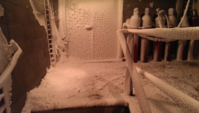
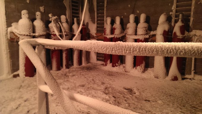
Yesterday's strong winds & snow, wreaked havoc in the Upper Air building here at the NWS in North Platte, NE. #newx
The weight of the heavy, wet snow in addition to those strong winds, downed trees and powerlines in some areas.
To the east, the Sioux City, Iowa, metro area picked up over a foot of snow, clogging roads the morning of March 24.
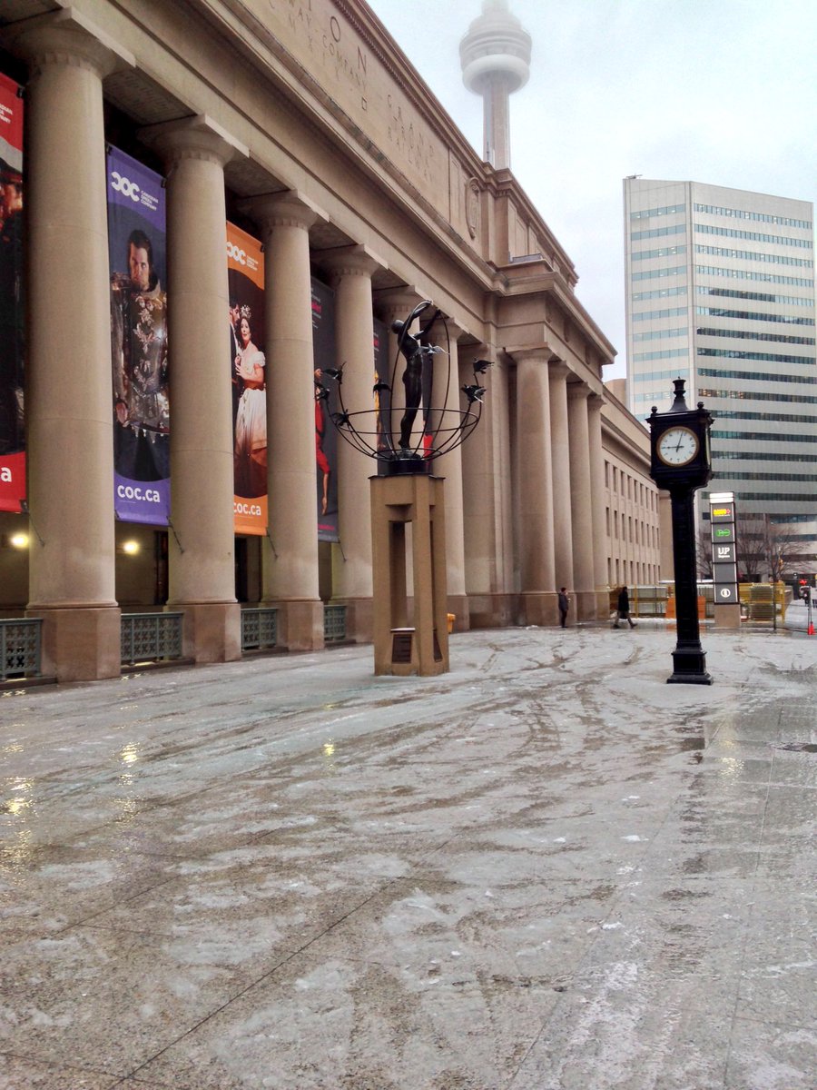
The ice spread into Ontario, leading to a tricky morning commute and power outages in Toronto.
The skating rink at Union Station #Toronto #FreezingRain #onstorm #IceDay #BTStormCentre #680NEWS @CP24
(MORE: Where March and April are the Snowiest Months)
The name Selene comes from Greek mythology meaning goddess of the moon.


No comments:
Post a Comment