By Courtney Spamer, Meteorologist
September 19,2015; 12:31AM,EDT
Drought-stricken areas across southern Brazil and Uruguay welcomed the rain through the end of the week. The wet pattern is expected to continue for the next few weeks.
A front that originated in Argentina early in the week stalled out near Porto Alegre, Brazil, allowing days of rain to help make up the rain deficit from the past few months.
Daily rain will be likely across the Brazilian states of Rio Grande do Sul and Santa Catarina through Friday, as well as Cerro Largo and Rivera areas of Uruguay. A few showers could sneak into northeastern Argentina.
"Rainfall amounts on the order of 12 to 25 mm (0.5 to 1.0 inches) are expected daily across this area," AccuWeather Senior Meteorologist Rob Miller said on Tuesday.
"A few thunderstorms developing along the front could bring some locally heavier rain," Miller said. "Too much rain, and instead the area could end up with flash flooding."

In Uruguay, rainfall amounts reached their peak in Melo, when 24 mm (about 1 inch) fell in the city on Wednesday. Other areas of northeastern Uruguay only accumulated a few millimeters. The higher rainfall totals remained further north in Rio Grande do Sul of Brazil.
On Wednesday alone, Porto Alegre had 26 mm (1.02 inches) of rain, the most rain the city has received in a single day since mid-july.
Another 30 mm (1.18 inches) of rain fell again on Thursday in Porto Alegre as thunderstorms rolled through the area.
Rain reached as far north as Florianopolis in the State of Santa Catarina, where 39 mm (1.5 inches) of rain fell Thursday into Friday morning.
Rain across northwestern Argentina remained very spotty, with only a few millimeters of rain falling throughout the week.
It is not unusual for there to be some periods of wetter weather as parts of South America transition into spring.
"The clash of warming air from the north with cooler air from the south produces a big enough contrast to produce some heavier rain," Miller added.
Porto Alegre com chuva! 18 graus!
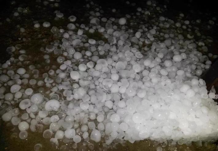
01:48 hs > Granizada en #Salto. Foto que nos envia @joaqco_uru. Varios reportes de usuarios de granizo en la ciudad
Never the less, AccuWeather Senior Meteorologist Jason Nicholls expects the rainy pattern this week and into next will impact crop growers across the states of Rio Grande do Sul and Santa Catarina.
"The wetter-than-normal pattern over the next couple weeks is likely going to cause problems for winter wheat harvesting that is getting underway," Nicholls said on Tuesday.
"The rains will be good for boosting soil moisture levels in advance of spring planting, however." Nicholls added.
The stormy weather, as predicted by AccuWeather meteorologists earlier in September, is expected to continue throughout the spring for eastern Argentina, Uruguay and southern Brazil.


No comments:
Post a Comment