El Niño and California Drought: Simplistically
Well, I was surprised to wake up Sunday to El Niño, nicknamed Bruce Lee, could mean nasty Colorado snows. I was just getting it together to prepare for Godzilla El Niño. Now I have some hybrid, flirty, mixed martial arts monster to prepare for. Must say I was a little surprised to see Bruce Lee attributed to our friends at climate.gov. It did lead to a relevation; we are headed back to polytheism. Aeolus blew a wind, out here, it is called Maria(h) and, well, here in 2015, in the Northwest U.S., there has not been a lot of Tess, and without Tess, Joe has just gone crazy. Apollo’s chariot descends towards the west, and I still have a blog to write before Selene awakes.
With this, the challenges offered to me by my new phone, and the stunning complexity of the “radio” in my rental car last week, there is not much place left for me in the world.
This is my El Niño blog. El Niño and La Niña are names given to frequently occurring patterns of variation that are concentrated in the tropical Pacific Ocean, but that change the average temperature of Earth for about a year. When there is an El Niño the globe is warmer, and when there is a La Niña the globe is cooler.
At this point, all of the forecast centers (see list at the end), are documenting and forecasting a “strong” El Niño event (Nature news story on 2015 El Niño). The current El Niño is comparable in strength to the strong El Niño of 1997-98, which for the U.S according to Ross et al. (1998), “was marked by a record breaking El Nino event and unusual extremes in parts of the country. Overall, the winter (December 1997- February 1998) was the second warmest and seventh wettest since 1895. Severe weather events included flooding in the southeast, an ice storm in the northeast, flooding in California, and tornadoes in Florida. The winter was dominated by an El Niño-influenced weather pattern, with wetter than normal conditions across much of the southern third of the country and warmer than normal conditions across much of the northern two-thirds of the country.”
There have been many blogs and stories about how this El Niño is the same or different from 1997-98. A notable analysis which begat many of the other stories comes from Andrea Thompson at Climate Central, who used several quotes from Michele L’Heureux at the National Oceanic and Atmospheric Administration. Quoting the Climate Central article –
“On the one hand, the two are comparable given that 1997 was the strongest El Niño on record and, at the moment, the best science indicates that the current event could match or rival that one — at least in terms of ocean temperatures. But on the other hand, each El Niño event is its own beast, the product of conditions in the ocean and atmosphere, of climate and weather that are unique in that particular place and time.
In the, albeit very short, modern record of El Niños, “we cannot find a single El Niño event that tracked like another El Niño event,” Michelle L’Heureux, a forecaster with NOAA’s Climate Prediction Center, said.
Forecasters like L’Heureux cringe at comparisons because there’s no guarantee the impacts of one El Niño will be just like that of a previous one, even if they look broadly similar. And it’s those impacts — like potential rains in drought-stricken California — that most really care about.”
What do I have to contribute to this discussion? Well, I am partial to this link from BBC News in November, 1997 – Science struggling to predict El Niño devastation. (Scientists had yet to find the language of hybrid, flirty, mixed martial arts monsters.) So I am going to offer up my simplistic thinking about El Niño.
The MetOffice has in their Weather for kids section an article on Understanding Weather. There is a small section on El Niño, which says, “The tropical Pacific Ocean has a warming and cooling cycle. This cycle is a completely natural event and usually lasts between three to seven years.” There is a nice figure:

Figure 1: From the MetOffice. La Niña effects weather all over the globe. During La Niña it is cool in the eastern Pacific. To the west of the cool area, marked La Niña, the water is warm, and there is active weather, represented by the clouds. Related to this region of active weather, are impacts throughout the northern hemisphere. For this plot, focused on the MetOffice’s priority area in Britain, the influence is represented by the red arrows, showing an impact over Europe.
I like the figure because it is simple. Unfortunately, it is for La Niña, the time when it is cool in the eastern Pacific, as opposed to El Niño, when the eastern Pacific is warm. However, it illustrates the point that the region of active weather has influence throughout the hemisphere. That is, that region stands as a place where weather systems can get started, pick up water, and then move to the north and the east. These weather systems move preferentially in paths that cross broad geographical regions, perhaps, a little less focused than suggested in this figure.
I am going to try a comparison here. Imagine that you need to walk across a thick forest, perhaps a wilderness, from west to east. You have some device that allows you to know that you are walking from west to east. But there are no major cleared paths in the forest. If a bunch of people started out together on one side of the forest, they can find their way through the forest, perhaps, all by different paths. And when they get to the other side, the bunch of people is likely to be spread out, because the paths diverged. Still, they made it from west to east.
One of the most fundamental facts of weather and climate is that the Sun provides more energy in the Earth’s tropics, near the Equator, than at the poles. The atmosphere and oceans respond to this imbalance of energy by trying to even it out. Therefore, weather systems transport heat (and water) from the equator towards the poles. Another fundamental fact is that the rotation of the Earth causes weather patterns to move from west to east. The location of oceans and continents and mountains on the continents, means that there are preferential paths that weather systems follow. They might start as a bunch in the tropics, but by the time they have made it through to the poles they have spread out.
What happens during El Niño, the eastern Pacific becomes warmer, and those little clouds in Figure 1 in the western Pacific Ocean move over to the east. That is, the region of active weather that helps to determine the start of the paths of weather systems moves. Weather systems still have to move north towards the pole and to the east, aligning with the rotation of the Earth.
So taking the lead from Figure 1, I have an even more simplistic figure. In Figure 2, all I suggest is that the paths of influence move eastward and, therefore, have a more direct influence on North America. With high confidence, we can say that storminess and moisture will increase somewhere in western North America. However, which particular path or paths that will be present in a specific year is far more difficult to predict in advance. For any given year, the global pattern might set up so that there is a path that leads to a series of storms. In the 1997-98 El Niño, California received a lot of rain. My figure suggests that California is likely to receive more rain than in a non - El Niño year; however, it is not a certain bet.

Figure 2: El Niño effects weather all over the globe. During El Niño it is warm in the eastern Pacific, and there is active weather, represented by the clouds. Related to this region of active weather, are impacts throughout the northern hemisphere. For this plot, focused on western North America, the influence is represented by the arrows. The arrows suggest several paths of influence are expected. The background map is from Ed Wiebe at UVic Climate Lab.
Above, I cited an article that emphasized that no two El Niño events are alike. Continuing with my simplistic approach, Figure 3 emphasizes two significant differences between now and 1997-98. First, we have that area of warm water off of the coast in the Northeast Pacific, which has been cited in other studies as having a large influence on North American weather. Second, we have the tremendous changes in the Arctic. Both of these are sources of uncertainty that are not simplistically evaluated based on past experience; hence, the question marks in the figure. These features should be expected to alter the paths of weather systems (storms) because they change the contrast between warm and cool regions; hence, change the energy transport. They are also likely to change the character of the storms in the sense of providing easy moisture to the atmosphere. Model experiments could be designed to assist in thinking about these uncertainties, but I am not aware of any systematic approach to do this.

Figure 3: Same as Figure 2, but with warm areas in Northeast Pacific and the Arctic to highlight differences with previous El Niño events. The background map is from Ed Wiebe at UVic Climate Lab.
What I have presented here is simplistic, and focused primarily on western North America, where there is persistent and dangerous drought. There is a lot of attention in the U.S. media on the influence El Niño will have on the drought. The simplistic thinking that El Niño brings a lot of rain in California is challenged not only by the inherent variability of weather and climate, but also by the persistent warm area in the Northeast Pacific and by the changes in the Arctic. The Arctic changes are undeniably related to planetary warming, and they represent a change that should be presumed to have influence on the movement of weather systems.
I end with another link to the MetOffice, Extreme weather planning for financial services. In this document, it is pointed out that recognizable patterns of risk and benefit are associated with El Niño and La Niña. This allows the use of knowledge to prepare a portfolio of responses that can be implemented as the specifics of the 2015-16 El Niño are revealed and short-term (weather) forecasts become accurate.
r
Forecast and Analysis Centers
Climate Prediction Center Alert System and the Climate Prediction Center Diagnostic Discussion
International Research Institute Forecast Products and the Quick Look
Japanese Meteorological Agency El Niño Monitoring and Outlook and a nice graph of historical events
Australian Bureau of Meteorology Wrapup
Information Portals
CLIVAR (Variability and predictability of the ocean-atmosphere system) Forecast Page
World Meteorological Updates
Pacific Marine Environmental Laboratory El Niño Theme Page Forecasts
Climate Prediction Center FAQ
NOAA’s El Niño Page and NOAA’s La Niña Page
Summaries in Blogs
NOAA’s ENSO Blog
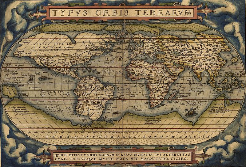
Figure 3: Ortelius World Map with a Monster in the Eastern Pacific. From Wikipedia
Well, I was surprised to wake up Sunday to El Niño, nicknamed Bruce Lee, could mean nasty Colorado snows. I was just getting it together to prepare for Godzilla El Niño. Now I have some hybrid, flirty, mixed martial arts monster to prepare for. Must say I was a little surprised to see Bruce Lee attributed to our friends at climate.gov. It did lead to a relevation; we are headed back to polytheism. Aeolus blew a wind, out here, it is called Maria(h) and, well, here in 2015, in the Northwest U.S., there has not been a lot of Tess, and without Tess, Joe has just gone crazy. Apollo’s chariot descends towards the west, and I still have a blog to write before Selene awakes.
With this, the challenges offered to me by my new phone, and the stunning complexity of the “radio” in my rental car last week, there is not much place left for me in the world.
This is my El Niño blog. El Niño and La Niña are names given to frequently occurring patterns of variation that are concentrated in the tropical Pacific Ocean, but that change the average temperature of Earth for about a year. When there is an El Niño the globe is warmer, and when there is a La Niña the globe is cooler.
At this point, all of the forecast centers (see list at the end), are documenting and forecasting a “strong” El Niño event (Nature news story on 2015 El Niño). The current El Niño is comparable in strength to the strong El Niño of 1997-98, which for the U.S according to Ross et al. (1998), “was marked by a record breaking El Nino event and unusual extremes in parts of the country. Overall, the winter (December 1997- February 1998) was the second warmest and seventh wettest since 1895. Severe weather events included flooding in the southeast, an ice storm in the northeast, flooding in California, and tornadoes in Florida. The winter was dominated by an El Niño-influenced weather pattern, with wetter than normal conditions across much of the southern third of the country and warmer than normal conditions across much of the northern two-thirds of the country.”
There have been many blogs and stories about how this El Niño is the same or different from 1997-98. A notable analysis which begat many of the other stories comes from Andrea Thompson at Climate Central, who used several quotes from Michele L’Heureux at the National Oceanic and Atmospheric Administration. Quoting the Climate Central article –
“On the one hand, the two are comparable given that 1997 was the strongest El Niño on record and, at the moment, the best science indicates that the current event could match or rival that one — at least in terms of ocean temperatures. But on the other hand, each El Niño event is its own beast, the product of conditions in the ocean and atmosphere, of climate and weather that are unique in that particular place and time.
In the, albeit very short, modern record of El Niños, “we cannot find a single El Niño event that tracked like another El Niño event,” Michelle L’Heureux, a forecaster with NOAA’s Climate Prediction Center, said.
Forecasters like L’Heureux cringe at comparisons because there’s no guarantee the impacts of one El Niño will be just like that of a previous one, even if they look broadly similar. And it’s those impacts — like potential rains in drought-stricken California — that most really care about.”
What do I have to contribute to this discussion? Well, I am partial to this link from BBC News in November, 1997 – Science struggling to predict El Niño devastation. (Scientists had yet to find the language of hybrid, flirty, mixed martial arts monsters.) So I am going to offer up my simplistic thinking about El Niño.
The MetOffice has in their Weather for kids section an article on Understanding Weather. There is a small section on El Niño, which says, “The tropical Pacific Ocean has a warming and cooling cycle. This cycle is a completely natural event and usually lasts between three to seven years.” There is a nice figure:
Figure 1: From the MetOffice. La Niña effects weather all over the globe. During La Niña it is cool in the eastern Pacific. To the west of the cool area, marked La Niña, the water is warm, and there is active weather, represented by the clouds. Related to this region of active weather, are impacts throughout the northern hemisphere. For this plot, focused on the MetOffice’s priority area in Britain, the influence is represented by the red arrows, showing an impact over Europe.
I like the figure because it is simple. Unfortunately, it is for La Niña, the time when it is cool in the eastern Pacific, as opposed to El Niño, when the eastern Pacific is warm. However, it illustrates the point that the region of active weather has influence throughout the hemisphere. That is, that region stands as a place where weather systems can get started, pick up water, and then move to the north and the east. These weather systems move preferentially in paths that cross broad geographical regions, perhaps, a little less focused than suggested in this figure.
I am going to try a comparison here. Imagine that you need to walk across a thick forest, perhaps a wilderness, from west to east. You have some device that allows you to know that you are walking from west to east. But there are no major cleared paths in the forest. If a bunch of people started out together on one side of the forest, they can find their way through the forest, perhaps, all by different paths. And when they get to the other side, the bunch of people is likely to be spread out, because the paths diverged. Still, they made it from west to east.
One of the most fundamental facts of weather and climate is that the Sun provides more energy in the Earth’s tropics, near the Equator, than at the poles. The atmosphere and oceans respond to this imbalance of energy by trying to even it out. Therefore, weather systems transport heat (and water) from the equator towards the poles. Another fundamental fact is that the rotation of the Earth causes weather patterns to move from west to east. The location of oceans and continents and mountains on the continents, means that there are preferential paths that weather systems follow. They might start as a bunch in the tropics, but by the time they have made it through to the poles they have spread out.
What happens during El Niño, the eastern Pacific becomes warmer, and those little clouds in Figure 1 in the western Pacific Ocean move over to the east. That is, the region of active weather that helps to determine the start of the paths of weather systems moves. Weather systems still have to move north towards the pole and to the east, aligning with the rotation of the Earth.
So taking the lead from Figure 1, I have an even more simplistic figure. In Figure 2, all I suggest is that the paths of influence move eastward and, therefore, have a more direct influence on North America. With high confidence, we can say that storminess and moisture will increase somewhere in western North America. However, which particular path or paths that will be present in a specific year is far more difficult to predict in advance. For any given year, the global pattern might set up so that there is a path that leads to a series of storms. In the 1997-98 El Niño, California received a lot of rain. My figure suggests that California is likely to receive more rain than in a non - El Niño year; however, it is not a certain bet.
Figure 2: El Niño effects weather all over the globe. During El Niño it is warm in the eastern Pacific, and there is active weather, represented by the clouds. Related to this region of active weather, are impacts throughout the northern hemisphere. For this plot, focused on western North America, the influence is represented by the arrows. The arrows suggest several paths of influence are expected. The background map is from Ed Wiebe at UVic Climate Lab.
Above, I cited an article that emphasized that no two El Niño events are alike. Continuing with my simplistic approach, Figure 3 emphasizes two significant differences between now and 1997-98. First, we have that area of warm water off of the coast in the Northeast Pacific, which has been cited in other studies as having a large influence on North American weather. Second, we have the tremendous changes in the Arctic. Both of these are sources of uncertainty that are not simplistically evaluated based on past experience; hence, the question marks in the figure. These features should be expected to alter the paths of weather systems (storms) because they change the contrast between warm and cool regions; hence, change the energy transport. They are also likely to change the character of the storms in the sense of providing easy moisture to the atmosphere. Model experiments could be designed to assist in thinking about these uncertainties, but I am not aware of any systematic approach to do this.
Figure 3: Same as Figure 2, but with warm areas in Northeast Pacific and the Arctic to highlight differences with previous El Niño events. The background map is from Ed Wiebe at UVic Climate Lab.
What I have presented here is simplistic, and focused primarily on western North America, where there is persistent and dangerous drought. There is a lot of attention in the U.S. media on the influence El Niño will have on the drought. The simplistic thinking that El Niño brings a lot of rain in California is challenged not only by the inherent variability of weather and climate, but also by the persistent warm area in the Northeast Pacific and by the changes in the Arctic. The Arctic changes are undeniably related to planetary warming, and they represent a change that should be presumed to have influence on the movement of weather systems.
I end with another link to the MetOffice, Extreme weather planning for financial services. In this document, it is pointed out that recognizable patterns of risk and benefit are associated with El Niño and La Niña. This allows the use of knowledge to prepare a portfolio of responses that can be implemented as the specifics of the 2015-16 El Niño are revealed and short-term (weather) forecasts become accurate.
r
Forecast and Analysis Centers
Climate Prediction Center Alert System and the Climate Prediction Center Diagnostic Discussion
International Research Institute Forecast Products and the Quick Look
Japanese Meteorological Agency El Niño Monitoring and Outlook and a nice graph of historical events
Australian Bureau of Meteorology Wrapup
Information Portals
CLIVAR (Variability and predictability of the ocean-atmosphere system) Forecast Page
World Meteorological Updates
Pacific Marine Environmental Laboratory El Niño Theme Page Forecasts
Climate Prediction Center FAQ
NOAA’s El Niño Page and NOAA’s La Niña Page
Summaries in Blogs
NOAA’s ENSO Blog
Figure 3: Ortelius World Map with a Monster in the Eastern Pacific. From Wikipedia
No comments:
Post a Comment