Published: March 9,2015
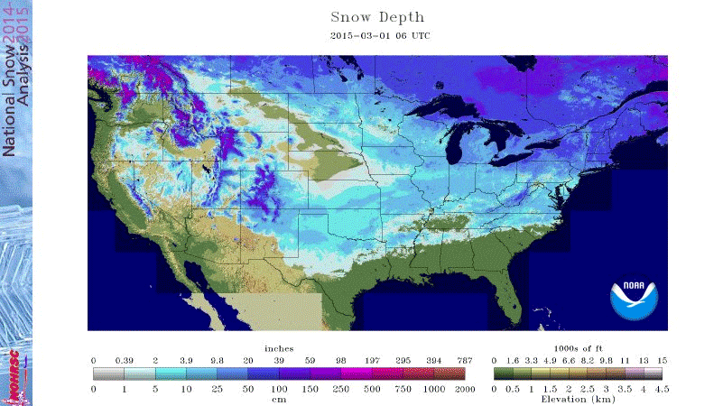

Since then, snow cover across the country has decreased in a huge way as the animation above illustrates. The NOHRSC analysis on March 9 showed that 25 percent of the Lower 48 states was covered by snow. The darker blue and purple shadings show the deepest snowpack remaining in New England, the northern Great Lakes and the Rockies. Meanwhile, the lighter shades of blue show areas where snow cover was lighter and prone to melting faster.
(GIFs: This Winter's Snow in 10 Seconds)
The snow melt that occurred the last few days hasn't been a gradual one. When looking at daily snowcover from March 1-9 in the animation below, you'll see a retreat of the snowpack from March 3-4, followed by an expansion March 5-6 from Winter Storm Thor. After Thor, snow cover was at 50.6 percent across the Lower 48 states on March 6.
Then, rapid melting occurred in the four days from March 6-9 with snow cover dropping from 50.6 percent to 25 percent.
Playing a role in this rapid snowmelt is a weather pattern change, which is allowing milder temperatures to grip the nation's midsection. With this pattern remaining in place into the new week ahead, expect the snow melt to continue.
(MORE: Warmer Weather Pattern)
No comments:
Post a Comment