By Samantha-Rae Tuthill, AccuWeather.com Staff Writer
October 5,2013; 10:57AM,EDT

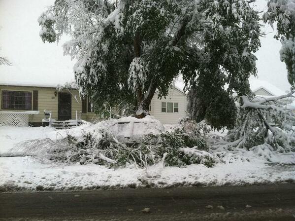
By Saturday morning, nearly 44 inches of snow had fallen northwest of Rapid City in Lead, S.D. according to NWS observer. One mile to the southwest of downtown Rapid City, S.D., a NWS employee reported 31 inches of snow.
Natrona County, Wyo., picked up 34 inches through early Saturday morning. Other locations across Wyoming saw 2 feet or more of snow as well.
As of 8:00 a.m. MDT Saturday, around 5,800 Casper, Wyo., residents are without power due to the storms.
RELATED
North Central Interactive Radar
Severe Weather Center
US Forecast Maps
 Snow piles up on deck in South Dakota, courtesy of Twitter user JazzinOC
 Heavy snow observed by State of Wyoming traffic camera along I-90 near Gillette, Wyo.
 Heavy snow moving through the Midwest, courtesy of USA Today Weather
PQ loved playing in the snow this morning! Wasn't quite as deep then, of course... #snowday #snowdog #brrr


No comments:
Post a Comment