Published: April 27,2016
NOAA's Storm Prediction Center has issued a severe thunderstorm watch for parts of eastern Louisiana and southern Mississippi until 3 p.m. CDT. This watch area includes New Orleans, Baton Rouge, and Jackson, Mississippi.
Before sunrise, winds gusted to 59 mph in Conroe, Texas, north of Houston in a squall line. The National Weather Service received reports of "numerous trees and power lines down" from Magnolia to Montgomery to Willis, Texas early Wednesday. Widespread power outages and tree damage were reported in Hardin County, Texas.
(MORE: Latest Severe Weather News/Impacts)

Current Radar with Watches and Warnings

Roughly 350 reports of severe weather (large hail, high winds/wind damage, and tornadoes) were received by National Weather Service offices in the 24-hour period ending 7 a.m. CT Wednesday. It was the second most active 24-hour period for severe thunderstorms so far in 2016, topped only by the Feb. 24 outbreak.
Despite that gaudy number, there were fortunately only 5 reports of tornadoes Tuesday. However, one tornado late Tuesday night was destructive in Grayson County, Texas. Large hail reports were numerous including one report of 5 inch diameter hail near Bremen, Kansas.
Severe Weather Forecast
Wednesday- Scattered severe storms expected from mid-Mississippi Valley to Louisiana and Mississippi.
- Detailed TOR:CON lists
- Threats: Damaging winds, large hail, a few tornadoes
- Cities: New Orleans | Memphis | St. Louis

Wednesday's Thunderstorm Outlook
(MORE: Late Week Severe Weather Threat Ahead)
Tuesday's Storm Reports
 Reports
of severe weather from 7 a.m. CDT, Tuesday April 26, 2016 until 6 a.m.
CDT Wednesday, April 27, 2016. The red icons indicate tornado reports,
while the blue icons represent either high/damaging wind or hail
reports.
Reports
of severe weather from 7 a.m. CDT, Tuesday April 26, 2016 until 6 a.m.
CDT Wednesday, April 27, 2016. The red icons indicate tornado reports,
while the blue icons represent either high/damaging wind or hail
reports.(NOAA/NWS/SPC)
A squall line tracked over 700 miles in just over 15 hours from far northeast Kansas early Tuesday morning to eastern Kentucky late Tuesday night, producing a swath of damaging thunderstorm winds meeting the critieria for a derecho.
 High
wind/wind damage reports for the 24-hour period ending 7 a.m. CDT,
Wednesday, April 27, 2016, illustrating the low-end derecho from
northeast Kansas to eastern Kentucky.
High
wind/wind damage reports for the 24-hour period ending 7 a.m. CDT,
Wednesday, April 27, 2016, illustrating the low-end derecho from
northeast Kansas to eastern Kentucky.Among the damage reports from this low-end derecho included:
- A carport flipped and blown into trees near Frankfort, Kansas
- A grain roof blown off and thrown 600 feet near Nortonville, Kansas
- A roof ripped off and four power poles snapped in Sedalia, Missouri
- Siding blown off a home in Mokane, Missouri
- Flag pole and mailbox pole snapped in half near Weldon Spring, Missouri
- Empty grain train cars rolled over in Pickneyville, Illinois
A picture of what was found at a house between Bremen &
Herkimer in Marshall County. Photo: Pat Bussmann #kswx
Herkimer in Marshall County. Photo: Pat Bussmann #kswx
Monday's Storm Reports
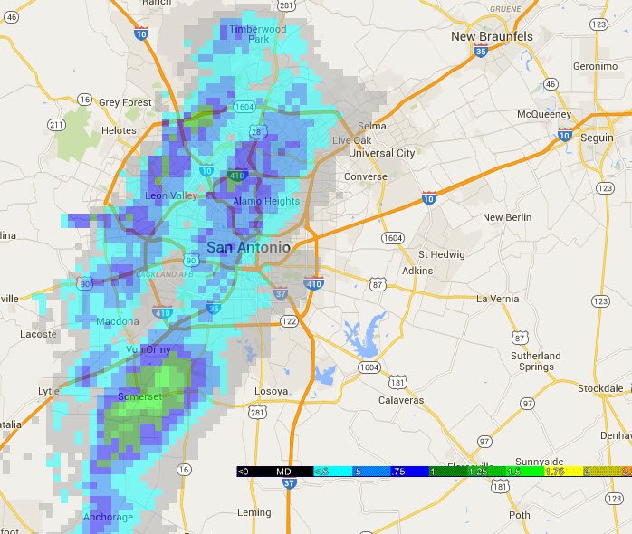
Monday, hail up to baseball size hail, 2.75 inches in diameter, to parts of the San Antonio metro, less than two weeks after, arguably, the area's more destructive hailstorm on record.(MORE: Yet Another San Antonio Hailstorm)
Another hail storm causing damage in San Antonio tonight. Not close to 4/12, but green areas have damage potential.
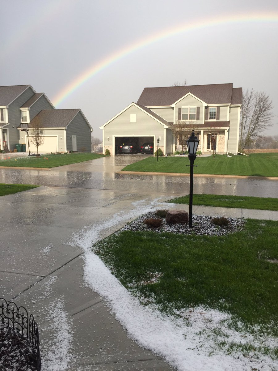
The picture below is of the hail in Port Washington.
@weatherchannel And a beautiful rainbow after the Hail!
Sunday's Storm Reports
Sunday evening, a tornado was reported near Holyrood, Kansas and near Glendale, Kansas, with numerous reports of funnel clouds near Ellsworth. Hail up to 3 inches in diameter was also observed near New Cambria, Kansas. Two tornadoes were also spotted in southern Nebraska, near Superior and Deshler Sunday evening. Damage to a trailer home has also been reported in Munden, Kansas, possibly due to a tornado and two people were injured during the storm.(MORE: Tornadoes, Hail Impact Plains Sunday)
Damage from a possible tornado was also reported in League City, Texas Sunday evening, including roof and fence damage.
Farther north, there were multiple reports of a brief tornado near Delavan, Minnesota Sunday night. A tornado was also reported near Waseca, Minnesota.


No comments:
Post a Comment