Published: April 26,2016
Two
tornadoes were reported in Indiana, another in Kansas and a fourth in
Texas as a very dangerous severe weather event swept across the Plains
into the Ohio Valley Tuesday. An EF-0 was confirmed in Missouri, just
west of St. Louis.
The
pattern also produced large hail and heavy thunderstorms, and at least
eight states were under some sort of severe watch for part of the
evening. This included a "Particularly Dangerous Situation" watch in
Texas and Oklahoma; the rare watch is only issued under the most severe
conditions.
Here are the latest impacts from these severe storms.
Indiana
According to the National Weather Service, a tornado touched down near Bloomfield, about 24 miles west of Bloomington Tuesday evening. The twister was moving east at 25 mph. A second tornado touched down outside Newburgh, the NWS said, moving east toward Boonville and Chandler. Trained spotters saw quarter size hail along with the twister.The NWS also reported trees down in Evansville, and social media photos from the city showed a stoplight hanging in the middle of an intersection, apparently torn from its original position by high winds.
This is from @14News viewer Jeff Bryant -- he says this light is hanging down @ Columbia & Stringtown in Evansville
Missouri
Across the state of Missouri, some 28,000 customers were without power at point Tuesday afternoon, according to several energy companies. The outages were caused by a complex of thunderstorms that brought damaging winds to the Show Me State.There was a brief radar-confirmed tornado west of St. Louis around 1 p.m.
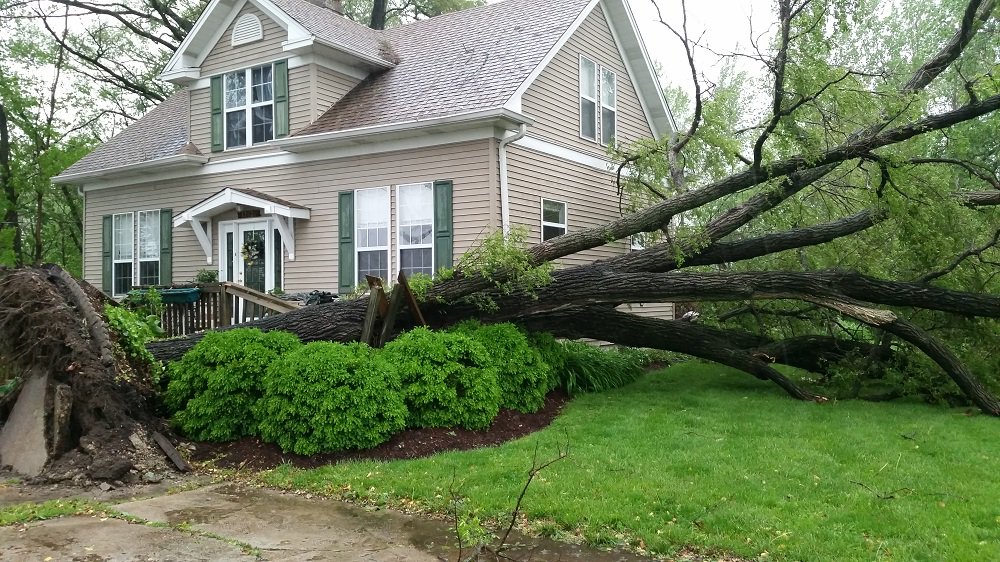
A tree barely missed falling on a home in the Chesterfield Valley today after storms rolled through.#STLWx #KMOV
The homeowners, who were home at the time, told Boone County firefighters they heard a close lightning strike and saw smoke coming from their garage. Fire crews arrived to see smoke and flames coming from the garage attic but had the blaze extinguished in about 10 minutes.
Illinois
Security forces at Illinois' Scott Air Force Base closed the Cardinal Creek Gate via South Drive due to flooding in the area. The base asked drivers to adjust routes accordingly.Kansas
The National Weather Service is warning of increasing flash flooding danger in Kansas between Manhattan and Topeka because of heavy rains. Meteorologist Chad Omitt says the area experienced 50-year rainfall amounts through Tuesday evening.Winds up to 60 mph were reported west of Topeka as cloud rotation spawned numerous tornado warnings that later were allowed to expire.
Hail approaching baseball size was reported on social media near the town of Blue Rapids and Waterville early Tuesday evening. Kansas State Universtiy closed its Manhattan campus Tuesday evening just before 5:30 p.m. and cancelled all remaining classes for the evening.
Just got a picture sent to the @KSNTNews email of baseball sized hail in Blue Rapids.
The storms began Tuesday morning with a hailstorm in the Kansas City metro that dumped hail at the airport. Social media documented the hailstorm, which left hail as big as golf balls in parts of the Kansas City area.
A brief rope tornado was reported near Mayfield around 5 p.m. local time the NWS reported.
(MORE: Severe Weather Outbreak Expected in the Plains)
(MORE: 4 Things To Know About This Outbreak)
Nebraska
The National Weather Service says tennis ball-sized hall has been reported in parts of south-central Nebraska. Meteorologist Shawn Rossi says the hail was reported near the town of Deshler, about 10 miles north of the Kansas border, but it's not clear whether it caused any damage.Funnel clouds were reported in the area, but Rossi says there weren't any confirmed tornadoes on the ground.
Oklahoma
About 25,000 people across the state were without power as of 9:30 p.m. Tuesday as a line of severe storms moved through.Tuesday morning, about 100 miles northwest of Oklahoma City, George Eischen moved vehicles off the lot at his Fairview, Oklahoma, Chevrolet dealership, moving them under cover with the threat of large hail in the area. He brought as many cars as possible into the shop and even the lobby floor in an attempt to keep them protected, he told the AP.
"We've never been hit by a tornado here in town, amazingly," Eischen told the AP. "But yeah, we've had hail. And that's the real enemy of the car dealer."
You know what time of year it is in #Tulsa when we begin our #haildrills to protect our vehicles from bad weather.


No comments:
Post a Comment