Published: April 28,2016
The Cornhusker State was just one of nine states to be hit by at least one tornado during the severe outbreak, which included Oklahoma, Texas, Indiana, Kansas, Kentucky, Iowa, Missouri, Indiana and Illinois, as the weather system shifted across the Plains and Ohio Valley.
(MORE: 4 Things to Know About the Continued Severe Weather Threat)
Over the course of two days, the storm system was responsible for more than 270 reports of wind damage and at least 240 hail reports, according to the Storm Prediction Center.
Nebraska
The National Weather Service said a short-lived EF1 tornado hit western Omaha Wednesday afternoon, but no injuries were reported. A preliminary survey found a damage path two-thirds of a mile long from the 50-yard-wide twister that was in progress for four minutes.Two Burke High School students witnessed the tornado in progress right in front of them on 132nd Street, lasting for only a few seconds.
"I didn't have time to react so I drove right through it," Haley Bonge told Omaha.com. "It was swirling around us."
Bonge didn’t see any noticeable damage to her car, but did say it had been hailing since she left school. It appears all damage from the tornado was minor, Omaha.com also said.
(MORE: Why Skies Turn Green in Thunderstorms)
On Tuesday, the Deshler Fire Department was forced to evacuate dozens from a nursing home in the area due to flooding, according to the AP. Parkview Haven Nursing Home administrator Mary Miller told the AP about 45 residents and patients from the nearby Meadowlark Heights Assisted Living were taken to Deshler High School because of the floods. Deshler is located about 10 miles north of the Kansas border.
Highway 136 was closed from Highway 5 to Highway 14 due to flooding, NBC Nebraska said, and Highway 30, one mile east of Elm Creek, was also reportedly closed with water over the road.
The NWS said tennis ball-sized hall was reported in parts of south-central Nebraska. Meteorologist Shawn Rossi told the Associated Press that hail was reported near Deshler.
Iowa
The NWS confirmed a tornado touched down early Wednesday evening about four miles north of Creston, near Green Valley Lake. The twister was seen moving north at 45 mph. Local law enforcement reported a tornado, likely the same one, north of Creston around the same time.The tornado that jumped through Stanton left localized damage to a few homes. No injuries were reported.
KevinBoughton @KevinBoughton
Nobody hurt, just this garage smashed in Stanton. Tornado touched down a few miles east of town. pic.twitter.com/PzvIxhwN92
This family is lucky: check out how close the garage is to the house! pic.twitter.com/mS73IgYEfb
Illinois
Three tornadoes hit central Illinois on Wednesday, according to the NWS. One was briefly in progress just before 8 p.m. Wednesday north of Olney, located in east-central Illinois. Another was spotted at 7 p.m. south of Altamont, the NWS said.A local fire department reported another tornado touched down near Raymond, according to the NWS. Raymond is a little over 65 miles northeast of St. Louis, Missouri.
No major damage or injuries were reported from the trio of tornadoes, which are yet to be assigned a rating from the NWS.
Kentucky
A brief tornado touched down in Madisonville, according to an NWS report. Ten mobile homes were damaged in Owensboro as a result of the storm, a local journalist reported. No injuries were sustained during the storm. Madisonville lies about 75 miles northwest of Bowling Green.A second tornado was reported in Knottsville Wednesday evening, moving northeast at 55 mph, according to the NWS in Paducah.
Texas
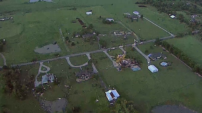
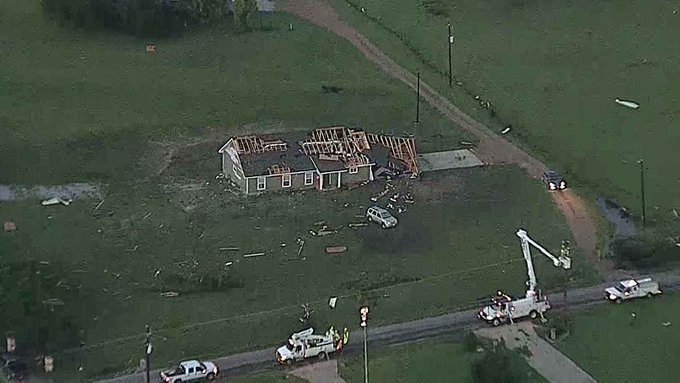
A 62-year-old woman was killed when a tree fell on her home early Wednesday morning in the Houston suburb of Tomball, according to KBTX.com. NWS officials later confirmed the death was caused by an EF0 tornado that hit the area, and soils softened by recent heavy rainfall and flooding allowed many trees to fall. The woman has not been identified.In North Texas, officials said the towns of Howe, Bells and Whitesboro sustained damage from a confirmed tornado Tuesday night, and four people were hospitalized following the storm, according to the AP. They were hurt when their vehicles were caught up in the tornado, Howe Police Chief Carl Hudman told the AP.
"We have several houses that have damage," Hudman told CBS Dallas-Fort Worth. "We have a metal storage building company on the east side that was hit and destroyed."
(MORE: Hail-Weary Residents Resort to Drastic Measures to Protect Cars)
WATCH LIVE: Sunrise reveals suspected tornado damage in Grayson County http://on.nbcdfw.com/v7hXWRM
Damage surveys found an EF1 tornado was in progress near Howe with maximum winds of 100 mph, and a second twister, rated EF0 with winds as high as 85 mph, touched down near Bells.
Storms moved east overnight and into Wednesday morning, slamming the Houston area with strong winds and heavy rain. At one point, CenterPoint Energy said more than 120,000 customers were without power in the Houston metro.
Wednesday's storms left several people injured in eastern Texas. KTRE.com said widespread damage was reported in Tyler County, where several minor injuries occurred and homes were damaged in the towns of Spurger, Ivanhoe and Harmony. In neighboring Jasper County, one person was injured near Sam Rayburn Dam after being pinned in bed by a falling tree, the NWS said.
Oklahoma
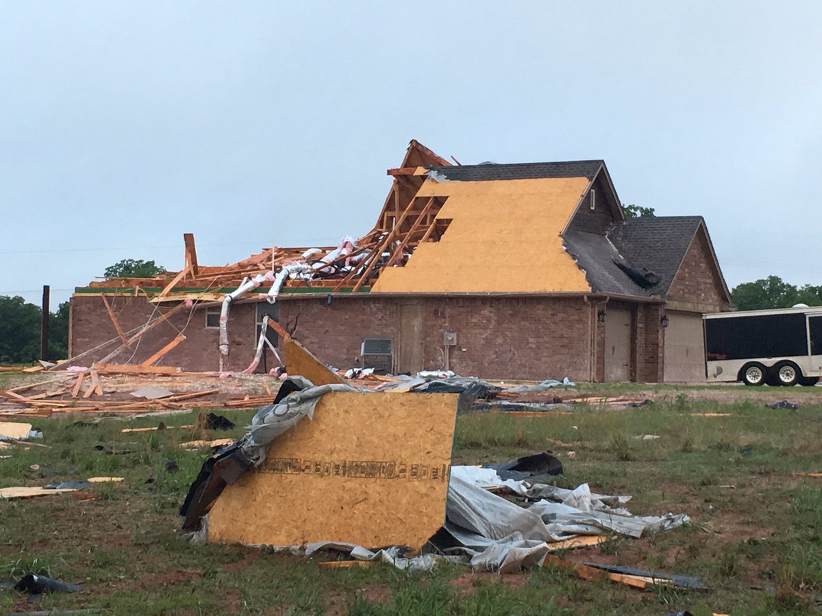
About 25,000 people across the state lost power during the storms Tuesday night, a large number of which lasted into Wednesday. Oklahoma hospitals said 12 people were injured by the storms statewide, according to the AP.Damage was reported in the town of Luther, northeast of Oklahoma City. At least one home suffered major damage from a confirmed EF1 tornado.
The sun is up&damage bad for this Luther family of 5.They are thankful to be a live&hopeful they can rebuild .@kfor
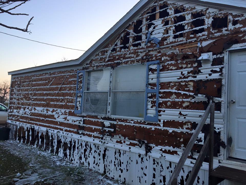
Hail as big as baseballs was also reported in Oklahoma by local media from Tuesday's storms.
Some of the worst hail damage reported yesterday was in NW OK. Baseball size hail reported near Sharon. @news9 #okwx
Kansas
Hail larger than softballs fell near Bremen, according to storm reports. Marshall County's emergency management chief said reports of roof damage and broken car windows were coming in hours after large hail fell for about 15 minutes early Tuesday evening.A brief rope tornado was reported near Mayfield around 5 p.m. local time, the NWS reported. An EF0 tornado was confirmed by the NWS in Smith County, located in far northern Kansas. The twister was 100 yards wide and had maximum winds of 70 mph.
(MORE: Kansas Offers Unique Shelters to Protect Drivers From Tornadoes)
At McConnell Air Force Base in Wichita, planes were removed Tuesday morning due to the high possibility of damaging storms, the Associated Press reported. Spokesperson Colby Hardin told the AP the planes were being sent to military bases in Spokane, Washington, and Grand Forks Air Force Base in North Dakota.
The storms also brought intense rainfall to parts of the state, and flood-prone areas were quickly swamped by high water. Water rescues were performed in South Wichita as the floodwaters rose Tuesday, according to WIVB.com.
The storms began Tuesday morning with a hailstorm in the Kansas City metro that dumped hail at the airport. Social media documented the hailstorm, which left hail as big as golf balls in parts of the Kansas City area.
Indiana
According to the NWS, a tornado touched down near Bloomfield, about 24 miles west of Bloomington Tuesday evening. The twister was moving east at 25 mph. A second tornado touched down outside Newburgh, the NWS said, moving east toward Boonville and Chandler. Trained spotters saw quarter size hail along with the twister.(MORE: Lightning-Sparked Fire Engulfs Kentucky Golf Clubhouse)
The NWS also reported trees down in Evansville, and social media photos from the city showed a stoplight hanging in the middle of an intersection, apparently torn from its original position by high winds. The NWS confirmed the damage in Evansville was caused by an EF1 tornado with maximum winds of 100 mph.
This is from @14News viewer Jeff Bryant -- he says this light is hanging down @ Columbia & Stringtown in Evansville
Missouri
Across the state of Missouri, some 28,000 customers were without power at one point, according to several energy companies. The outages were caused by a complex of thunderstorms that brought damaging winds to the Show Me State.There was a pair of brief tornadoes spotted, one west of St. Louis around 1 p.m. Tuesday afternoon, the other a few miles northeast of Cameron Wednesday.
(MORE: 17 Things That Shocked Us Most About the 2011 Superoutbreak)
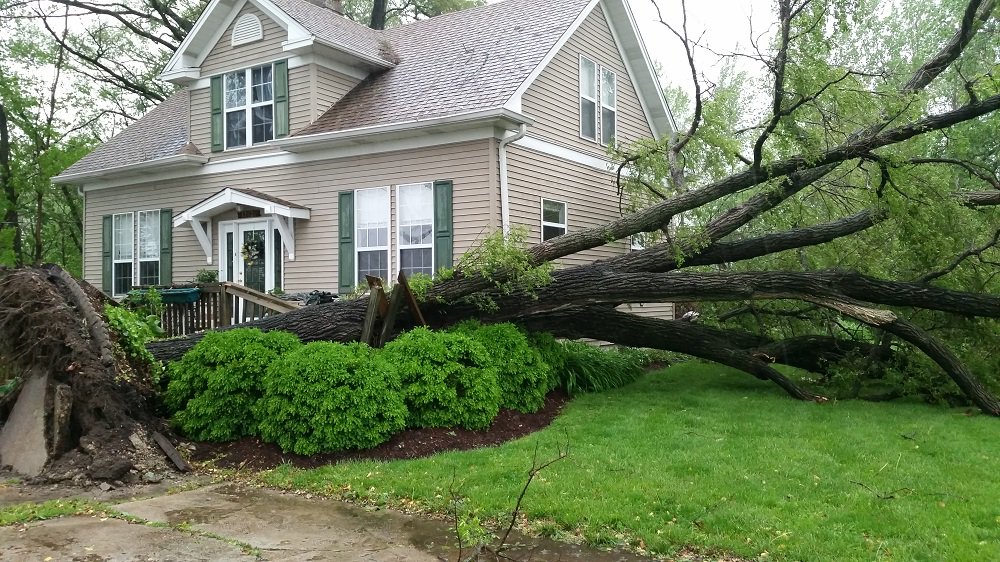
A tree barely missed falling on a home in the Chesterfield Valley today after storms rolled through.#STLWx #KMOV
The homeowners, who were home at the time, told Boone County firefighters they heard a close lightning strike and saw smoke coming from their garage. Fire crews arrived to see smoke and flames coming from the garage attic but had the blaze extinguished in about 10 minutes.








No comments:
Post a Comment