By: By Chris Dolce
Published: April 12, 2014
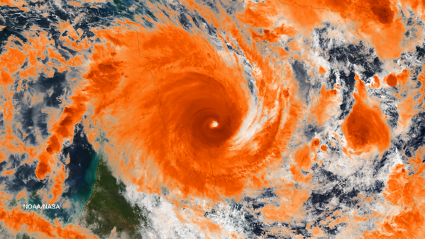
Powerful Tropical Cyclone Ita (pronounced "EYE-tuh") made landfall in
northeast Australia near Cape Flattery in the Queensland state late
Friday night, local time (around 7 a.m. U.S. EDT).
Ita Satellite

(FORECAST: Cairns | Cooktown | Port Douglas)
Cape Flattery measured a peak wind gust just shy of 99 mph at 9 p.m. local time Friday, and had already picked up over three inches of rain from Ita's outer rainbands and eyewall before observations ceased there around 10 p.m.
According to the Cairns Post, roof damage was reported to the James Cook Museum in Cooktown, as well as to several homes in the town. The peak wind gust clocked, there, was 76 mph.
Heavy rain and flooding is possible over parts of northeast Australia into Sunday as the center of the cyclone turns southeastward and heads back into ocean.
Tropical cyclones are not uncommon in Australia. The Australia Bureau of Meteorology says that the season typically runs from November through April.
In fact, this part of northeast Australia is thought to hold the world record for highest storm surge from the 1899 Bathurst Bay Cyclone.
(DR. JEFF MASTERS BLOG: World Storm Surge Records)
The northwest coast of Australia has the most frequent encounters with tropical cyclones and averages about two landfalls each season. Intense Category 4 or Category 5 cyclones are most likely to occur in March and April.
Prior to heading towards Australia, Ita and the disturbed area of weather it formed from produced heavy rain and deadly flooding in the Solomon Islands.
Ita then rapidly intensified from a strong Category 1 to a Category 4 equivalent cyclone in just 12 hours Thursday.
Tropical Cyclone Ita Hits Australia
Trop Cyclone #Ita just offshore near Cape Flattery, #Queensland, #Australia http://www.nnvl.noaa.gov/MediaDetail2.php?MediaID=1533&MediaTypeID=1 … @NOAASatellites


No comments:
Post a Comment