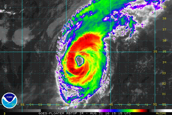
Hurricane Gaston is well away from land in the central Atlantic Ocean, but could pass near the Azores from Friday into the weekend.
A tropical storm watch has been issued for the western and central Azores. Winds on Friday could reach or exceed 40 mph in the Azores.
(MORE: Interactive Storm Tracker)
On Sunday, Gaston became the first major hurricane (Category 3 or higher on the Saffir-Simpson Scale) of the 2016 Atlantic hurricane season. That appeared to have been Gaston's intensity peak, but winds reintensified to a Category 3 level early Wednesday. Since then, winds have come down.
Here's the latest on Gaston:
- Gaston was located about 935 miles west of The Azores, as of Wednesday night.
- Weakening is forecast during the next couple of days.
- Gaston's forward speed has increased.
- While well over 1,000 miles off the East Coast, Gaston has generated swells that continue to reach the East Coast. Dangerous rip currents are possible.
- Gaston may get close to the Azores in the northeast Atlantic by Friday night as a tropical storm. Check back for updates on possible impacts.

Current Storm Status

Projected Path

#Gaston is now the longest-lived Atlantic named storm since Nadine in 2012.

No comments:
Post a Comment