Published: September 27,2016
Typhoon Megi made its final landfall in southeast China, near Quanzhou, early Wednesday morning, local time, at Category 1 strength, after clobbering Taiwan with torrential rain and wind gusts well over 100 mph.
(LATEST NEWS: Almost 3 Million Lose Power in Taiwan)
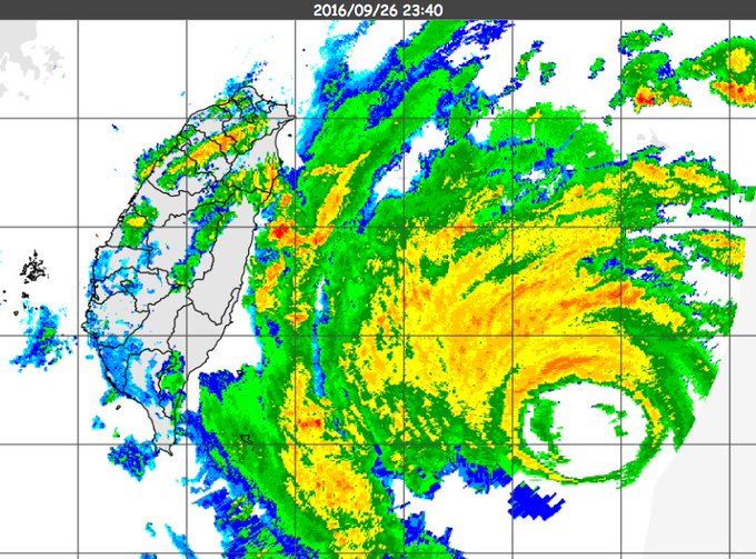
According to the U.S. Joint Typhoon Warning Center (JTWC), Megi's 35 mile-wide eye came ashore in northeast Taiwan's Hualien County around 1 p.m. local time - or 1 a.m. U.S. EDT, Tuesday, Sept. 27.
(WATCH: High-Resolution Satellite Loop of Landfall from NWS/OPC)
 Typhoon
Megi makes landfall in northeast Taiwan at 1 p.m. local time on
September 27, 2016, as the equivalent of a Category 4 storm.
 (RECAPS: Malakas | Meranti)

Current Storm Status
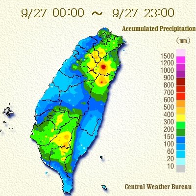
Rain was falling at the rate of over 3 inches per hour Tuesday.
Peak #Taiwan rainfall total over 3 feet (945mm ~ 37.20") Tue. alone at Taipingshan. 4 other locations with > 2' of rain today alone. #Megi
- Pengjiayu: 105 mph
- Taoyuan Int'l Airport, Taipei: 99 mph (with peak sustained wind of 71 mph)
- Songshan Int'l Airport, Taipei: 98 mph
- Taichung: 73 mph

Current Winds, Gusts
Forecast
Additional bands of heavy rain may continue to plague parts of Taiwan into Wednesday afternoon, local time, even though Megi's center is over China, producing another several inches of rain in some spots, particularly over the mountains.(MORE: Hurricane Central)
Downed trees, power outages, structural damage, particularly to poorly-constructed buildings, coastal flooding and battering waves will gradually wind down Wednesday afternoon.
(FORECAST: Taipei)

Rainfall Outlook Through Friday
Megi's circulation will continue to weaken over southeast China, to the northeast of Hong Kong, through Wednesday.

Projected Path and Intensity
Additional heavy rainfall, with a threat of flash flooding, will impact southeast China over the next day or so.
Projected Path and Intensity
(FORECAST: Hong Kong)
As mentioned earlier, Megi is the fourth typhoon to either brush or make landfall in Taiwan this season, and third to do so in the past two weeks.
 Typhoons
to either landfall or brush Taiwan in 2016 through September 21, along
with dates of their closest approach and intensities.
Typhoons
to either landfall or brush Taiwan in 2016 through September 21, along
with dates of their closest approach and intensities.As many as seven typhoons have struck Taiwan in four separate years, most recently in 2001, according to the CWB.
This past weekend, Megi rapidly intensified with wind speeds increasing from a 50 mph tropical storm to a 105 mph typhoon in just 24 hours.
Monday, Megi replaced its eyewall, something common in stronger tropical cyclones, which could be seen from Taiwan's CWB radar on September 26.


No comments:
Post a Comment