By Jillian MacMath, AccuWeather.com Staff Writer
November 10,2014; 9:10PM,EST
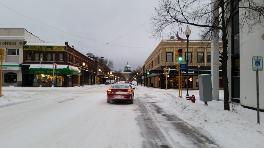
A snowstorm is unfolding across northern Plains and upper Great Lakes, threatening to dump more than a foot of snow across northern Wisconsin and the Upper Peninsula of Michigan through the first half of the week.
Due to the path of the storm, some of the bigger cities around the Great Lakes, such as Chicago and Detroit, will miss out on the snow.
Central Minnesota could receive close to a foot of snow. From northern Wisconsin through the Upper Peninsula of Michigan, between 12 and 18 inches could fall. As of Monday evening, St. Augusta, Minnesota, has already seen 16.5" of snowfall. Follow the minute-by-minute forecast for the snowstorm with AccuWeather's Minutecast®.

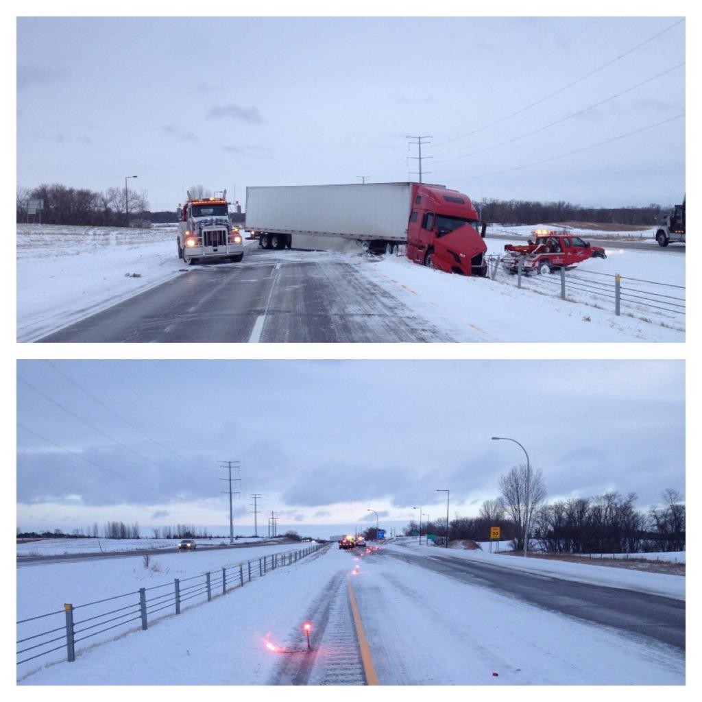
Hundreds of vehicle related accidents have been reported across Minnesota as of Monday evening, including one fatal collision, according to the state highway patrol.
Windy conditions through Tuesday and Tuesday night across open areas of Minnesota, Wisconsin and northern Michigan will worsen visibility in the area. This will make for dangerous travel conditions, slowing roadway traffic and threatening continued delays or cancellations of flights.
MAP: More Than a Foot of Snow to Whiten Upper Midwest
Only Eight States to Dodge Icy Air From Slipping Polar Vortex
See When the Snow Will Start, Stop by Tracking AccuWeather's Minutecast®
UPDATES (All times listed in Central Standard Time):
7:55 p.m. CST:
#MSPcrash Troopers on scene of a 1 veh rollover-no inj. I94 EB mp106 (Alexandria) #PayAttention #SlowItDown
7:55 p.m. CST: Wichita, Kansas, saw temperatures fall from 77 F to 40 F in the past 4 hours.
7:45 p.m. CST:
6:50 p.m. CST:
5:31 p.m. CST
I94 EB mp100 (Alexandria) jackknifed semi blocking both lanes. Traffic directed through EB rest area
4:36 p.m. CST Since 5 a.m. CST, Minnesota State Patrol has responded to nearly 400 crashes. A fatal crash was reported at 3 p.m. in Nicollet County.
4:34 p.m. CST As of 3 p.m. MST, Springfield, Colorado, saw a temperature drop of 31 F in one hour from 78 F to 47 F.
4:25 p.m. CST: Watch the latest edition of AccuWeather LIVE.
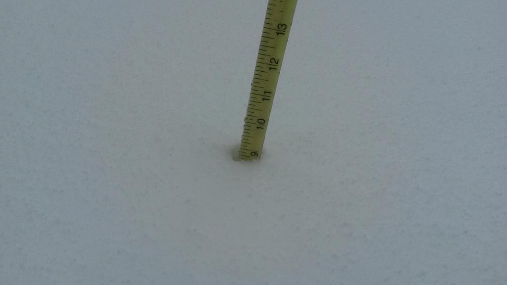
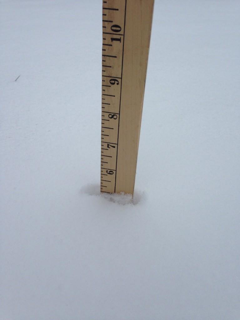
3:08 p.m. CST: A trained spotter reports 10 inches of snow near Willmar, Minnesota.
2:12 p.m. CST:
1:40 p.m. CST: A trained spotter reports 9 inches of snow in Birchwood, Wisconsin.
1:08 p.m. CST: "The heaviest band of snow at 1 p.m. is situated from east-central Minnesota eastward through northern Wisconsin and into the Upper Peninsula of Michigan," AccuWeather.com Meteorologist Erik Pindrock said. "Snowfall rates in the heaviest areas of snow can be as high as 1 to locally 2 inches an hour," he said.
12:29 p.m. CST: Delays for arriving flights to Minneapolis-St. Paul International Airport are now down to an average of two hours, the FAA reports.
12:17 p.m. CST:
11:54 a.m. CST:
5 inches in Kulm, ND #NDWX
11:41 a.m. CST:
11:28 a.m. CST: Arriving flights at Minneapolis-St. Paul International Airport are being delayed by an average of six hours, the FAA reports. FlightStats reports that nearly 300 flights have been canceled.
11:23 a.m. CST: Watch the latest edition of AccuWeather LIVE for the most recent details on the snowstorm.
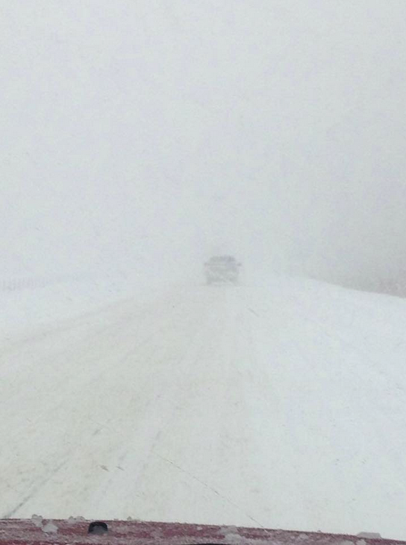
Whiteout conditions on I94 near St Cloud, MN heading toward Fargo taken by Samantha Ann Brouillard #snow #ArcticBlast
10:45 a.m. CST: Since 5 a.m., Minneapolis State Police have responded to 180 crashes statewide.
10:13 a.m. CST: There are widespread reports of accidents across the Twin Cities region as snow continues to create hazardous conditions along major roadways. These trucks were traveling westbound along I-94 when snowy conditions forced them off the road.
 (Photo/Sgt. Jesse Grabow/Trp. Kleinschmidt)
10:03 a.m. CST: Southwest and Delta airlines have announced waivers to those travelling through Minneapolis-Saint Paul International Airport while snow and ice creates long flight delays and cancellations.
9:40 a.m. CST: The Minnesota Department of Transportation reports of 12 crashes and/or vehicles that have spun out of control as snow and ice covers large portions of roadways around the Twin Cities.
8:55 a.m. CST: According to a trained spotter, 2 inches of snow reported within three hours in Burnett County, Wisconsin.
8:45 a.m. CST: Delays underway for flights headed to Minneapolis, due to snow and ice at Minneapolis St. Paul International Airport, the FAA reports.
On Social Media

Professor Jeremy
JeremyHL
Wow -55 RT @breakingweather: La Junta, CO, saw a high of 79 F today, but as of right now it is snowing and 24 F: ow.ly/E5AHr

Kellogg's Painting
KelloggsPaintCo
LIVE: First Snowstorm of Season for Minneapolis Delays Flights, Commute fb.me/3a9RgZqEo






No comments:
Post a Comment