June 18,2014; 9:09PM,EDT
A complex of severe thunderstorms continues to race through Ohio into parts of Pennsylvania.
"These storms will affect cities such as Cleveland, Columbus and eventually Pittsburgh by this evening," AccuWeather.com Meteorologist Brian Edwards said.
The storms will continue racing southeastward into the mid-Atlantic states tonight bringing a threat for damaging winds to cities as far east as Harrisburg and Philadelphia, Pennsylvania.
Meanwhile, additional severe thunderstorms, some producing tornadoes, will continue to develop from the Dakotas to western Texas into tonight.
RELATED:
Midweek Severe Storms to Rattle Minneapolis to NYC
AccuWeather Severe Weather Center
Five Essential Steps to Take Before Severe Weather Hits
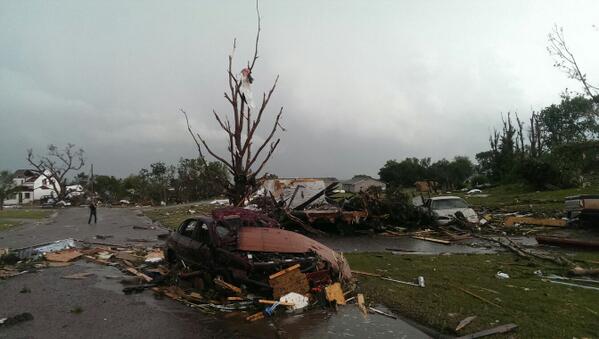
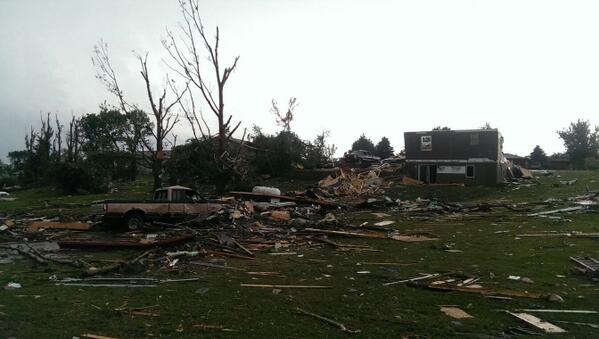
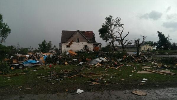
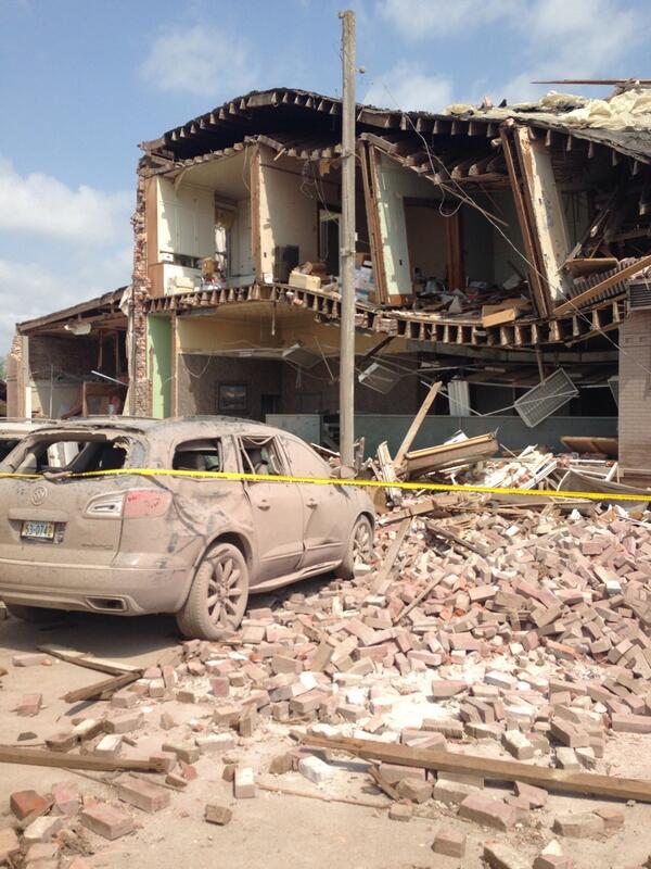
The Lincoln Journal Star is reporting catastrophic damage to the town of Pilger, Nebraska, according to reports from the scene. The Associated Press is reporting a second fatality has been blamed on the tornadoes and at least 19 people were taken to hospitals.
For more reports from early in the outbreak, click here.

UPDATES: (All times are listed in Central time)
10:11 p.m. CDT Wednesday:10:02 p.m. CDT Wednesday: The Associated Press is reporting that one person was hurt after a tornado struck near Wessington Springs, South Dakota.
9:51 p.m. CDT Wednesday: About 35,000 DTE Energy customers in the Detroit area are without power, the utility reports.
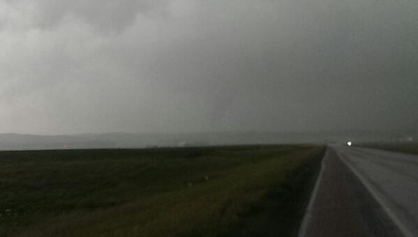
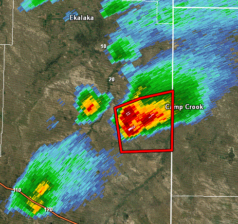
9:41 p.m. CDT Wednesday: South Dakota tornado damage:
9:34 p.m. CDT Wednesday: A tornado on the ground 10 miles north of Platner, Colorado, report trained spotters.
9:28 p.m. CDT Wednesday: Colorado tornado reported:
9:24 p.m. CDT Wednesday: Storm near North Platte, Nebraska:
9:22 p.m. CDT Wednesday: About 62,000 Ohio power customers without power, utilities report.
9:06 p.m. CDT Wednesday: 70 mph gust 4 miles south of Long Island, Kansas, reports trained spotter.

9:02 p.m. CDT Wednesday: Numerous trees downed by a storm in DuBois, Pennsylvania, reports trained spotter.
8:57 p.m. CDT Wednesday: About 15,000 First Energy customers in Pennsylvania are without electricity, the utility reported.
8:36 p.m. CDT Wednesday:
8:35 p.m. CDT Wednesday:
8:33 p.m. CDT Wednesday:
8:05 p.m. CDT Wednesday:
8:04 p.m. CDT Wednesday:
7:46 p.m. CDT Wednesday:Wind gusts up to 77 mph reported near Aurora, Illinois, according to Mesonet.
7:45 p.m. CDT Wednesday:
7:33 p.m. CDT Wednesday:
7:19 p.m. CDT Wednesday: A large rain-wrapped tornado was spotted near Wessington Springs and remained on the ground for 10 minutes, reports NWS spotter.
7:02 p.m. CDT Wednesday: Tornado reported on the ground 1 mile east of Gann Valley, South Dakota, reports NWS spotter at 6:54 p.m. CDT.
6:15 p.m.CDT Wednesday:Canton, Ohio:
6:00 p.m. CDT Wednesday:Due to wind, multiple trees and power lines downed near New Castle, Indiana, reports law enforcement.
5:44 p.m. CDT Wednesday: Wind gusts up to 65 mph reported near Sheffield, Ohio, according to emergency management.
4:51 p.m. CDT Wednesday:
4:45 p.m. CDT Wednesday:
4:36 p.m. CDT Wedensday: Approximately 15,000 DTE Energy customers without power, the utility reports.

4:00 p.m. CDT Wednesday:Flooding across highway 66 near Mankato, Minnesota, reports deptarment of highways.
2:30 p.m. CDT Wednesday: Wind gusts up to 81 mph reported near Adrian, Michigan, according to an NWS observation.
2:22 p.m. CDT Wednesday: Wind gusts up to 56 mph reported near Shambo Ranch, South Dakota, reports Mesonet.
1:02 p.m. CDT Wednesday: A 15 minute rain total of .53" fell was recorded near East Grand Rapids, Michigan, reports NWS spotter.
12:49 p.m. CDT Wednesday: A co-op observer reported a 53 mph wind gust in East Grand Rapids Michigan.
12:05 p.m. CDT Wednesday:
11:26 a.m. CDT Wednesday: A co-op observer in Buffalo County, Wisconsin, reports 2.31 inches of rain.
10:55 a.m. CDT Wednesday: Watch Meteorologists Andrew Baglini and Heather Waldman provide the latest updates on the severe weather threat on this edition of 'AccuWeather LIVE.'
10:29 a.m. CDT Wednesday: The FAA is listing ground delays at Chicago O'Hare due to the thunderstorms.
9:52 a.m. CDT Wednesday: An NWS-trained spotter in Clarion County, Pennsylvania, is reporting multipel flooded roadways.
9:17 a.m. CDT Wednesday:
9:06 a.m. CDT Wednesday: "There is a squall line moving eastward across northern Illinois and southeastern Wisconsin that will hit Chicagoland during the midday hours with blinding rain, gusty winds and frequent lightning strikes," said AccuWeather.com Senior Meteorologist Alex Sosnowski.
8:30 a.m. CDT Wednesday: Hail the size of ping-pong balls reports in Kent County, Michigan, by an NWS-trained spotter.
8:11 a.m. CDT Wednesday: Quarter-sized hail reported by NWS-trained spotter in Jamestown, Michigan.
7:44 a.m. CDT Wednesday: FlightStats lists excessive delays amid thunderstorms in Detroit:

7:16 a.m. CDT Wednesday: Quarter-sized hail reported by an NWS-trained spotter in Grant County, Wisconsin.
7:00 a.m. CDT Wednesday: A co-op observer in Iduna, Wisconsin, reports 4.72 inches of heavy rain.
6:27 a.m. CDT Wednesday: Law enforcement reports flash flooding across Trempealeau County, Wisconsin, closing many roads.
6:10 a.m. CDT Wednesday: Early morning lightning flashes in Iowa:
5:55 a.m. CDT Wednesday: Hundreds are reportedly without power across portions of Wisconsin, Iowa and Michigan. Numbers are expected to climb as people wake up later this morning.
5:28 a.m. CDT Wednesday: States of emergency have been declared for parts of Wisconsin, South Dakota and Alberta, Canada.
5:03 a.m. CDT Wednesday: Penny to nickel-sized hail reported in Mower County, Minnesota, by local law enforcement.
4:25 a.m. CDT Wednesday: Law enforcement in Algona, Iowa, report multiple flash floods overtaking roadways.
3:10 a.m. CDT Wednesday: A wind gust of 54 mph was measured in Waseca, Minnesota.
1:58 a.m. CDT Wednesday: The NWS via law enforcement reported damage to farm outbuildings near Royal, Iowa, southwest of Spencer. It is not known at this time if damage was the result of a tornado.
1:22 a.m. CDT Wednesday: A wind gust of 66 mph was measured in Spencer, Iowa, with this thunderstorm. Doppler radar indicating rotation, which means a tornado is possible.

12:45 a.m. CDT Wednesday: A nearly stationary thunderstorm is causing flooding in Mankato, Minnesota, southwest of Minneapolis. Law enforcement is reporting several roads are impassable in the city. Water is reported to be up to car bumpers in Rapidan, Minnesota, to the southwest of Mankato. Doppler radar estimates that rainfall rates of 2-3 inches an hour are occurring.
11:31 p.m. CDT Tuesday: Thunderstorms rapidly developing in the Milwaukee, Wisconsin metro area. They can produce high winds, hail and downpours as they move through the area.

11:22 p.m. CDT Tuesday: Record flooding is occurring on the Big Sioux River along the South Dakota and Iowa border. Below is the river gage data from the USGS at Akron, Iowa, courtesy of NOAA.

10:18 p.m. CDT Tuesday: The Storm Prediction Center has issued a severe thunderstorm watch until 4 a.m. CDT Wednesday for parts of Iowa, Wisconsin, Illinois and Indiana. This includes Milwaukee, Wisconsin, and the entire Chicago metro area.
10:08 p.m. CDT Tuesday: An NWS employee reports the tornado near Laurel, Nebraska, is still on the ground and nearly stationary.
10:00 p.m. CDT Tuesday: Squall line with damaging wind gusts of 60 mph or higher moving through New York State. Albany, New York, could be impacted later tonight.

8:45 p.m. CDT Tuesday:
8:38 p.m. CDT Tuesday: A tornado was spotted 1 miles northwest of Coleridge, NE, reports emergency management.
8:15 p.m. CDT Tuesday:
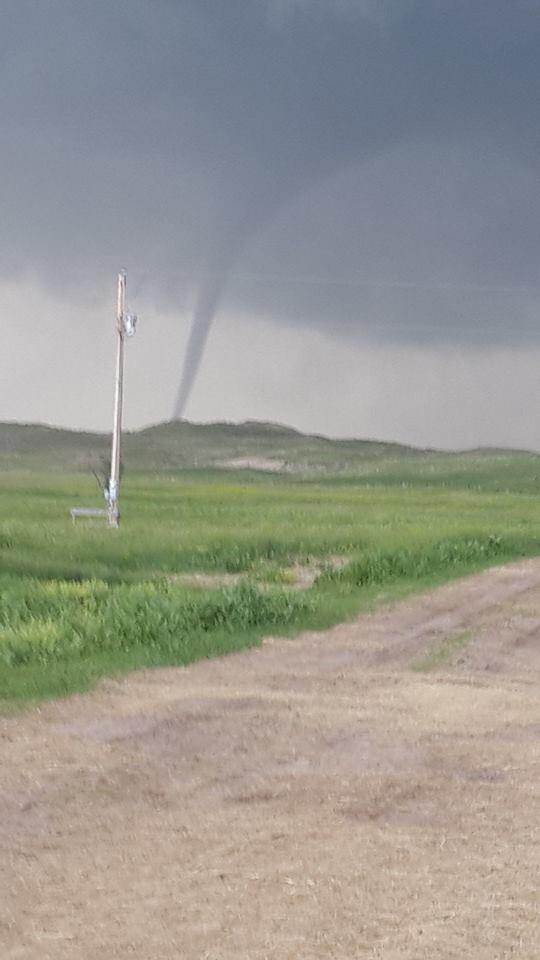
This tornado was spotted ~25 mi. n. of Whitman at 6p MT from Tanya Storer #NEwx
8:15 p.m. CDT Tuesday: Tornado reported near Hartington, Nebraska, reports NWS spotter.
8:01 p.m. CDT Tuesday:

AviWxChasers
Broadcasting & Media Production · 2,754 Likes
· Yesterday at 8:52pm ·
Damage Survey from Carter County, MT courtesy of NWS Billings
7:02 p.m. CDT Tuesday: Multiple tornadoes reported in Cherry County, Nebraska, reports NWS. Tornado spotted at 6:43 p.m. near Cody, Nebraska, NWS reports.

6:55 p.m. CDT Tuesday:
5:46 p.m. CDT Tuesday:
5:39 p.m. CDT Tuesday: Hail 1.5 inches in diameter reported near Merriman, Nebraska, reports a NWS spotter.
4:26 p.m. CDT Tuesday:

Montana Storms
Public Figure · 27,821 Likes
· Yesterday at 5:15pm ·
Photo of current tornado near Capitol, MT #mtwx
4:20 p.m. CDT Tuesday: Tornado reported 9 miles northwest of Capitol, Montana, reports NWS trained spotter.
3:41 p.m. CDT Tuesday:
3:28 p.m. CDT Tuesday: Quarter sized hail reported near Ismay, Montana, reports NWS spotter.
2:36 p.m. CDT Tuesday: Multiple reports wind damage and downed power lines in Penfield, New York, reports law enforcement.
1:54 p.m. CDT Tuesday:
1:02 p.m. CDT Tuesday:
12:14 p.m. CDT Tuesday:
11:46 a.m. CDT Tuesday:
10:38 a.m. CDT Tuesday:
9:33 a.m. CDT Tuesday: Tree branches went down in Wisconsin when storms tore through the area last night into this morning:
 (Instagram/delsol666)
9:09 a.m. CDT Tuesday: An NWS-trained spotter reports half-dollar sized hail covering the ground in Brockway, Montana.
8:51 a.m. CDT Tuesday: According to FlightStats, Chicago O'Hare International Airport has the most delayed incoming flights of any domestic hub.
8:29 a.m. CDT Tuesday: CNN is reporting that the death toll from the twin tornadoes has risen to two.
8:06 a.m. CDT Tuesday: Nearly 20,000 MidAmerican Energy customers still without power.
On Social Media







No comments:
Post a Comment