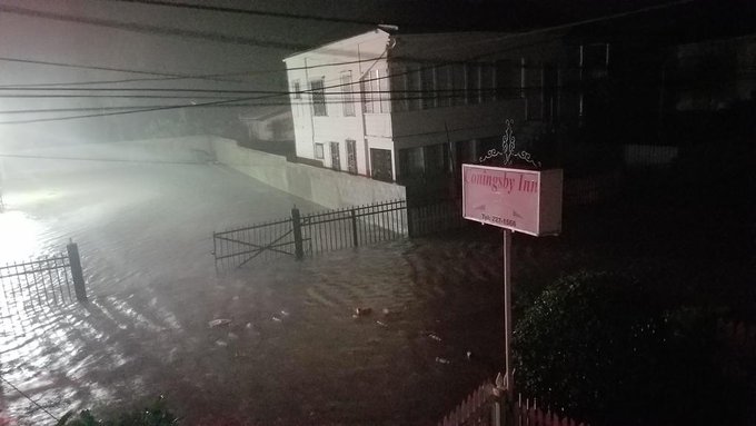
Tropical Storm Earl made landfall early Thursday morning near Belize City as a Category 1 hurricane with estimated maximum sustained winds of 80 mph. Now, the main concern going forward will transition to excessive rainfall and major flooding.
(MORE: Belize Lashed By Strong Winds, Rain)
 Hurricane Earl's landfall statistics early Thursday morning.
Radar loop of #Hurricane #Earl landfall (Cat. 1) just south of Belize City, via Belize NMS.
2 am. Wind has lost its bite. Surge is slooowly receding. 999 mb. #Hurricane #EARL is pulling away from #Belize City
(MORE: Why Western Caribbean Sea Had Been Hurricane-Free Since 2013)
The center of Earl was located about 115 miles west of Belize City, Belize, with maximum sustained winds around 50 mph as of late Thursday morning.

Current Status
Earl Forecast: Heavy Rain Threat
Due to strong high pressure aloft over the southern United States, Earl will continue to be steered west-northwest, weakening to a tropical depression by Thursday night.(FORECAST: Belize City | Cancun | Cozumel)

Projected Path
Earl will continue westward as a tropical depression or remnant low over interior southern Mexico this weekend, but one threat looms large despite this weakening.
Rainfall totals of 8-12 inches (locally higher) are possible along the path of Earl in parts of Belize, Guatemala and southern Mexico, including parts of the Yucatan Peninsula. Dangerous flash flooding and mudslides are possible through the weekend in these areas.
(MORE: Tropical Storms and Hurricane in Mexico and Central America Have a Tragic History)

Forecast Rainfall Associated with Earl
Battering waves riding atop the surge would also add to any flooding or beach erosion in these areas.
(MORE: Hurricane Central)
The track of Earl will remain well south of the U.S.
However, some increase in showers may spread to parts of South Texas this weekend.
Of perhaps more concern is the threat for higher surf and rip currents by the weekend up the Texas coast, possibly as far north as Galveston.
(FORECAST: S. Padre Island | Corpus Christi)
Earl's History
Earl became a Category 1 hurricane on Wednesday, August 3, when NOAA Hurricane Hunters found winds of 75 mph. Earl was just off the coast of Honduras at the time.Earl was named late Tuesday morning after a Hurricane Hunter reconnaissance mission found that an area of low pressure had formed.
This system was already impactful prior to being named Earl. Six people were killed in the Dominican Republic Sunday into Monday as this system passed near the island.
(MORE: 6 Killed in Dominican Republic)
As often the case, Earl's parent tropical wave could be traced back thousands of miles to a tropical wave coming off Africa the previous week.


No comments:
Post a Comment