Published: August 4,2016
If you have a vacation planned for Florida or elsewhere in the Southeast into next week, it may be a good idea to pack ponchos, umbrellas and rain coats, as locally heavy rain, and even some flash flooding, is expected across the region.
While it won't rain all day over the next several days, thunderstorms are expected to pop up each afternoon as they typically do in mid-summer, but areal coverage of the storms will be more widespread than the usual scattered activity.
(MORE: Where Flooding Has Been Most Frequent in the U.S.)
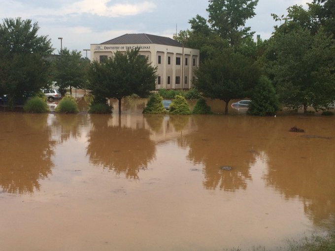
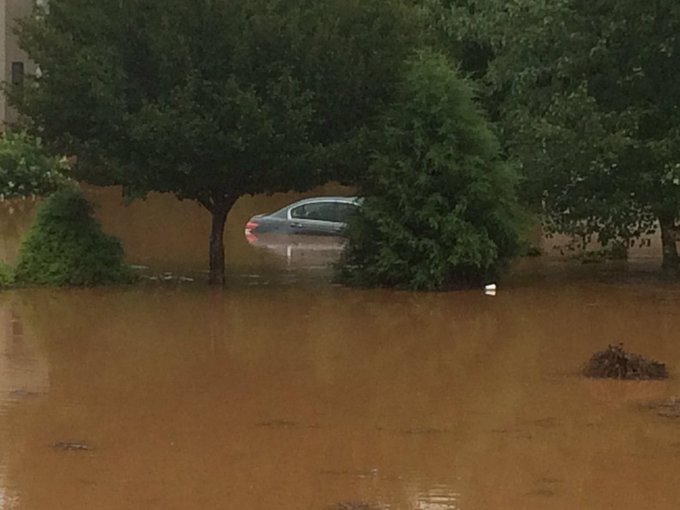
Wednesday, over 7 inches of rain triggered severe flooding in Statesville, North Carolina, flooding the grounds at Statesville High School with up to waist-deep water and requiring 18 water rescues, according to WSOC TV.
The scene now near Brookdale Drive, Statesville; cars submerged @wsoctv

Radar, Watches, and Warnings
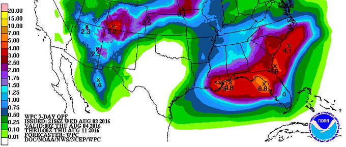
Rainfall Forecast
A broad swath of 1 to 3 inch rain amounts is expected across the Southeast into early next week, from the northern and eastern Gulf Coast northward into the Carolinas.The most widespread heavy rain threat appears to set up from the western Florida Gulf Coast to the Florida Panhandle, southern Alabama, southern Mississippi and southeast Louisiana, where widespread 3-inch-plus rain totals are most probable into next week.
Much heavier amounts in short periods of time will occur where any slow-moving or stationary downpours set up, quickly triggering dangerous local flash flooding, possibly similar to what was seen in Statesville, North Carolina, Wednesday.
(MORE: View National Interactive Radar Map | Difference Between a Watch and a Warning)

Southeast Rainfall Outlook
(MORE: July's Extreme Heat Breaks Records Across South)
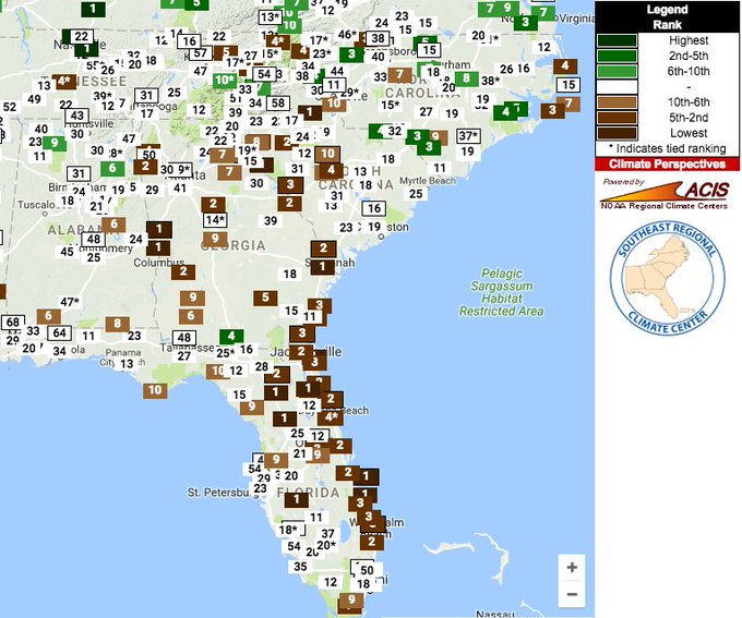
After one of the drier Julys on record (rankings on @SERCC map), a real soaking is ahead for parts of SE.
Why the Sudden Soaking?
What is sometimes daily afternoon thunderstorms in mid-summer in the Southeast (sometimes called the "Southeast Monsoon" by some meteorologists) will be a bit more noteworthy the next several days.A stalled front will be in place over the Southeast. Meanwhile, abundant Gulf moisture will be in place across the region, continuously fueling the showers and storms that develop.

This weather pattern is not expected to change much until at least the middle of next week.
MORE: West Virginia Flooding in June


No comments:
Post a Comment