Published: August 25,2017
Hurricane Harvey underwent rapid intensification from late Wednesday into Thursday and continued to quickly strengthen as it churned through the Gulf of Mexico.
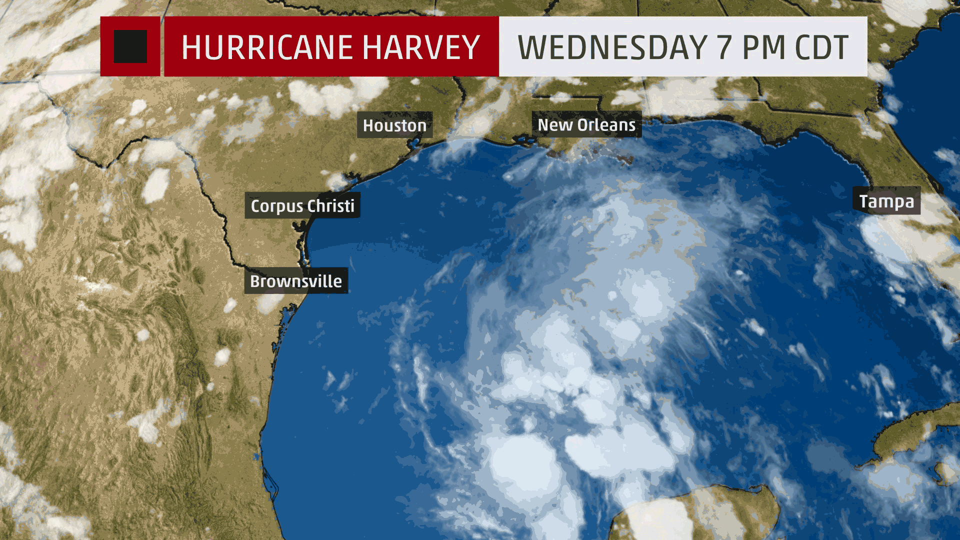
Harvey regenerated as a tropical depression, with maximum sustained winds of 35 mph at 10 a.m. CDT Wednesday. Twelve hours later, Harvey reached tropical storm strength, with winds of 40 mph.
(MORE: Hurricane Central)
Thursday morning, Harvey's strengthening accelerated and its maximum sustained winds increased to 65 mph by 11 a.m. Harvey continued to intensify and became a hurricane Thursday at 1 p.m. with winds of 80 mph. This increase from 35 mph on Wednesday night to 80 mph early Thursday afternoon exceeded the qualifications for Harvey having undergone rapid intensification.
Rapid intensification is defined as taking place when a tropical cyclone increases its maximum sustained winds by at least 35 mph in 24 hours or less.
(MORE: Hurricane Harvey's Forecast)
 Satellite
images of Harvey from Wednesday night, August 23 through Friday
morning, August 25, showing its transformation from a tropical
depression to a hurricane.
Satellite
images of Harvey from Wednesday night, August 23 through Friday
morning, August 25, showing its transformation from a tropical
depression to a hurricane. Satellite
images of Harvey from Wednesday night, Aug. 23 through Friday morning,
Aug. 25, showing its transformation from a tropical depression to a
hurricane.
Satellite
images of Harvey from Wednesday night, Aug. 23 through Friday morning,
Aug. 25, showing its transformation from a tropical depression to a
hurricane.Maximum sustained winds remained at 85 mph from Thursday afternoon until 1 a.m. Friday, when maximum sustained winds reached 100 mph. Steady strengthening persisted with winds climbing to 110 mph Friday morning.
In addition to the remarkable increase in winds, Harvey's central pressure drop was also impressive. Harvey's minimum pressure was 1002 millibars on Wednesday at 10 p.m., and 24 hours later, its pressure had dropped to 973 millibars – a difference of nearly 30 millibars. Even more striking was how Harvey's pressure plunged to 947 millibars by 10 a.m. on Friday – a 26-millibar drop in just 12 hours.
(MORE: Four Things To Know About Harvey)
The combination of low vertical wind shear and very warm water temperatures helped to create ideal conditions for this explosive development.
Harvey, upgraded Friday afternoon to a Category 3 hurricane on the Saffir-Simpson Hurricane Wind Scale, will remain in a favorable environment for further strengthening up to landfall.
The Weather Company’s primary journalistic mission is to report
on breaking weather news, the environment and the importance of science
to our lives. This story does not necessarily represent the position of
our parent company, IBM.
No comments:
Post a Comment