By Mark Leberfinger, AccuWeather.com Staff Writer
December 29,2015; 10:20PM,EST
As of 12:00 p.m. EST Tuesday, this blog is no longer active. Archived reports from the storm can be found below. Additional forecast information into Tuesday night can be found here.
Areas of snow, sleet and freezing rain will continue across the midwestern and northeastern United States into Tuesday afternoon, creating difficult travel conditions.
"Massachusetts, upstate New York, Vermont, New Hampshire and especially Maine will continue to see travel difficulties into the afternoon," AccuWeather Meteorologist Evan Duffey said.
Major travel delays are expected until the icy mix changes over to rain later in the afternoon and evening. Low visibility and icy roads have contributed to accidents and delays across the region.
This same storm produced major flooding across the Missouri Valley, tornadoes across Texas and a blizzard from New Mexico into western Texas during the weekend.
RELATED:
First winter storm of season brings ice, snow to northeastern US in final days of 2015
States implement plow trackers, dash cams to improve snow removal operations
AccuWeather winter weather center
UPDATES: (All times are listed in EST)
11:57 a.m. EST Tuesday: Up to a foot of snow could fall in portions of central and northern Maine and northern New Hampshire as the storm continues on Tuesday. Additional forecast information on the widespread snow and ice storm and impacts into Tuesday night can be found here.
10:48 a.m. EST Tuesday: Speed limits are reduced to 45 mph on I-95 and I-295 in Maine, according to the Department of Transportation.
10:39 a.m. EST Tuesday: In Auburn, Maine, one driver forgot to close his sunroof in advance of the storm:
10:04 a.m. EST Tuesday: Massachusetts State Police responded to multiple incidents this morning as road conditions proved hazardous.
On Interstate 290, no one was injured after a slide-off.
No one was injured after a truck jackknifed along Interstate 91 southbound.
9:54 a.m. EST Tuesday: Snow and ice caused a large pine tree to fall on a house in Mountain Top, Pennsylvania. No major damage occurred.
9:25 a.m. EST Tuesday: Nearly 5,000 National Grid customers are without power across New York, the utility reports.
9:22 a.m. EST Tuesday: Inbound flights to Boston Logan International Airport may be subject to a ground stop program due to snow and ice, according to the FAA.
8:29 a.m. EST Tuesday: Road conditions are still slippery in parts of New York:
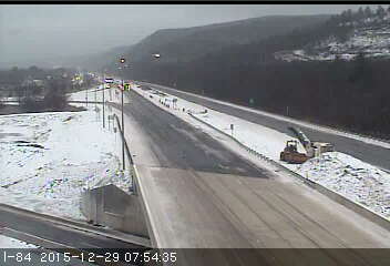
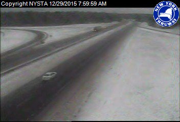
Slushy/icy roads, and sub-freezing temperatures remain, for Syracuse, Utica, the Catskills, and Poconos.
7:58 a.m. EST Tuesday: Inbound flights to Philadelphia International Airport are subject to a ground delay program due to low clouds, FAA reports.
7:36 a.m. EST Tuesday: Ice and snow made for a slushy start in Boston on Tuesday morning:
7:19 a.m. EST Tuesday: A NWS trained spotter reports 4.3 inches of snow in Bristol, New Hampshire.
6:54 a.m. EST Tuesday: More than 1,300 crews treating state roads throughout Massachusetts, according to MassDOT.
5:52 a.m. EST Tuesday: Jackknifed tractor-trailers close Interstate 495 near Chelmsford, Massachusetts, MassDOT reports.
5:30 a.m. EST Tuesday: Commuter rail service is running normally in Massachusetts, the MBTA reports.
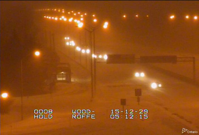
Ottawa - #HWY417 near Woodroffe - snow covered road - traffic is moving slowly in that area #ONHwystraffic
5:14 a.m. EST Tuesday: More than 7,700 New York power customers are without service as a result of the winter storm, utilities report.
5:00 a.m. EST Tuesday: Cold air is fighting against warmer air, creating an icy situation from northeastern Pennsylvania to southern New England, except for Boston, AccuWeather Chief Video Meteorologist Bernie Rayno said.
Kink in isobars across NW nj and southern New England showing that low level cold is fighting warm advection
3:47 a.m. CST Tuesday: Snowy conditions are occurring in Downtown Northampton, Massachusetts, MassTraveler.com reports.
3:32 a.m. CST Tuesday: Interstate 44 near Jerome, Missouri, is closed due to flooding from the Gasconade River, the National Weather Service office at Springfield said.
2:31 a.m. CST Tuesday: Over 6,500 National Grid customers in New York, mostly in the southwestern part of the state, are without power, the utility reported.
2:47 a.m. CST Tuesday: Snowy, icy conditions reported on Niagara Street at Rainbow Bridge, Niagara Falls, New York, according to NITTEC.
2:41 a.m. CST Tuesday: Flooding continues to be an issue on the QEW near Fort Erie, Ontario, 511Ontario reports.
2:19 a.m. CST Tuesday: Two inches of snow with a half mile visibility was reported by an NWS-trained spotter located 2 miles east-northeast of Stratham, New Hampshire.
2:13 a.m. CST Tuesday: Speed limit restriction on Interstate 90 in Massachusetts, MassDOT reports.
1:29 a.m. CST Tuesday: Snowy conditions on Highway 417, Ottawa, Ontario, 511Ontario webcam shows.
1:14 a.m. CST Tuesday: Flooding reported on the QEW at Fort Erie, Ontario, 511Ontario said.
| Mena, Ark. | 8.26 |
| Russellville, Ark. | 8.08 |
| Mount Ida, Ark. | 7.42 |
| Batesville, Ark. | 6.91 |
| Fayetteville, Ark. | 6.86 |
| Paris, Texas | 6.82 |
| Brownwood, Texas | 6.74 |
| Flippen, Ark. | 6.24 |
| Fort Smith, Ark. | 6.17 |
| Bentonville, Ark. | 6.07 |
SHERIFF's OFFICE: Ramps to I-41 in Winnebago County are closed until further notice. http://fb.me/25whVqBVr
12:08 a.m. CST Tuesday: Wet road conditions occurring in New York City, with icy conditions possible north of the city, 511NY reports.
12:05 a.m. CST Tuesday: Slow improvement on main highways in Michigan, state officials report.
Click here for earlier reports.


No comments:
Post a Comment