By Brian Lada, Meteorologist
December 26,2015; 9:48PM,EST
A powerful storm system over the southern Plains has begun to produce severe thunderstorms, flooding rain and blizzard conditions over the region.
The primary threat through the first half of the night will be severe thunderstorms in eastern portions of Texas and Oklahoma.
According to AccuWeather Senior Meteorologist Frank Strait, thunderstorms will continue past midnight and will bring the threat of damaging wind, hail and a few isolated tornadoes.
Meanwhile, blizzard conditions will begin to unfold over eastern New Mexico and the Texas Panhandle.
"The combination of strong winds and heavy snow will create blizzard conditions from Roswell, New Mexico, to Lubbock and Amarillo, Texas," AccuWeather Meteorologist Brett Rathbun said.
RELATED:
First winter storm of season to spread ice, snow across northeastern US next week
Winter storm to aim at Minneapolis, Chicago, Detroit Monday
AccuWeather severe weather center
UPDATES: (All times are listed in CST)
9:04 p.m. CST: Freezing rain has started to fall in Lubbock, Texas. This will lead to deteriorating road conditions through Saturday night.
8:54 p.m. CST: There have been at least four fatalities in Texas due to Saturday evening's tornadoes, according to Fox4.
8:29 p.m. CST:Snow, sleet and ice is shifting from New Mexico into Texas. This combined with strong winds have already lead to some power outages, according to Law Enforcement.
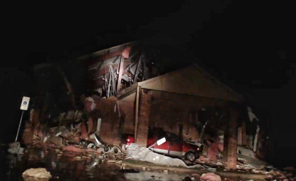
8:00 p.m. CST: Multiple houses have been destroyed in Ovilla, Texas due to a tornado.
(Photo/Haylie Brown)
(Photo/Jonny Snow)
7:43 p.m. CST: A tornado is on the ground northeast of Dallas headed toward the town of Leonard, Texas.
7:40 p.m. CST: People are trapped under collapsed buildings in Copeville, Texas, according to NWS spotter.
7:24 p.m. CST: There is a major pileup on interstate 30 near Dallas. Multiple people are trapped and there are some severe injuries.
6:53 p.m. CST: A new tornado has touched down east of Dallas near Sunnyvale, Texas, according to NWS spotter.
6:41 p.m. CST: Storm damage near Lancaster, Texas, located just south of Dallas.
More #tornado damage north of Lancaster, TX. @MPrendergastTX is streaming live. Praying everyone is ok. #txwx #DFW
6:22 p.m. CST: A wind gust of 105 mph was recorded at Mid-Way Airport near Midlothian, Texas, located south of Dallas.
6:11 p.m. CST:A tornado has been confirmed on the ground and is headed toward downtown Dallas.
(Photo/National Weather Service)
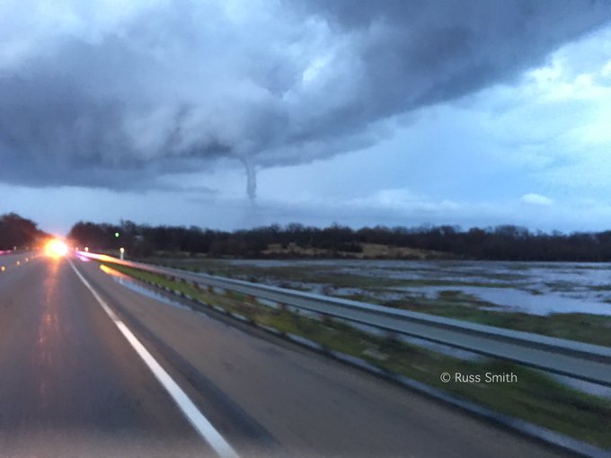
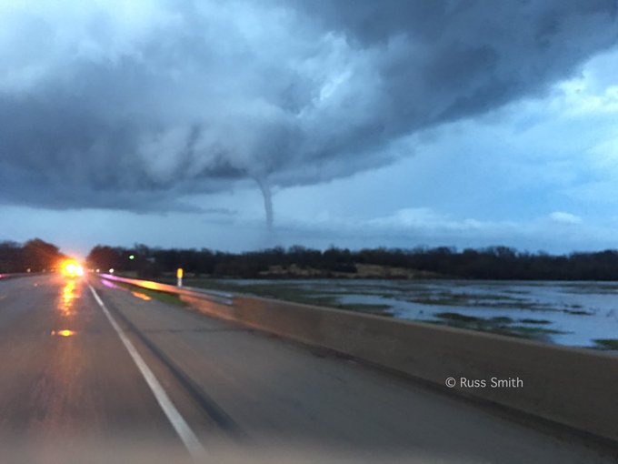
6:03 p.m. CST: A funnel cloud that was spotted east of Dallas earlier this evening.
Defined funnel under lowering of Emory, TX storm 15 minutes ago. #TXwx


No comments:
Post a Comment