By Kevin Byrne, AccuWeather.com Staff Writer
December 23,2015; 8:47PM,EST
Severe storms are set to rattle a swath of the central U.S. into Wednesday night, creating hazardous travel from Louisiana to Illinois.
Wind gusts up to 70 mph may lead to property damage and power outages. Drenching rain may not only lead to travel disruptions, but also flooding. Isolated tornadoes are possible as well, with one radar-confirmed tornado reported Wednesday morning in northern Arkansas.
In Atkins, Arkansas, about 65 miles northwest of Little Rock, a tree crashed onto a house Wednesday morning. Trees and power lines were reported down throughout the area, according to local emergency management.
"The most favorable conditions to produce tornadoes is from northern Mississippi through western Tennessee into Wednesday evening," AccuWeather Storm Warning Meteorologist Alex Avalos said.
RELATED:
Pre-Christmas tornado, flood threat to unfold in Mississippi and Ohio valleys
The difference between tornado watches and warnings
AccuWeather severe weather center
UPDATES: (All times are listed in CST)
9:28 p.m. CST Wednesday: American Red Cross opens emergency shelters in the Clarksdale, Mississippi, after tornado hits area.
Quitman County, MS damage.Praying for these families.
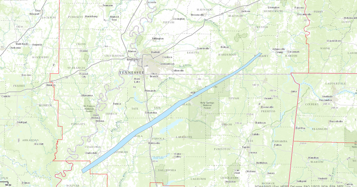
A preliminary damage track from the exceptionally long-track, violent tornado today. Keep N. MS in your thoughts.
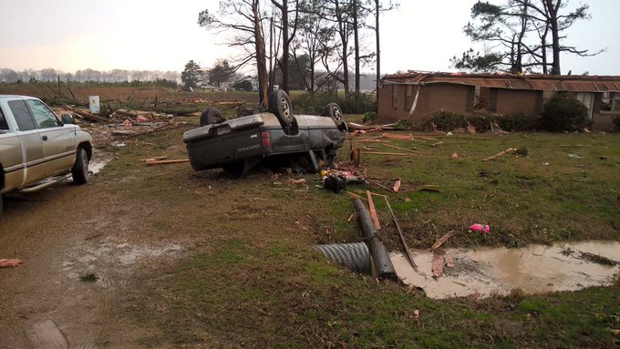
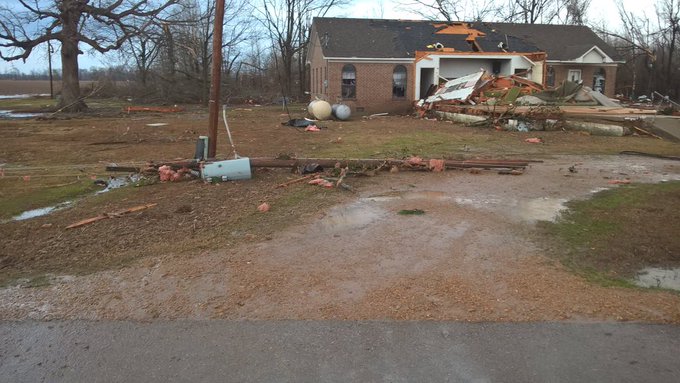
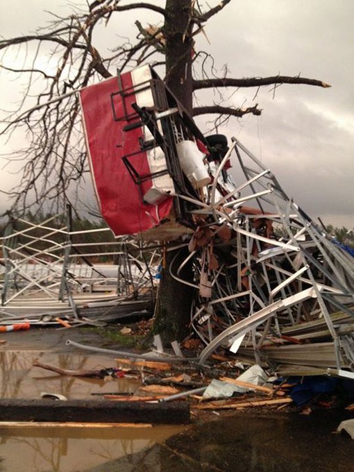
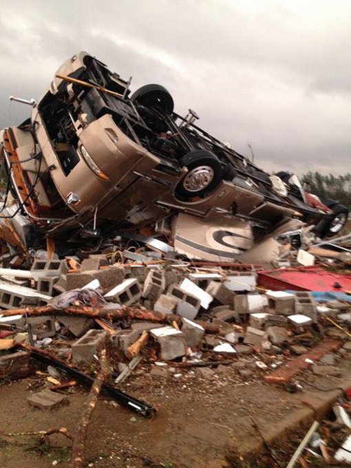
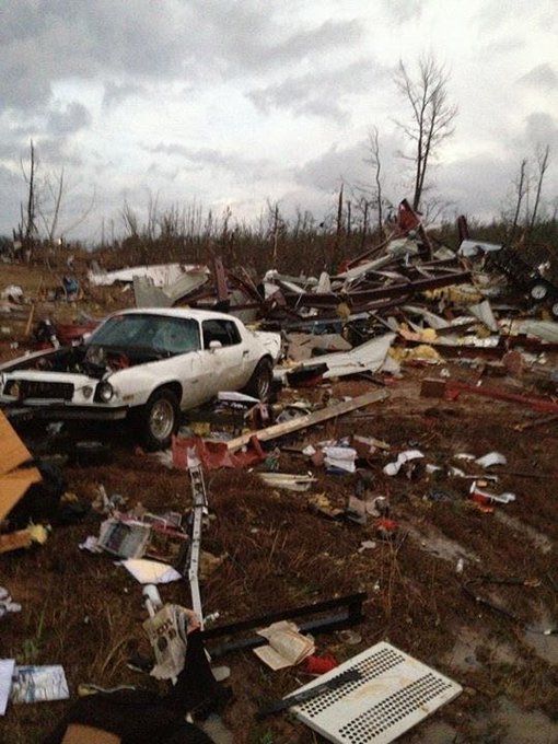
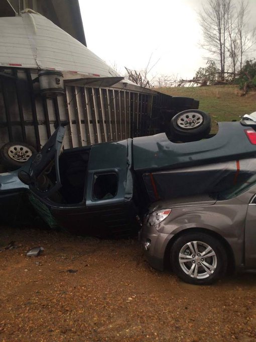
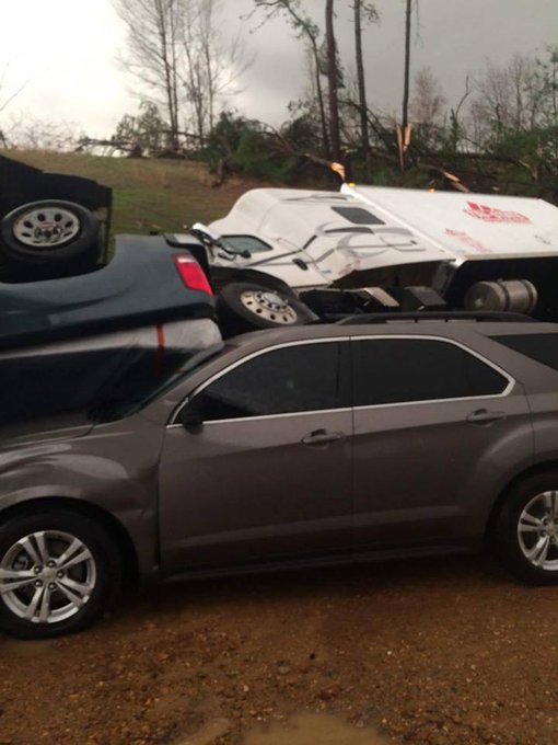
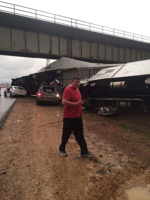
8:04 p.m. CST Wednesday: Images show major destruction wrought by today's tornado at Holly Springs Motorsports Park.
Holly Springs Motorsports Park… photos from Jeff Reed
7:30 p.m. CST Wednesday: Multiple injuries were reported with homes damaged and power lines down in Wayne County, Tennessee, emergency management reports. Additionally the Wayne County post office in Lutts, Tennessee was destroyed.
7:19 p.m. CST Wednesday: The Mississippi Emergency Management Agency has the latest on tornado-related injuries in the state. The agency also reports "extensive" damage in Marshall, Benton, Tippah, Coahoma, Panola and Quitman counties. Shelters are being opened for those impacted.
6:48 p.m. CST Wednesday: Storm debris is causing traffic delays on Mississippi highways, the Mississippi Department of Transportation said.
Tornado damage near Holly Springs, MS... photos from David Moore
5:31 p.m. CST Wednesday: Significant tornado damage reported south of Middletown, Tennessee, near the Tennessee and Mississippi border, an NWS trained spotter reports.
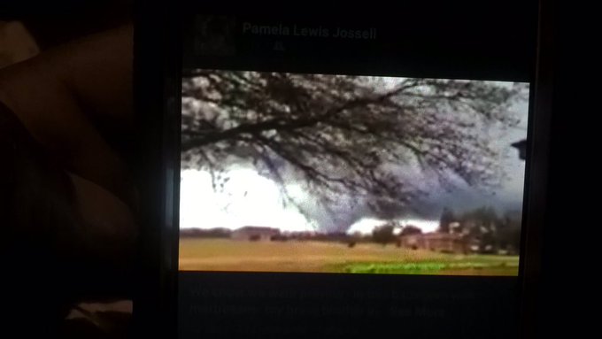
5:25 p.m. CST Wednesday: A look at the damaging tornado spotted near Clarksdale, Mississippi.
5:16 p.m. CST Wednesday: Wedge tornado on the ground on highway 72 east of Walnut, Mississippi, an NWS spotter reports.
5:09 p.m. CST Wednesday: This footage captures the tornado spotted near Clarksdale, Mississippi, earlier today.
Amazing photo from my friend Adam Ford, of tornado over Sciota, IL earlier. @NWSQuadCities #ilwx
4:33 p.m. CST Wednesday: Flash flooding reported throughout the city of Providence, KY, an NWS spotter reports.
4:30 p.m. CST Wednesday: A tornado emergency is in effect for Holly Springs, Mississippi. A large and dangerous tornado is approaching the city. Residents need to take shelter immediately.
4:41 p.m. CST Wednesday: More than 4,000 Indianapolis Power & Light customers are without power, the utility reports.
3:50 p.m. CST Wednesday: A funnel cloud was reported near Diamond Lake Resort in Owensboro, Kentucky, around 3:30 p.m. CST an NWS spotter said.
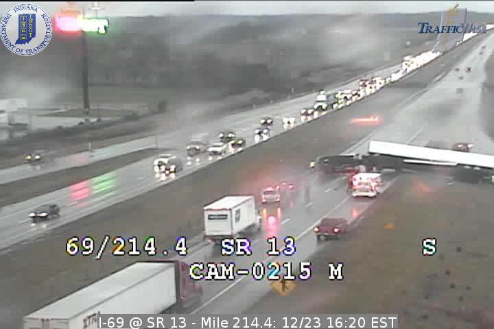
3:30 p.m. CST Wednesday: An overturned tractor trailer is blocking southbound traffic in Madison County Indiana on Interstate 69.
/I 69 SB @ 214 MM/MADISON CO CO/ALL LANES CLOSED DUE TO OVERTURNED SEMI
2:10 p.m. CST Wednesday: Power lines down in the south side of Evansville, Indiana, law enforcement reports. Power outages were reported on the west side of the city along with a blown over billboard.
1:45 p.m. CST Wednesday: A semi truck was blown over 4 miles north of Decker, Indiana, near U.S. Highway 41, emergency management reports. The Indiana State Patrol reported one injury and is on the scene.
12:23 p.m. CST Wednesday: More than 4,000 Entergy Arkansas customers are without power across the state, the utility reports.
11:29 a.m. CST Wednesday: Local police report a power line is blocking a roadway in East Prairie, Missouri, about 160 miles south of St. Louis.
11:10 a.m. CST Wednesday: A funnel cloud was reported by a NWS trained spotter near Glendale, Illinois.







No comments:
Post a Comment