Published: August 19,2015
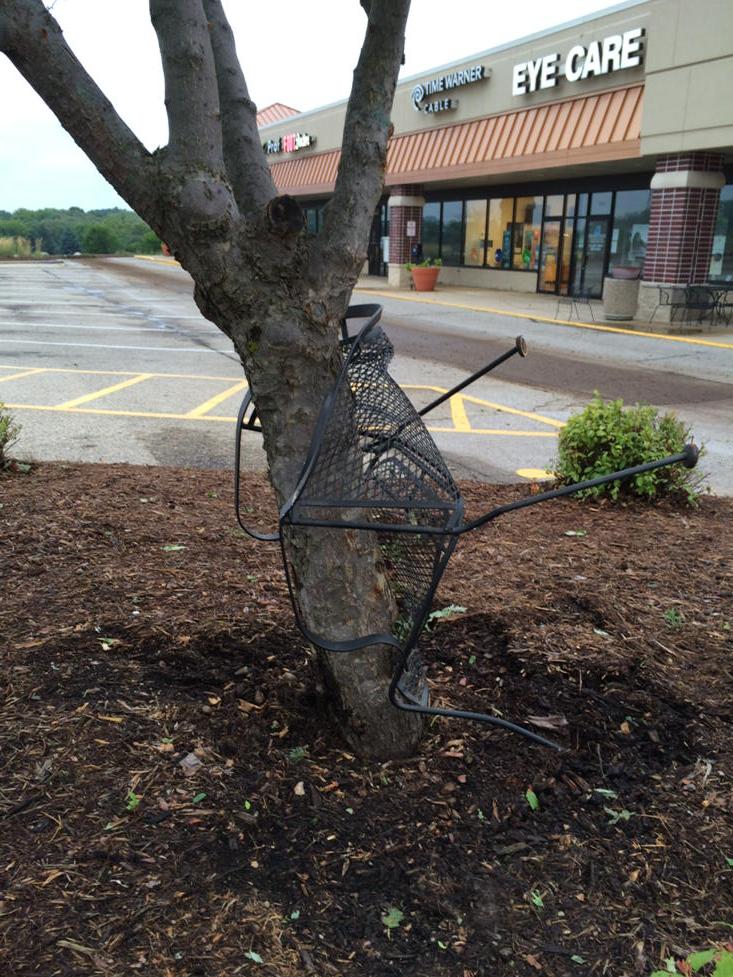
Damage from an EF1 tornado was reported near Lake Geneva, Wisconsin. The storm moved through the area at around 9 p.m. local time Tuesday night, and damage to several buildings was found by authorities after that, according to Fox6Now.com.
Likely tornado Lake Geneva, WI. Just saw this...crazy! Metal patio chair wrapped around tree. @WISN12News @Ginger_Zee
"A rather potent low-pressure system for mid-August standards was responsible for Tuesday's severe weather in the Midwest," said weather.com meteorologist Chris Dolce. "More severe weather is possible ahead of this storm system on Wednesday from the Great Lakes to the Ohio Valley, lower-Mississippi Valley and Texas. Meanwhile, temperatures 10 to 30 degrees below average will plunge through parts of the Plains and Upper Midwest behind the front."
(MORE: Track Severe Storms As They Move East)
Southwest of Chicago, residents reported seeing another possible funnel cloud near Crest Hill.
The NWS also relayed 16 reports of hail and 50 wind damage reports on Tuesday, with a majority of those reports coming from the Plains and Midwest. But the Southeast also experienced problems from severe storms that brought strong winds and dumped inches of rain in a short time period.
Flooding Closes Streets in Charleston, South Carolina
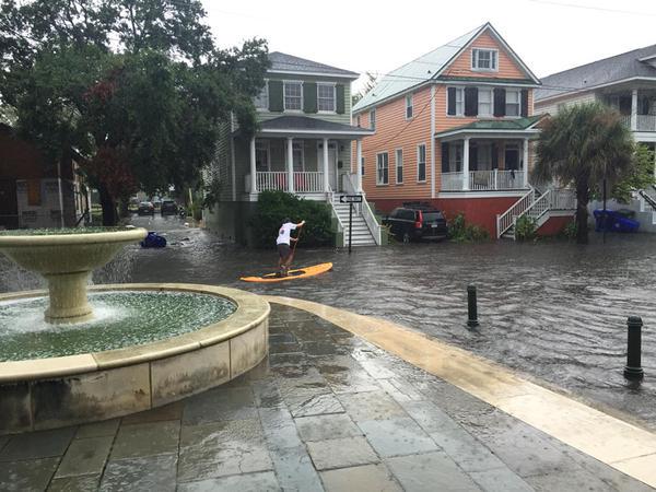
Police departments in Charleston and Mount Pleasant began reopening streets as flooding subsided Tuesday evening, after a line of heavy storms dumped large amounts of rain over the area for more than four hours, beginning around 1 p.m.The NWS reported 3.61 inches of rain in one location in the Charleston area. At least 15 streets were closed at some point during the afternoon, including a section of the Crosstown in Charleston. Fox Carolina reported some people were trapped in stalled cars that had flooded, and authorities feared water would enter homes and businesses as it continued to rise.
Via @GeoffYost Paddling the waves. #chswx


No comments:
Post a Comment