Winter Storm Warning for northeastern Alaska
There was snow last week in Glacier National Park, but winter storm warnings were not issued. Temperatures dipped into the 30s into much of northern Montana, including Cut Bank, where the low hit 32 degrees Aug. 23.
(MORE: Summer Snow Blankets Mountains of Alberta, Northwest Montana)
Snowfall Forecast
Current Conditions and Radar
Now, at the end of August, a winter storm warning has been issued for the northeastern Brooks Range above 2,500 feet in northern Alaska. The warning has been extended through early Saturday evening due to heavy snow that may make travel difficult. Another 1 to 3 inches of snow was expected, with the heaviest snow overt Atigun Pass.
Strong and gusty winds will also accompany the snow with wind gusts up to 25 mph, causing some blowing and drifting of the freshly fallen snow.
(FORECAST: Anaktuvuk Pass | Arctic Village)
A winter weather advisory was also posted through Saturday morning for elevations above 3,000 feet, where a storm total of 4-8 inches of snow was expected.
Incidentally, the season's first snow over the higher peaks of Alaska is known locally as "termination dust", signifying the end of the summer warm season, there.
This snow is courtesy of an impressive cold vortex of low pressure centered over our 49th state, wrapping in moisture over the higher peaks of Alaska, where temperatures are cold enough for snow.
Wet snow had also fallen in Barrow Friday and early Saturday. Officially, 0.2 inches of snow was recorded there Friday.
Snow in northern Alaska is not rare in late August. Barrow saw its first measurable snow of the 2015-16 snow season on Aug. 18 when 0.2 inches of snow fell. On average, 0.7 inches of snow is observed in August in Barrow.
According to Stu Ostro, senior director of weather communications at The Weather Channel, this system in Alaska is not directly a part of former Super Typhoon Atsani, but there does appear to be a moisture connection from that area that also includes former Hurricane Loke.
(MORE: 10 Stunning images of Super Typhoon Atsani and Typhoon Goni)
Earlier in the week, warmer temperatures and rain poured into the state.
Barrow set a daily rainfall record Tuesday with 0.55 inches of rain. The high in Barrow on Tuesday reached 52 degrees, 10 degrees above average. It was alsowarm in southern Alaska where Cold Bay set a daily record high of 70 degrees Wednesday. In Anchorage, a daily record warm low temperature was set on Wednesday, as the low only fell to 56 degrees.
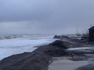
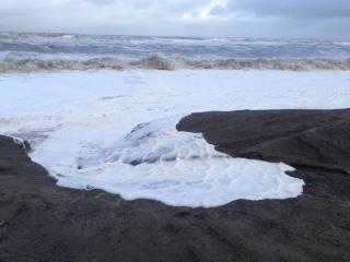
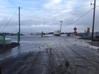
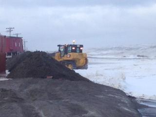
Nome received 1.22 inches of rain on Tuesday and another half an inch on Wednesday from this strong area of low pressure. In addition, strong west winds brought coastal flooding and erosion to Barrow earlier in the week. A coastal flood warning and high surf advisory were posted for portions of the northwestern Alaska coast into Friday.
Here are some photos of the high water in Barrow taken by an NWS employee this morning. #akwx
MORE: Montana, Wyoming Snow July 27, 2015 (PHOTOS)


No comments:
Post a Comment