Published: October 26,2016
With chilly temperatures in place, portions of the interior Northeast will see snow into Thursday as a low pressure system moves through the region.
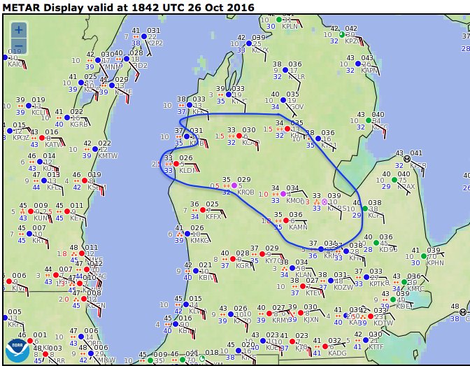
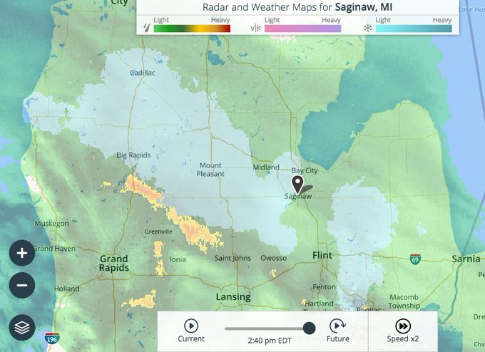
That same system tapped just enough cold air in place over northern Lower Michigan to produce snow there Wednesday afternoon and evening. Wet snow was reported in Saginaw and a few other locations.
Wet #snow now reported in several Lower MI locations, including Saginaw, Mt. Pleasant and Ludington. http://wxch.nl/2eMzBTO #miwx
As the moisture spreads into the Northeast region, snow will continue to develop in additional locations. Here's a look at what to expect.
Accumulating Snow Moving Into Northeast, Even at Lower Elevations
The weather system approaching the Northeast into Thursday will bring mainly rain, but parts of upstate New York and New England will see precipitation begin as snow or a rain/snow mix.Last weekend's snowfall was confined to the higher elevations of the Adirondacks, Catskills, Green Mountains and White Mountains.
While any significant accumulation from this system will likely stay in the mountains, minor accumulations are expected even at some lower elevations.
One area of concern is the Poconos of northeast Pennsylvania and adjacent areas of northwest New Jersey where freezing rain is forecast to fall overnight into early Thursday. Ice accumulations are expected to be light, generally a few hundredths of an inch. However, roadways and walkways could become slick.
(MORE: When the First Snow of the Season Typically Falls)
Here's a brief timeline of this forecast:
- Through Wednesday Night: Precipitation develops from west to east across the Ohio Valley, Pennsylvania, New York, New Jersey and southern New England. A brief period of snow or a rain/snow mix is possible before changing over to rain in most areas. However, snow or a wintry mix remains possible in upstate New York, northeast Pennsylvania and northwest New Jersey into Thursday morning. Freezing rain and minor ice accumulations are possible in the Poconos of northeast Pennsylvania and adjacent northwest New Jersey.
Wednesday Night's Forecast
- Thursday: Precipitation spreads northeastward across New York and much of New England. While most places quickly change to rain, snow or a rain/snow mix may continue through the morning in parts of central and eastern New York, as well as in western New England, before the changeover. The precipitation may remain mainly snow or a rain/snow mix in northern New York and the higher elevations of New England for much of the day.
Thursday's Forecast
- Friday: Rain and snow will linger into Friday in portions of upstate New York, as well as in northern New England. Snow is expected in far northern New England, as well as in portions of northern New York (especially the Adirondacks). Snow will transition to snow showers during the afternoon in northern New York, while northern Maine may see snow showers persist into Friday night. Rain is expected for much of New England.
Snowfall Forecast
Significant snow accumulations, however, should remain confined to the Adirondacks, Green Mountains and White Mountains.
Chilly Temperatures Continue
While much of the region will not see accumulating snowfall, chilly temperatures will continue to be felt by most of the Northeast through late week.High temperatures will generally be 5 to 10 degrees below average across the Northeast through Thursday before recovering to near average by Friday and the weekend.
Meanwhile, low temperatures could be up to 10 to 15 degrees below average in some areas through Thursday morning.
Portions of the Northeast saw their first freeze Wednesday morning, including Atlantic City, New Jersey, and Harrisburg, Pennsylvania.
(MORE: Urban Heat Islands: Why Cities are Warmer than Rural Areas)
Forecast Morning Lows
New York City will mainly be in the low 50s with lows diving into the 30s to near 40 degrees through Thursday morning. The Big Apple saw its first reading in the 30s Wednesday morning, when the temperature dropped to 38 degrees.
On average, Boston sees its first freeze in early November, and New York City sees its in mid-November. Our current forecast on weather.com expects both cities to remain above 32 degrees the next several mornings, though the rural areas outside of the cities may dip to the freezing mark.
(MORE: A Handy Guide to When Your First Freeze Typically Arrives)
MORE: Northeast Snow, Oct. 2016


No comments:
Post a Comment