By Brian Lada, Meteorologist
July 30,2016; 10:34PM,EDT
Rain and thunderstorms moved through the mid-Atlantic on Saturday with downpours leading to major flooding in some communities.
Baltimore was one of the hardest hit areas across the region with radar-estimated rainfall of 4 inches just west of the city.
This led to numerous water rescues which prompted the National Weather Service to issue a flash flood emergency.
Rain was so heavy in Ellicott City, Maryland that some roads turned to rivers.
 (Photo/@djcrome)
 (Photo/@djcrome)
Saturday's thunderstorms also led to power outages across Maryland with Maryland.gov reporting over 13,000 customer outages across the state, may of which being in or just west of Baltimore.
RELATED:
Soaking storms to elevate flash flood threat in northeastern US this weekend
Interactive weather radar
AccuWeather MinuteCast® for your exact location
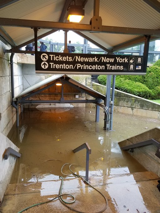
The flooding rain was not limited to just the Baltimore area with major flooding occurring in New Jersey.
Flooding unlike any I've ever seen in #PrincetonJunction.
More rain and thunderstorms are forecast to move through on Sunday, but are not expected to bring as much rainfall as the rain and thunderstorms on Saturday.


No comments:
Post a Comment