By Kevin Byrne, AccuWeather.com Staff Writer
April 26,2015; 11:16PM,EDT
Severe thunderstorms are rumbling across parts of Texas and Oklahoma Sunday evening.
The storms are bringing the threat of large hail, blinding downpours, damaging winds and isolated tornadoes. Multiple tornadoes have already been confirmed in Texas with one confirmed near Cross Plains, Texas, and another near Comanche, Texas.
"Severe thunderstorms will continue to fire across parts of Texas and Oklahoma through Sunday evening. The strongest storms will target northern Texas, including Dallas," AccuWeather.com Meteorologist Andy Mussoline said. "The most violent thunderstorms will be capable of producing tornadoes, some large and hail up to softball size."

RELATED:
Severe Storms to Return to Texas, Oklahoma Sunday
AccuWeather Severe Weather Center
The Difference Between Tornado Watches and Warnings
UPDATES: (All times are listed in CDT)
10:30 p.m. CDT:

10:05 p.m. CDT: More than 5,000 Texas customers are without power, utilities report.
9:36 p.m. CDT: Large tornado on the ground between Brazos Point and Eulogy, Texas, trained spotter reports.

9:30 p.m. CDT:
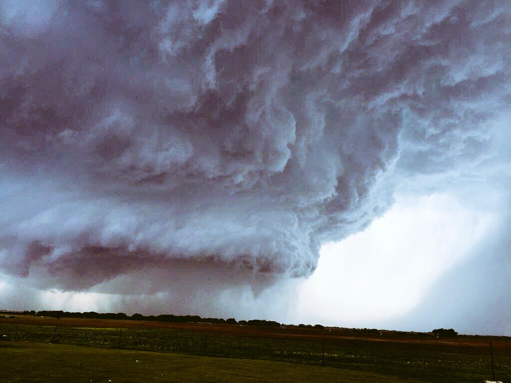
AMAZING #tornado producing supercell today over Stephenville, TX! Just amazing! #txwx #weather @breakingweather

9:07 p.m. CDT: Ground stop for arriving flights at Dallas-Fort Worth airport and delays for flights at George Bush Intercontinental Airport, Houston, the FAA said.

7:51 p.m. CDT: Hail, 3 inches in diameter, reported 1 mile southwest of Dublin, Texas, according to an NWS trained spotter.
7:42 p.m. CDT: Tornado sirens blaring in the western portion of Hood County, Texas.
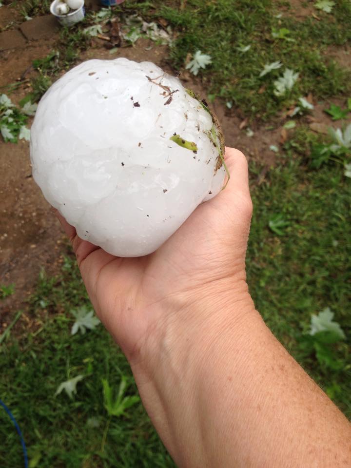
Baseball hail delayed report broke out truck and car windows on HWY 205 7 Mi E Stephenville TX.#txwx @NWSFortWorth
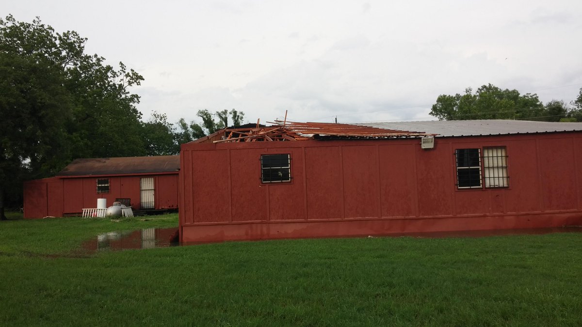
Wind damage from storm when it was in Wharton Co at FM 1301 at CR 117 . Photo via Wharton OEM

6:50 p.m. CDT: Hail blankets the ground in Dublin, Texas, following a tornado that moved through the area earlier in the evening.
 (Photo/Twitter user @twoguyschasing)
6:35 p.m. CDT:
A KTAB viewer sent us this picture of hail found in Rising Star over the last 30 minutes. Be careful out there!
Attention! Residents of Erath County take cover! Tornado on the ground and softball sized hail near Dublin, TX.
4:53 p.m. CDT: Tornado-warned supercell north of Hico, Texas.
 (Photo/Twitter user @ScottWilliams78)
4:34 p.m. CDT: A large tornado was located just south of Dublin, Texas, the National Weather Service reports. Residents need to take shelter now!

4:29 p.m. CDT:
 (Photo/Twitter user @aaronjayjack)
4:06 p.m. CDT: Mammatus clouds over Fort Worth, Texas.
 (Photo/Twitter user @JasonDasho)
3:54 p.m. CDT: Golf ball-sized hail reported 6 miles north of Brown, Texas, the local fire department reports.
3:52 p.m. CDT:
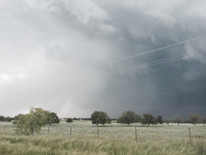
Here is current circulation just north of Comanche. Not doing damage. #txwx
Jaw dropping supercell near Cross Plains Texas. Amazing. #txwx @breakingweather











No comments:
Post a Comment