Published: February 18,2015
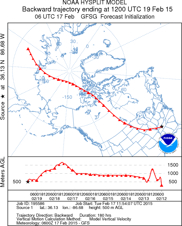
Temperatures are plunging once again as a frigid air mass that has a connection to Siberia surges across the central and eastern United States.
This follows two blasts of bitter cold air that engulfed these regions late last week into Monday, resulting in record lows and the coldest temperatures in years for some cities.
(RECAP: Arctic Blast Duo)
Through late week, dozens of daily record low temperatures will be threatened, and lows in the single digits above and below zero will reach all the way into parts of the South. In addition, all-time record lows for the entire month of February will be threatened. Some cities could also see their coldest temperatures since January of 1994 – something that happened in several Northeast cities last week.
This latest reinforcing shot of cold air arrived in the Upper Midwest Tuesday into Wednesday morning. From there, it dives into the South and spreads east through the end of the week.
The swath of snow cover left behind by Winter Storm Octavia will play a role in just how cold it gets. Places that see significant snowfall are much more prone to see extreme cold on at least one night later this week, as snow cover radiates (loses) energy to outer space quickly. Where skies are clear, this can result in rapid temperature drops (clouds reflect some of that lost energy back to earth).
Daily forecast details are below.
Arctic Invasion Begins
Wednesday highs were up to 30 degrees below average in the Midwest, with highs mainly in the single digits and teens. In fact, the Twin Cities topped out at just 2 degrees Wednesday, or 28 degrees below average.Parts of the Northeast and Southeast, including Florida, were 10 to 20 degrees below average. For example, Pensacola, Florida topped out at a brisk 53 Wednesday, 11 degrees below average, after a frosty morning low of 29.
According to the National Weather Service in Chicago, the Windy City has not had a high temperature below 10 degrees this late in the winter since 1963. And on Wednesday, Chicago's high was only 8 degrees. The average high for Feb. 18 in Chicago is 36.
(MORE: Your City's Forecast)
Up to 40 Degrees Below Average; Subzero Lows in the Mid-South
- Thursday morning lows: Record lows will be threatened in about four dozen locations across parts of the South, Midwest and East. Subzero lows are possible as far south as Nashville, Tennessee, and Asheville, North Carolina. Wind chills in the 20s below zero possible as far south as the Ohio Valley. Lows in Florida range from the 20s in the north to the 40s in the south.- Potential record lows (current record in parentheses): Charlotte, North Carolina (8 degrees) | Baltimore (5 degrees) | Louisville, Kentucky (0 degrees) | Chicago (minus 7 degrees)
- If Nashville falls below zero Thursday morning, it will be the latest in the season with a temperature of zero degrees or lower in the city since records began in 1871. Also, it would be only the 13th time in February with a subzero low in the Music City.
- Thursday highs: Up to 40 degrees below average from the Mississippi River Valley eastward. Single digits, teens and 20s for highs from the Upper Midwest to the Mid-South and Northeast. Temperatures will be 10 to 25 degrees below average in Florida, with highs ranging from the 40s in north Florida to the low or middle 60s in Miami.
(MORE: Your City's Forecast)
Frigid Temperatures Continue; February Record Lows Threatened
- Friday morning lows: Record lows will be threatened in more than six dozen locations across the East, from New England to Florida. Subzero lows or single digit lows from the Upper Midwest to the Northeast. Single digits are possible as far south as north Georgia, North Carolina and Tennessee. Widespread wind chills in the teens and 20s below zero across the Northeast. Florida lows range from the upper 20s in the north to 40s in the south.Potential daily record lows (current record in parentheses): Boston (0 degrees) | New York City (7 degrees) | Washington, D.C. (8 degrees) | Raleigh, North Carolina (13 degrees) | Miami (42 degrees)
- All-time February record lows possible (current record in parentheses): Knoxville, Tennessee (minus 10 degrees in 1905) | Roanoke, Virginia (minus 1 degree last tied in 1996) | Charleston, West Virginia (minus 12 degrees in 1996) | Cincinnati (minus 17 degrees in 1899) | Cleveland (minus 16 degrees in 1899)
- Coldest Since 1994? A low of 4 degrees or colder in Washington, D.C. would be the coldest temperature there since January 1994. A low of minus ten degrees or colder would also be the coldest temperature since January 1994 in Louisville, Kentucky. If Charleston, West Virginia reaches minus 13 degrees or colder, it would be the coldest reading there since January 1994.
- All-time record lows? It's not out of the question that a few all-time record lows could be tied or broken. Charleston, West Virginia will be within striking distance of its all-time record of 17 below zero set Dec. 30, 1917.
- Friday highs: 10 to 25 degrees below average from Maine to Florida.
(MORE: Your City's Forecast)
More Record Lows Possible This Weekend
- Below-average temperatures will continue Saturday in much of the Midwest and Northeast.- Our forecast shows that more than a dozen locations in the Northeast and Mid-Atlantic could threaten daily record lows on Saturday morning.
- Potential record lows (current record in parentheses): Richmond, Virginia (13 degrees) | Baltimore (8 degrees) | Newark (1 degree)


No comments:
Post a Comment