February 24,2017, 4:46:31PM,EST
As of 2:30 p.m. CST Friday, this reports story will no longer be updated.
A snowstorm with localized blizzard conditions is snarling travel across the central United States on Friday.
Snow will intensify and wind will pick up from eastern Nebraska to Wisconsin throughout the Friday morning commute. Thundersnow has already been reported in parts of the Midwest and there could be more reports throughout Friday morning.
“The highest winds will develop across Iowa, southern Minnesota, eastern South Dakota and northeastern Nebraska, causing extensive blowing and drifting snow,” AccuWeather Meteorologist Dave Samuhel said.
RELATED
Blizzard to clog travel with up to a foot of snow from Iowa to Michigan
Interactive weather radar
Winter Weather Center
As of 2 p.m. CST, a band of snow was stretched from eastern Nebraska to northwest Wisconsin with some of the heaviest snow falling around Omaha, Nebraska.
Portions of I-80 have been closed in Nebraska due to a number of accidents, according to Nebraska State Patrol. Motorists in this area should expect delays until the accidents are cleared and road conditions improve.
Travel delays may continue across the region into Friday night, especially in Minnesota and Iowa where strong winds will blow around the fresh snow, limiting visibility and causing poor road conditions.
Road conditions continue to improve in Iowa, but snow is still falling across the state as of 1 p.m. CST.

Through 11 a.m. CST, there have been more than 287 vehicle crashes in Minnesota that have resulted in 38 injuries, according to the Minnesota State Patrol. Additionally, there have been more than 200 vehicle spin outs.
Snow continues to cause dangerous travel across stretches of Iowa roads as of 10 a.m. CST. Low visibility was reported near Garner, Iowa, while a stretch of U.S. Highway 20 was closed between Rockwell City and Fort Dodge due to a semi- trailer.
Traffic is stopped and backed up for a stretch on northbound Interstate 35 near the town of Albert Lea in southern Minnesota, according to the Minnesota Department of Transportation.

Travel remains tricky across northern Wisconsin as of 7:40 a.m. CST.

The storm has delivered a wide range of snowfall totals across South Dakota this morning, including up to a foot of snow in Yankton.
As of 5:50 a.m. CST, road conditions in parts of northern and northwestern Iowa remain treacherous.
The combination of snow and high winds is leading to whiteout conditions across the Midwest. Even after snow has ended, gusty winds will lead to blowing, drifting snow and limited visibility throughout Friday.
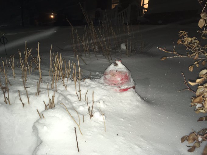
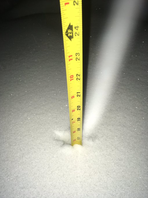
How mich
snow does Troop E have? About a fire hydrant's worth. 17" and still
falling. Please stay off the roads if at all possible.
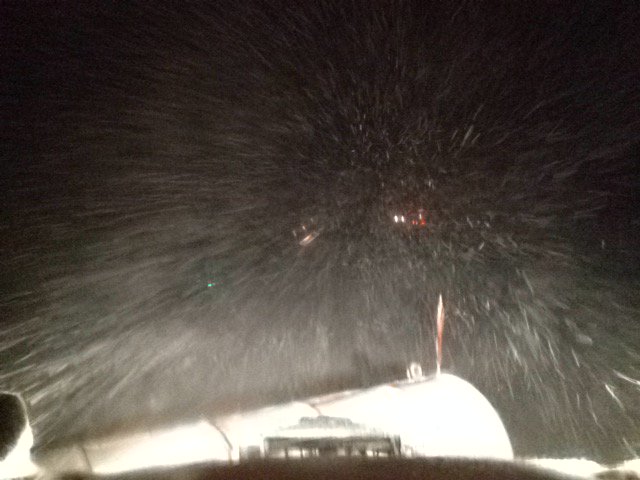
Travel not advised on I-35 from Story City to Minnesota border by @iowadot. Plow cam near Mason City shows reduced visibility. #iawx #iowawx
Blizzard conditions are leading to limited visibility across portions of Iowa early Friday.
As of 1 a.m. CST Friday, roadway conditions in southern Minnesota are rapidly deteriorating due to heavy snow. Travel is not advised for large portions of interstates 35 and 90.

Along the southern edge of the storm, thunderstorms with hail are being reported across Iowa and Illinois.


Snow is piling up across the Midwest. As of 11:30 p.m. CST, 16 inches were reported in Hemingford, Nebraska, 11 inches in Valentine, Nebraska, and 8.2 inches in Sergeant Bluff, Iowa.
Law enforcement reports 18-inch snow drifts in O’Neill, Nebraska, with visibility less than 100 yards.
Hail has also been reported across much of the region in Nebraska and Iowa. Parts of southern Wisconsin have experienced some thundersleet as well.
Thunderstorms are producing three-fourths of an inch of hail around Omaha, Nebraska. Less than 40 miles west in Wahoo, snow is falling.
As colder air dives southward, rain will changeover to all snow in Omaha into Friday morning.
As of 8:30 p.m. CST, thundersnow is being reported from Algona to Mason City in northern Iowa. It's currently raining in the central and southern portions of the state, but a change over to snow will occur Friday morning.
As of 8 p.m. CST, many roads across the northern half of Nebraska were completely covered in snow with heavy snow still falling across the state.

Roads were also covered in snow across northern and western Iowa with several reports of thundersnow throughout the evening.

Conditions will continue to deteriorate across northern and western Iowa through Thursday night as blizzard conditions reduce visibility to just a few hundred feet, making travel very difficult.
Heavy snow fell across Wyoming, Nebraska and Colorado on Thursday afternoon as the snowstorm emerged from the Rockies and moved into the central United States.
Between one and four inches of snow fell around the Denver area with higher amounts accumulating in the mountains. This led to travel delays ahead of the evening commute, especially along I-70 west of Denver.

Higher snow amounts were observed across Wyoming with Casper picking up 16 inches of snow.
The heavy snow limited visibility to just a few hundred feet, causing dangerous travel conditions. Many roads were closed across the state with WYDOT advising against unnecessary travel.
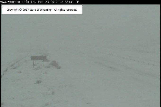
Many roads
are closed or WYDOT advises No Unnecessary Travel. Stay home and off the
roads. 3pm webcam view at Rock Springs shows I-80 empty.


No comments:
Post a Comment