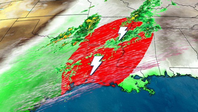
Another round of severe thunderstorms is flaring up in portions of the South, bringing a threat of damaging winds and tornadoes, in addition to drought-helping heavy rainfall to the region. These severe storms will move from Mississippi and Louisiana to the east this evening.
NOAA's Storm Prediction Center has issued the following tornado watches:
- For northeastern Mississippi, extreme northwestern Alabama, and portions of southern Tennessee valid until 11:00 PM central time. This watch area includes Tupelo and Oxford, MS and Lawrenceburg, Tennessee.
- For northeastern Alabama and south-central Tennessee valid until 12:00 AM central time. This watch area includes Huntsville and Cullman, AL.
- For extreme northwestern Georgia and southeastern Tennessee valid until 4:00 AM eastern time. This watch area includes Chattanooga, Tennessee.
- For northern Alabama and southern middle Tennessee valid until 3:00 AM central time. This watch area includes Huntsville, Alabama.
- For southern and eastern Louisiana, most of central Mississippi, and a portion of west central Alabama valid until 5 AM central time. This watch area includes Lafayette, Louisiana, Jackson and Meridian, Mississippi, and Tuscaloosa, Alabama. The potential for a significant tornado exists in this area.
(MORE: Southern Drought Relief | Gatlinburg, Tennessee, Fire Disaster)
Gulf of Mexico moisture, in combination with a powerhouse jet stream, providing both unstable air and strong wind shear (change of wind speed and direction with height) are the favorable ingredients for severe thunderstorms.

Latest Radar, Warnings
A confirmed tornado hit near Tullahoma in Coffee County, Tennessee. The storm blew over trees and caused roads to be impassible. Power lines were also downed.
(MORE: Latest Storm Damage)
Widespread severe storms are likely to continue into the overnight hours. A strong tornado or two is possible from southwestern Mississippi into northwestern Alabama, and storms containing damaging winds are likely. Damaging hail will also be a possibility.
(MORE: View National Interactive Radar Map | Difference Between a Watch and a Warning)
Below is our latest forecast thinking on the timing and magnitude of the severe threats.
Severe Weather Forecast
Overnight into Wednesday (through sunrise)- Forecast: Severe thunderstorms will spread northeastward into parts of Tennessee, Alabama, and persist in Mississippi and Louisiana. Toward sunrise, one or more squall lines may form and the threat will slowly transition to straight-line winds. A few storms will continue in northwestern Georgia.
- Threats: Damaging straight-line winds are likely throughout the night. Tornadoes, potentially significant, are possible. The slow motion of storms in Mississippi and Alabama could lead to ponding on roadways or even flooding.
- When: A broken line of thunderstorms is forecast to remain stationary or nudge slowly east from southern Louisiana to northern Alabama through the early morning hours. An additional kick of energy aloft will give the line of thunderstorms a shove to the east by sunrise.

Tuesday Evening's Thunderstorm Forecast
- Forecast: A squall line will likely be ongoing Wednesday morning from the southern Appalachians to the Louisiana/Mississippi Gulf Coast. A few strong wind gusts will remain possible as it pushes eastward and eventually fizzles late day. Isolated severe storms may continue from southeast Alabama and southwest Georgia into the Florida panhandle later in the day, as well as parts of southeast Virginia and eastern North Carolina.
- Threats: Damaging wind gusts and, perhaps, a tornado or two. Large hail may also be possible.

Wednesday's Thunderstorm Forecast
Severe Weather Recap
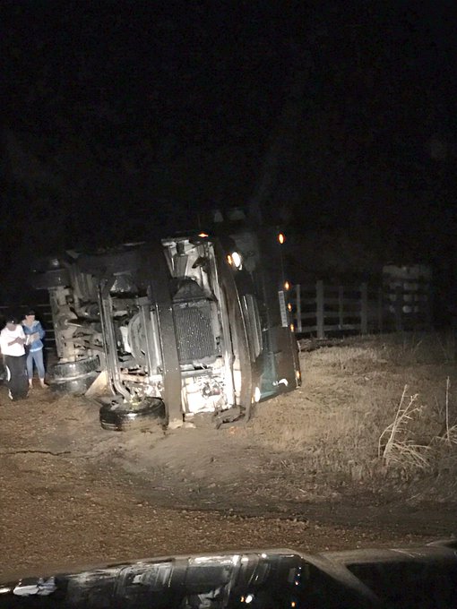
On Tuesday, severe storms including a few tornadoes rolled through Mississippi and Louisiana.High winds caused this UPS truck to overturn. It is possible that this was caused by a tornado.
UPS truck overturned in storm between Mouldon and Aberdeen on Highway 25 @WTVAWeather @wtva9news No injuries. Roof off of nearby barn
(LATEST NEWS: Severe Weather Impacts Across the South)
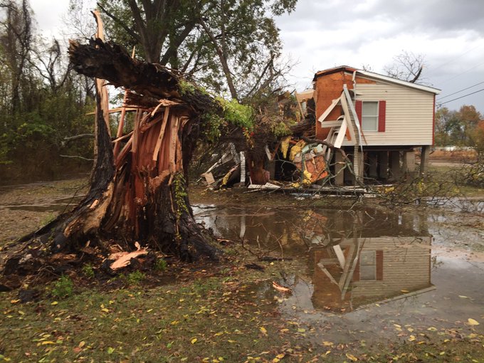
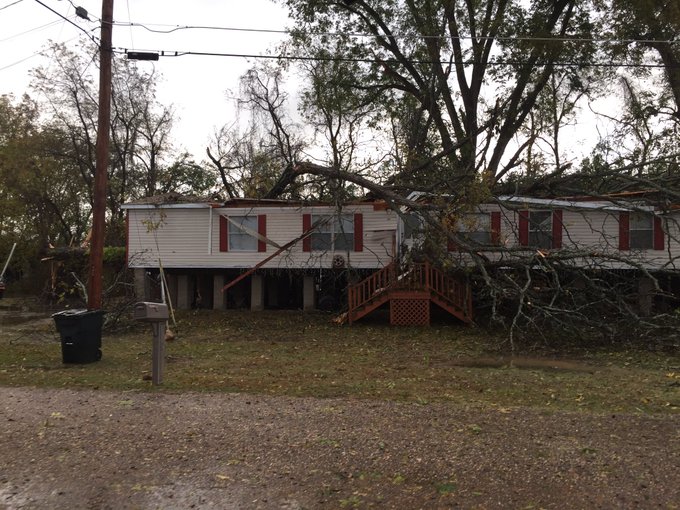
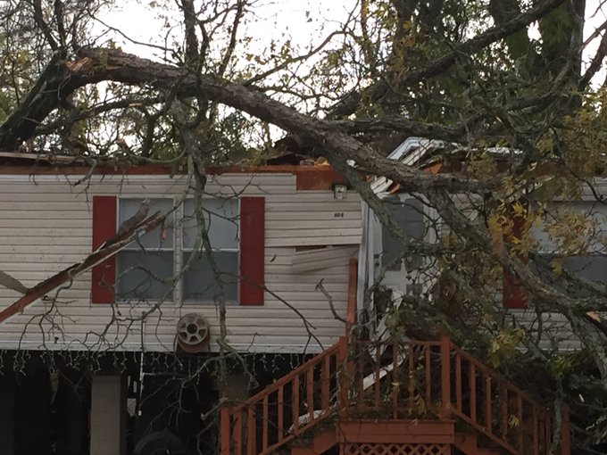
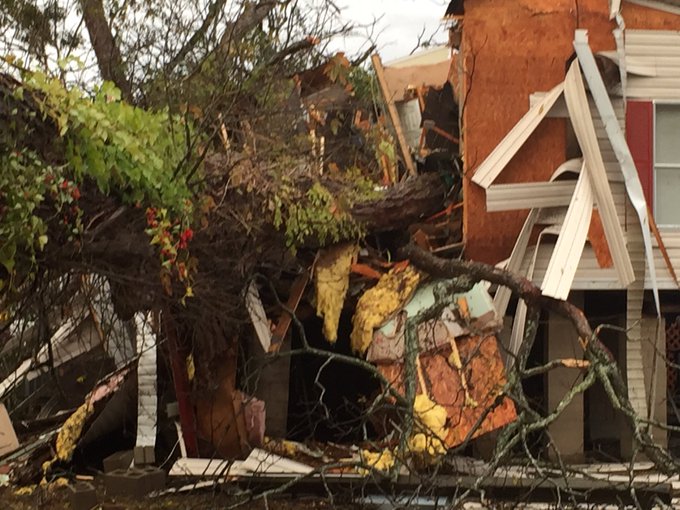
Above: Video of a tornado in Parkersburg, Iowa, on November 28, 2016. (Courtesy: Melissa Avis)Monday afternoon, severe thunderstorms knocked down trees across parts of central Mississippi, including one onto the Town Hall of Eden, Mississippi, and another onto this house in Warren County, Mississippi.
A tree falls on a house in Warren County. A woman inside survived without a scratch.
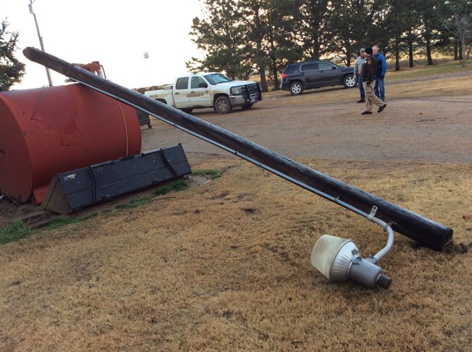
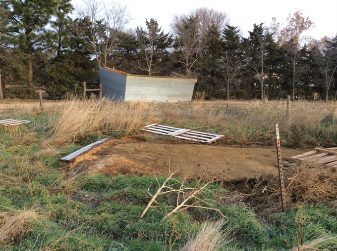
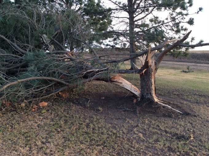
Damage survey indicates preliminary EF1 tornado about 5 miles east of Red Cloud from tornado Nov 27 2016. #NovTOR
Slow 'Second' Season of Severe Weather, So Far
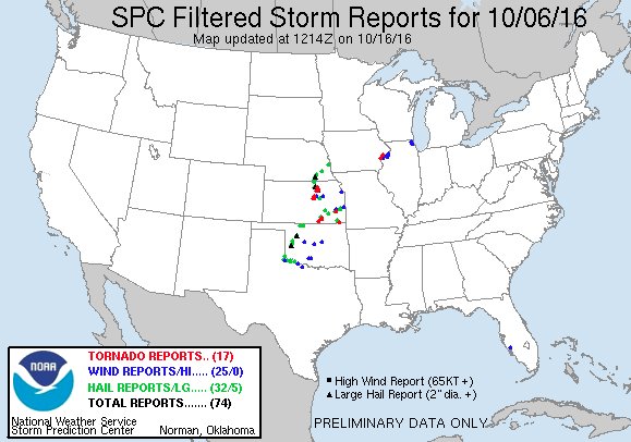
The second half of October and, especially, November can often be a "second" season for tornadoes and severe thunderstorms, particularly in parts of the South. That hadn't been the case so far this year, however, through Thanksgiving week.Prior to Monday, we hadn't seen a single day with at least 50 reports of severe weather in the U.S. since October 6, when at least eight tornadoes were spawned in Kansas.
It's been over 7 weeks since we had a day with over 50 #severe reports in the U.S. Today could snap that streak. http://wxch.nl/2gnjeND
For more details on the slow tornado pace in 2016, see the link below.
(MORE: Lack of Tornadoes Continues in "Second" Tornado Season)




No comments:
Post a Comment