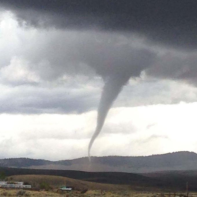
Severe thunderstorms with damaging winds, large hail and perhaps a few tornadoes are expected to continue to pound parts of the Midwest into Wednesday. Flash flooding will also be a concern this week as the storms unleash heavy amounts of rainfall in a short period of time.
Serious flash flooding occurred in Minnesota Monday evening, with as much as 10 to 12 inches of rain falling in a matter of hours in central and eastern portions of the state.
A reported tornado caused damage to homes in Litchfield, Minnesota, early Monday evening.
For more on Monday's storm reports, click here to read our impacts article.

Current Radar with Watches and Warnings

Below are the latest daily forecast details followed by more information on setup for the stormy weather.
Severe Weather Forecast
Tuesday- Forecast: Some severe weather may continue on Tuesday as the cold front stalls from southern Wisconsin and northern Illinois into parts of southern Iowa, northern Missouri and east Kansas.
- Threats: Damaging winds, large hail and locally heavy rainfall.
- Cities: Chicago | Des Moines | Kansas City

Tuesday's Thunderstorm Forecast
- Forecast: Isolated to widely scattered severe thunderstorms are expected to develop from eastern parts of Nebraska and Kansas to portions of Wisconsin, northern Illinois and western Michigan.
- Threats: Damaging winds, large hail and locally heavy rainfall.
- Cities: Milwaukee | Chicago | Omaha, Nebraska

Wednesday's Thunderstorm Forecast
Thursday
Wednesday's Thunderstorm Forecast
- Forecast: The cold front will push farther south and east. Isolated to scattered severe storms are possible from the interior Northeast into the Ohio Valley and also in the southern Plains.
- Threats: Damaging winds, hail and locally heavy rainfall.

Thursday's Thunderstorm Forecast
Storm Reports Since Sunday
Sunday evening, a swarm of thunderstorms with damaging hail, in addition to damaging winds, tore across the northern Plains from far eastern Montana to northern Minnesota.Damage to siding, windows, and skylights was reported in the town of Killdeer, North Dakota, about 100 miles west-northwest of Bismarck, thanks to hail larger than baseballs, driven by high winds.
Winds gusted as high as 70 mph in Fairfield, North Dakota, and that combined with 1.75 inch hail broke both car and home windows.
Snapped An Awesome Shot? Share Your Photo
If you crave pictures of severe weather, you've found your home here. Upload your photos or video (taking care to only take photos and videos from a safe location) to us and share your experience.MORE: Plains, Midwest Severe Weather and Flooding


No comments:
Post a Comment