Published: July 12,2016
(MORE: Where Severe Storms Could Hit Next)
 Trailers in Litchfield, Minnesota, show damage from a reported tornado.
 (Bill Keller/KMSP-TV)
Litchfield Mayor Keith Johnson told Fox 9 this is the worst tornado damage he has ever seen in the city.
"I've lived in this town 52 years and I’ve never seen a storm like this in our community," Johnson told KARE.
Another apparent tornado in progress near Watkins was also relayed by the National Weather Service. Homes and a nursing home were reportedly damaged, and there was also a report of minor injuries in Watkins, the AP also said. Electricity was out Monday evening in Watkins and northwestern Litchfield.
Power lines down, garage and shed destroyed in Litchfield. @kare11
The National Weather Service in Chanhassen, Minnesota, estimated at least four tornadoes occurred in central Minnesota Monday. Storm survey crews will be on the way to assess the damageTuesday
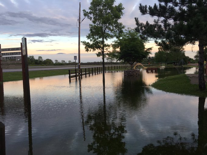
@EquinoxWeather Some flooding by Lake Superior Ashland 7-12-16
Hardest hit in Minnesota were parts of Pine, Aitkin, Carlton and Crow Wing Counties, where 6 to 10 inches of rain had fallen.
The National Weather Service in Duluth said widespread road closures and washouts had affected 20 different communities, including Brainerd and Hinckley, Minnesota, as well as Hayward, Ashland and Hurley, Wisconsin.
According to KARE, the Crow Wing County Sheriff’s Office is advising no travel throughout the county due to a "life threatening" flooding situation.
The Mississippi River in Aitkin, Minnesota, was expected to crest at moderate flood levels Tuesday, which could flood the city park and surround homes in the Cedarbrook neighborhood, according to National Weather Service forecasts.
 24-hour
radar-estimated precipitation totals over northern Minnesota and
northwest Wisconsin from July 11 through early morning July 12, 2016.
The heaviest rainfall is depicted in the darkest maroon and purple
contours. Flash flood reports over that period are shown by blue icons.
24-hour
radar-estimated precipitation totals over northern Minnesota and
northwest Wisconsin from July 11 through early morning July 12, 2016.
The heaviest rainfall is depicted in the darkest maroon and purple
contours. Flash flood reports over that period are shown by blue icons.U.S. 63, the primary route between Bayfield County and the Ashland area to the Hayward "Chain of Lakes" area was washed out in both directions at Matts Drive, according to the Wisconsin Dept. of Transportation.
The White River south of Ashland, Wisconsin, rose about 7 feet to a record level early Tuesday, topping the previous record from July 1, 1953.
To the east of Ashland, the Bad River near Odanah rose over 15 feet in 6 hours to its third highest level on record before the river gauge stopped reporting early Tuesday.
MORE: Severe Weather, Flooding in the Plains and Ohio Valley


No comments:
Post a Comment