Published: July 7,2016
States of emergency were declared in Kentucky and Tennessee Thursday after torrential rain triggered major flash flooding in both of the states, swamping homes and prompting evacuations and water rescues.
Some of the worst flooding was in the Land Between the Lakes region of southwest Kentucky and northwest Tennessee, where radar estimated 6 to 8 inches of rain had fallen, prompting the National Weather Service to issue a rare flash flood emergency for Stewart, northwest Cheatham and Montgomery Counties.
"This line of thunderstorms didn't merely sweep through, but rather trained over parts of Kentucky and Tennessee like boxcars of a train moving over the same section of railroad track, bringing repeated rounds of heavy rain over one inch per hour," said weather.com senior meteorologist Jonathan Erdman.
A separate line of thunderstorms passed over the Northern Plains, where four reports of tornadoes were made in North Dakota and one in Nebraska.
Tennessee
A state of emergency was declared by the Tennessee Emergency Management Agency (TEMA) Thursday. Officials say flash flooding heavily damaged homes in two counties and straight-line wind also downed trees and caused power outages in Nashville and northern and middle parts of the state.About 20 home were destroyed in Stewart county, along with a church and a daycare, the Associated Press reports. In Sumner County, 30 homes were reportedly damaged and four bridges sustained major damage.
According to TEMA, six counties encompassing Nashville and areas north to the Kentucky line were affected by locally heavy rainfall, that reached up to 8 inches in some locations.
TEMA also reported swift water rescues in Stewart, Sumner, and Robertson counties as flood waters inundated homes and roadways, but said no deaths or injuries have yet been reported.
In Clarksville, Tennessee, a mother and her young child had to be rescued from their flooded home after the still rising water reached the mother's knees, Tennessean reports.
 Emergency
management officials in Marshall County, Kentucky, reported multiple
agencies were conducting water rescues in the county early Thursday
morning.
(Curt Curtner/Marshall County Emergency Management )
Floodwaters trapped some residents in their homes in the far northern Nashville suburbs of Gallatin and Springfield early Thursday. Numerous roads were flooded and closed in Sumner County, Tennessee.
 Emergency
management officials in Marshall County, Kentucky, reported multiple
agencies were conducting water rescues in the county early Thursday
morning.
 (Curt Curtner/Marshall County Emergency Management )
Floodwaters trapped some residents in their homes in the far northern Nashville suburbs of Gallatin and Springfield early Thursday. Numerous roads were flooded and closed in Sumner County, Tennessee.
In Big Rock, Tennessee, about 75 miles northwest of Nashville, flooding trapped residents in their homes.

Flash Flood Reports
North of Nashville, a family of four escaped their Millersville home unharmed when it caught fire after it was struck by lightning early
Thursday morning, WKRN reports. Heavy rains helped suppress the flames
but flooding in the area made fighting the fire a challenge.
Flash Flood Reports
The National Weather Service (NWS) reports 1,000 Dyersburg Electric System customers were without power in the Cumberland Furnace area and another 1,300 were powerless in Dickson.
Kentucky
Governor Matt Bevin declared a statewide emergency Thursday in response to the flooding.
“As always, our primary concern is safety,”
Bevin said in a statement. “This declared state of emergency gives
emergency management the resources they need to proactively respond to
local needs. We thank all of the officials working hard to minimize the
impact of this storm system. We urge all citizens to take the necessary
precautions needed to stay safe.”
The severe weather that struck the western parts of the state left thousands without power.West Kentucky Rural Electric reported about 1,600 customers without power as of Thursday afternoon. About 2,700 customers of Jackson Purchase Energy were also without electricity.
Emergency management officials in Marshall County, Kentucky, reported that evacuations were underway at a mobile home park in Hardin early Thursday morning and that multiple agencies in the county were conducting water rescues.
Evacuations were ordered throughout Marshall County, Kentucky, including the city of Gilbertsville, where waist-high water reached the door of one mobile home.
Six people were trapped in an apartment due to flooding in Possum Trot, Kentucky. Flooding was also widespread in Christian County, Kentucky, including Hopkinsville. Water up to the roof of a vehicle was reported in Russellville, Kentucky.
 Storm-total
radar estimated rainfall over Kentucky and Tennessee as of early
morning, July 7, 2016. The heaviest rainfall is shown in the purple,
pink and white contours.
 Storm-total
radar estimated rainfall over Kentucky and Tennessee as of early
morning, July 7, 2016. The heaviest rainfall is shown in the purple,
pink and white contours.
Storm-total
radar estimated rainfall over Kentucky and Tennessee as of early
morning, July 7, 2016. The heaviest rainfall is shown in the purple,
pink and white contours.Illinois
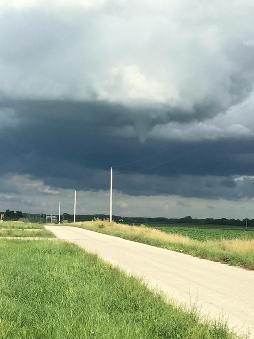
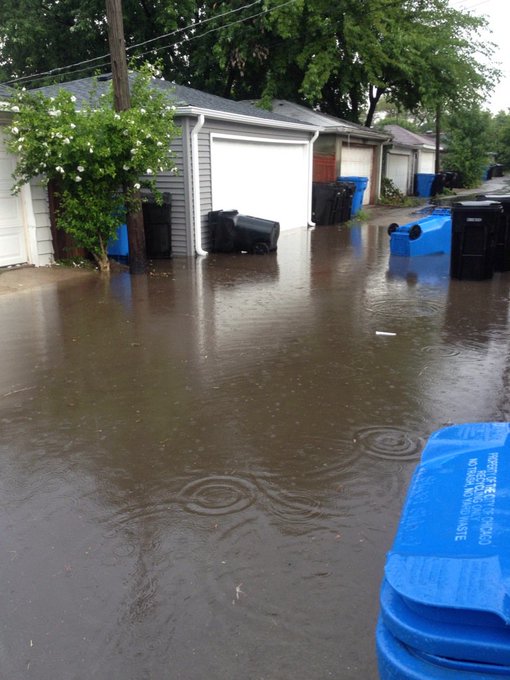
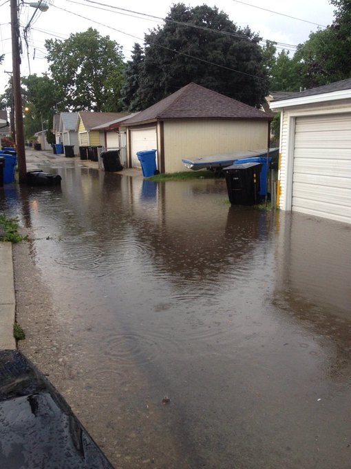
There were reports of funnel clouds, but flash flooding was the main impact as a strong storm moved through the Chicago area Thursday.
Weather Intern Avery Duling saw a 2nd funnel cloud from same shower that moved N of Champaign earlier this eve.#ilwx
About a foot of water was reported on streets near Damen Avenue and Melrose Street in Cook Thursday, NWS also reports.
Iowa
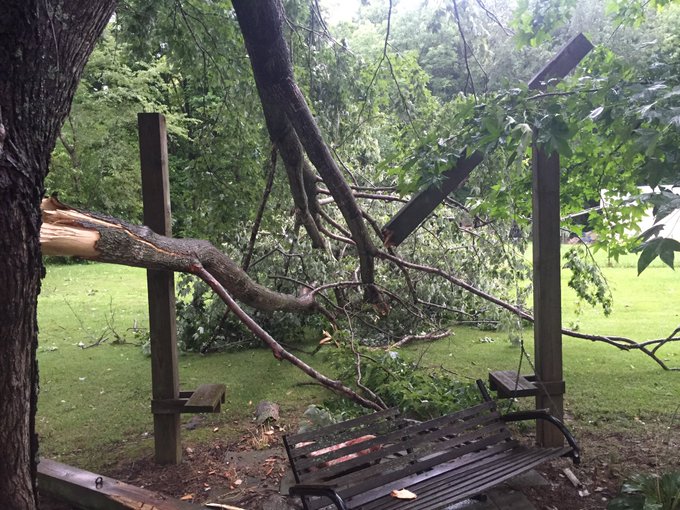
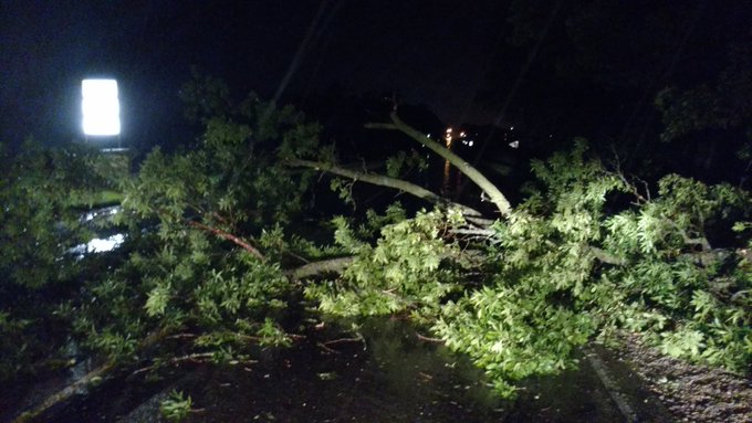
A stretch of Highway 65 blocked by downed trees and power lines south of Northwood Thursday after powerful storms swept the area with heavy rain and strong winds. Traffic had to be detoured onto 440th Street and Raven Avenue to Highway 470/105.
Large tree limb blocking hwy 69 about a mile North of Forest City @NWSDesMoines
(MORE: Summer's Thunderstorm Clusters are Heavy Rain Producers)

Latest Radar and Flood Warnings
PHOTOS: Plains, Midwest Mid-June 2016 Severe Weather and Flooding




No comments:
Post a Comment