By Heather Janssen, AccuWeather.com Staff Writer
January 23,2016; 10:55AM,EST
As snow continues to pile up in the eastern United States, road closures and treacherous travel spread from Washington D.C. and Philadelphia to New York City.
As of Saturday morning, State of Emergency's were declared in nine different states in the Mid-Atlantic, with snow expected to continue through Saturday night for many.
In addition to over a foot and a half of snow in some places, coastal flooding remains a concern along New Jersey beaches.
Nine storm-related deaths have been reported, according to The Associated Press.
More than 50 million people are likely to be affected through the weekend. The full forecast, including predicted snow totals, can be found here. For archived reports of the storm, click here.
RELATED:
Could the DC, Baltimore blizzard eclipse historic snowstorm totals?
Be a part of the story: Submit your blizzard photos and videos
Track the blizzard on radar
UPDATES: (All times are listed in EST)
12:24 p.m. EST Saturday: More than 38,000 Jersey Central Power and Light customers are without power, the utility reports.
12:05 p.m. EST Saturday: A car completely covered in snow in the Hagerstown, Maryland, area.
11:43 a.m. EST Saturday: A declaration of disaster was issued for the city of York, Pennsylvania, the York City Fire Department reported.
11:33 a.m. EST Saturday: Over 40,000 Atlantic City Electric customers are without power, the utility reports.
11:30 a.m. EST Saturday: Snow up to a mailbox in Hopwood, Pennsylvania:
11:18 a.m. EST Saturday: AccuWeather Meteorologists Laura Velasquez and Heather Waldman give the latest updates on the blizzard.
10:30 a.m. EST Saturday: Large snow drifts at the Blue Knob All Seasons Resort in Claysburg, Pennsylvania, around 25 miles south of Altoona, Pennsylvania.
10:15 a.m. EST Saturday: The Metropolitan Transportation Authority of New York is suspending all New York City bus services starting at noon Saturday, the New York governor reported.
10:00 a.m. EST Saturday: Flooding in the Ocean City, New Jersey area.
9:48 a.m. EST Saturday: Emergency management in York County, Pennsylvania reporting multiple disabled vehicles in the region.
9:40 a.m. EST Saturday: Thundersnow as seen from the International Space Station:
8:45 a.m. EST Saturday: A 40 mile backup has left vehicles stuck on the Pennsylvania Turnpike up to 10 hours.
8:24 a.m. EST Saturday: As much as 3-6 inches of snow has been reported across Allegheny County.
8:17 a.m. EST Saturday: A fire department in Massapequa, New York on Long reported a foot of snow.
8:10 a.m. EST Saturday: Snow drifts in the Frederick, Maryland, area:
7:36 a.m. EST Saturday: The Delaware River in Lewes, Delaware, now at major flood stage.
7:35 a.m. EST Saturday: A 75 mph wind gust was reported at Dewey Beach, Delaware.
7:14 a.m. EST Saturday: A NWS trained spotter reported 18 inches of snow at Garrett Park, Maryland, a suburb of the of DC area.
6:57 a.m. EST Saturday: Duquesne University men's basketball team has been stuck on the Pennsylvania Turnpike for more than 9 hours, the university said.
6:32 a.m. EST Saturday: No flights expected Saturday at Reagan National Airport, Washington, D.C., the airport said on its Twitter feed.
Heavy snow continues @Reagan_Airport. No flights expected Saturday.
6:12 a.m. EST Saturday: Over 1 foot of snow has fallen at the Dulles Airport, Washington, D.C.
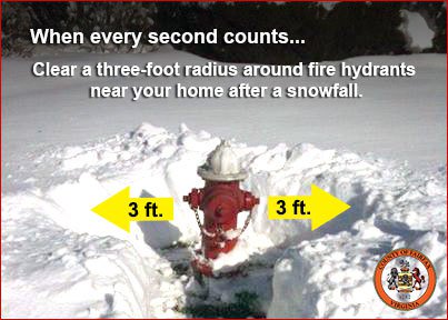
5:08 a.m. EST Saturday: Washington, D.C., residents are reminded to shovel out fire hydrants in case of emergencies.
#StaySafeDC: As soon as the strong winds and heavy snowfall ends, shovel snow from around fire hydrants.
4:38 a.m. EST Saturday: Snow at Times Square, New York, EarthCamwebcam shows.
4:21 a.m. EST Saturday: Heavy snow, thunder, sleet and blowing snow at BWI Airport.
4:13 a.m. EST Saturday: Snowy travel on FDR Drive in Manhattan, 511NY webcam shows.
4:06 a.m. EST Saturday: More than 3,400 flights are canceled so far on Saturday as a result of the blizzard, FlightStats reports.
4:00 a.m. EST Saturday: White-out conditions on U.S. Route 30 near Lancaster, Pennsylvania, PennDOT webcam shows.
3:50 a.m. EST Saturday: Very low visibility on Interstate 81 at Carlisle, Pennsylvania, PennDOT webcam shows.
3:34 a.m. EST Saturday: About 2,300 customers are without power in southern Maryland, the Maryland Emergency Management Agency reported.
3:31 a.m. EST Saturday: It continues to snow in Fairfax, Virginia, where as much as 1 foot of snow has fallen.
@breakingweather @NWS_BaltWash this snow is amazing in Fairfax Virginia
3:17 a.m. EST Saturday: 55-mph gust off Delaware Bay near Cape May, New Jersey, the National Data Buoy Center reports.
3:11 a.m. EST Saturday: Snowy travel on Interstate 99 at State College, Pennsylvania, where there is a 45-mph speed restriction.
2:55 a.m. EST Saturday: The Pennsylvania Turnpike is blocked from Donegal to Bedford due to disabled vehicles, the turnpike said.
2:44 a.m. EST Saturday: Snow band approaching Long Island and New York City from the south could produce rates of more than 2 inches per hour, AccuWeather Meteorologist Brett Rathbun said.
2:39 a.m. EST Saturday: 7.4 inches of snow at Laurel, Delaware, according to the Delaware Environmental Observing System.
2:35 a.m. EST Saturday: Winter storm contributing to current high tides between 2 to 4 feet above normal on the Chesapeake Bay.
2:30 a.m. EST Saturday: Snow plowing has stopped until 10 a.m. Saturday in Aberdeen, Maryland, city police said.
2:06 a.m. EST Saturday: Snow depth around Washington, D.C.: Dulles Airport, 10 inches; Reagan National, 8 inches; and BWI Airport, 8 inches, the National Weather Service reports.
2:02 a.m. EST Saturday: 45-mph speed restriction on Interstate 80 from Williamsport, Pennsylvania, to Pennsylvania/New Jersey state line, PennDOT reports.
2:00 a.m. EST Saturday: Skier takes advantage of Washington, D.C., blizzard, according to extreme snow chaser and meteorologist Reed Timmer.
1:25 a.m. EST Saturday: More than 1,000 Maryland customers, especially in the southern part of the state, are without electricity, the state's Emergency Management Agency reported.
1:23 a.m. EST Saturday: Over 9 inches of snow/sleet has fallen at the University of North Carolina at Asheville.
Nightfall has come but our teams are still active. Continue to visit http://snow.dc.gov for updates and info.
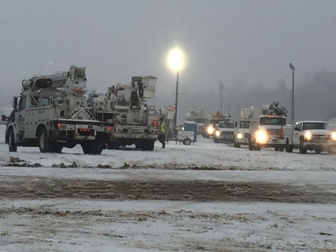
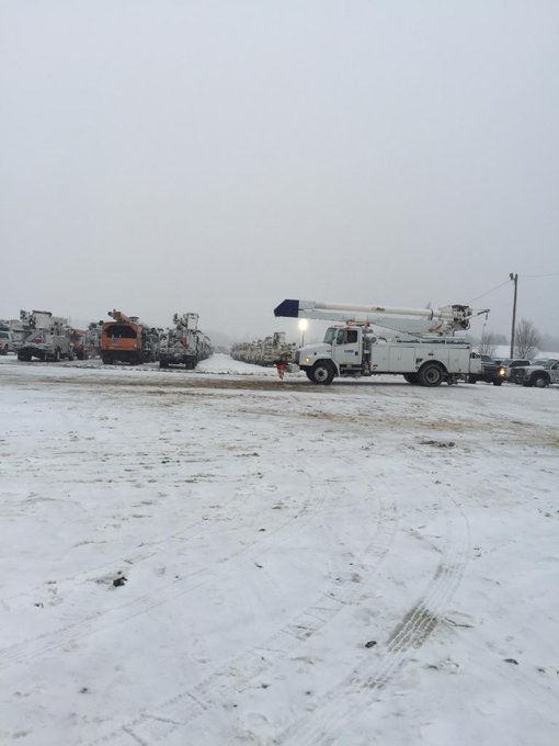
Additional crews from Florida to Michigan continue to arrive & will be deployed as outages occur. #ThankALineman
12:41 a.m. EST Saturday: Snowfall rates of 1 to 2 inches per hour possible across the lower Susquehanna River Valley in Pennsylvania, AccuWeather Meteorologist Brett Rathbun said.
12:09 a.m. EST Saturday: Snow falling at the Hudson County Extension Interchange at Jersey City, New Jersey, 511NY webcam shows.
For storm reports prior to 12:00 a.m. Saturday, click here.


No comments:
Post a Comment