By Kevin Byrne, AccuWeather.com Staff Writer
February 2,2015; 7:58PM,EST
As of 6:35 p.m. EST Monday, this blog is no longer live. Archived reports from the storm can be found below.
A major winter storm that invaded the Midwest and Great Lakes on Sunday with snow and ice is marching across New England.Having hit much of the Northeast and creating hazardous travel on Monday morning, conditions will continue to deteriorate in the Northeast throughout the day. AccuWeather.com Meteorologist Mike Doll said snowfall rates of 1 inch per hour are likely in cities like Boston during the day on Monday.
Blizzard conditions battered parts of Illinois including areas around Chicago on Sunday with O'Hare International Airport recording nearly 20 inches of snow. The 19.2 inches that fell into Monday morning put the storm into the top-five largest snowstorms for the city.
Following the storm, a rapid freeze-up will make for dangerous travel in some areas. Temperatures will plunge in the Northeast Monday night, turning slush and standing water into ice.
RELATED:
Frigid Start to February for the Midwest, Northeast
AccuWeather Winter Weather Center
Groundhog Day Snowstorm Snarls Travel From New York to Massachusetts
UPDATES (All times are listed in Eastern Time):
6:18 p.m. EST Monday: All Boston Public Schools will be closed on Tuesday.
5:51 p.m. EST Monday:
NWS Chicago ✔ @NWSChicago Follow
5:26 p.m. EST Monday: The New England Patriots Super Bowl championship parade has been postponed to Wednesday due to weather, the Boston Globe reports.
4:33 p.m. EST Monday: Watch the latest edition of AccuWeather LIVE:
4:10 p.m. EST Monday:
NWS Albany ✔ @NWSAlbany Follow
"Heavy snow is sweeping eastward across Long Island and coastal Connecticut on the back edge of the storm," said AccuWeather.com Meteorologist Alex Sosnowski. "Roads can go from wet and slushy to snow-covered in a matter of minutes with Snowfall rates of 1-2 inches per hour," he added.
3:40 p.m. EST Monday:
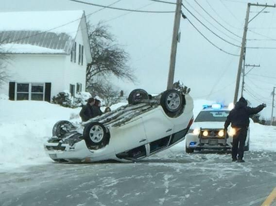
This motorist was attempting to pass a TT unit and lost control. No injury thanks to seatbelt use. #TakeItSlow
Plowing I-90 in the Capital Region #WinterStormLinus
Side shot of our tow plow working along I-90 near the Guilderland Service Area #WinterStormLinus
VTRANS plow involved in multi-vehicle crash on I-91. @WCAX sideswiped by 18-wheeler pic.twitter.com/nmcTkDzjzn" http://ow.ly/ImLdy
Starting to see an increasing number of spinouts in #RI. Drive slow and use caution. Stay off the roads if possible.
1:48 p.m. EST Monday: Road conditions and visibility along I-95 near Bangor, Maine, remain poor.
1:36 p.m. EST Monday: Nearly 2,000 PSEG Power customers near Ramblewood, New Jersey, are without power as a snow and ice storm hovers over the region.
1:00 p.m. EST Monday: For detailed, current information on the storm, watch the latest edition of AccuLIVE:
12:33 p.m. EST Monday:
tractor trailer vs. car accident @MaineTurnpike reports between York/Wells @ Turnpike mile 13. Courtesy: @MariaWGME
12:06 p.m. EST Monday: Roads across Massachusetts are snow-packed like these in Hingham, roughly 20 minutes from Boston.
11:48 a.m. EST Monday: "Cold air is holding its ground across southern New England and the New York City area. Where the snow turned to slush at midday, a quick freeze-up will occur Monday night as arctic air pours into the region in the wake of the storm," AccuWeather.com Meteorologist Alex Sosnowski said. "Heavy snow spread into the southern parts of Vermont and New Hampshire, as well as coastal Maine."
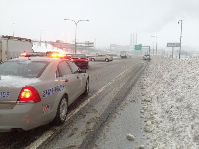
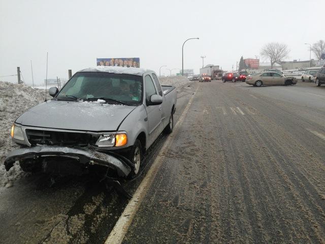
11:10 a.m. EST Monday: Massachusetts State Police responded to an accident on I-195 westbound near New Bedford, Massachusetts, on Monday morning as snow and ice created hazardous travel.
10:56 a.m. EST Monday: After widespread delays of up to 20 minutes due to the storm, many New York Metro-North Railroad lines are back to operating as normal.
Metro-North Railroad @MetroNorth Follow
Hudson, Harlem & New Haven Line
Service is now operating on/close to schedule. We apologize for any
inconvenience you may have experienced.
10:12 a.m. EST Monday:
NYSDOT @NYSDOT Follow
Speed limit reduction to 45 MPH on I-84 in the Hudson Valley from the PA to CT state lines, due to conditions.
8:54 a.m. EST Monday: Due to snow and ice, inbound flights to La Guardia International Airport are delayed up to 30 minutes, the FAA reports.
8:41 a.m. EST Monday: The National Weather Service in Boston reports 4.9 inches of snow as of 8:30 a.m., with snowfall rates hitting an inch per hour.
8:17 a.m. EST Monday: Heavy snow from upstate New York and into parts of New England will impact travel into later this morning, AccuWeather.com Meteorologist Dave Dombek said. A zone of ice is accompanying the system just to the south of those areas as well, he said.
"In places such as New York City where it has transitioned to rain and is very sloppy and slushy, all of that will freeze up solid tonight," he said.
7:50 a.m. EST Monday:
NWS Detroit ✔ @NWSDetroit Follow
Official storm totals: 16.7" Detroit, 9.2" Flint, 7.1" Saginaw, 14.1" Ann Arbor, 11.2" White Lake #MIwx
5:11 a.m. EST Monday:
4:53 a.m. EST Monday: 20 inches of snow fell at Kalamazoo, Michigan, NWS spotter reported.
4:44 a.m. EST Monday:
4:32 a.m. EST Monday: Snow-covered roads continue around the Detroit area, MDOT webcams show.
4:06 a.m. EST Monday: Snowy travel around Hartford, Connecticut, including I-84, ConnDOT webcams show.
3:50 a.m. EST Monday: Speed limit restrictions posted in Massachusetts.
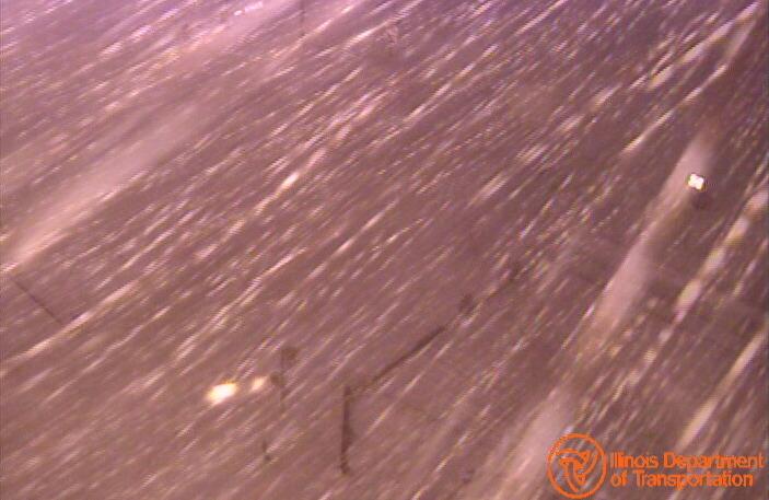
3:38 a.m. EST Monday: Difficult travel is occurring over more than two-thirds of Illinois, IDOT reports.
3:34 a.m. EST Monday: Snowy travel on Route 3, Chelmsford, Massachusetts, MassDOT webcam shows.
3:10 a.m. EST Monday: Light snow moves into Boston.
2:51 a.m. EST Monday: Speed limit restrictions continue in Pennsylvania, 511PA reports.
2:48 a.m. EST Monday: Snowy travel continues across the Detroit area, MDOT reports.
2:20 a.m. EST Monday: Waterloo, Iowa, broke its Feb. 1 snow record with 6.3 inches; the old record was 5.1 inches, set in 2011.
2:07 a.m. EST Monday: Severe snow and icing occurring around Amherst and Williamsville, north of Buffalo, New York, reports 511NY.
1:20 a.m. EST Monday: 18.4 inches of snow fell at Midway Airport while 17.5 inches fell at O'Hare Airport, Chicago, according to NWS observations.
1:18 a.m. EST Monday:
Blowing snow, reduced visibility, black ice overnight. If you must drive, be prepared in case you get stranded. #ilwx
1:01 a.m. EST Monday: 13.5 inches of snow have fallen at Schererville, Indiana, where it is still snowing, NWS spotter reported.
12:56 a.m. EST Monday: Reduced visibility on the Verrazano-Narrows Bridge at Brooklyn/Staten Island, 511NY webcam shows. Other roadways affected in the New York City area.
12:35 a.m. EST Monday: 15 inches of snow fell at Oshtemo, Michigan, NWS spotter reported.
12:25 a.m. EST Monday: Travel remains difficult in Illinois, IDOT reports.
Many roads remain snow covered (red on map.) Blowing/drifting snow creating near zero visibility in some areas. #ilwx
12:21 a.m. EST Monday: Regular school day ahead in New York City.
12:18 a.m. EST Monday: Vehicle crash closed northbound I-75 at Springwells Street, Detroit, MDOT reports.
12:14 a.m. EST Monday: Northeast storm will bring blizzard conditions to parts of Canada on Monday.
11:53 p.m. EST Sunday:
11:42 p.m. EST Sunday: Snowy travel with poor visibility occurring in southwestern Ontario, Ontario 511 reports.
11:15 p.m. EST Sunday: 15 inches of snow have fallen 5 miles north of La Porte, Indiana, NWS spotter reported.
11:03 p.m. EST Sunday: Snowing currently in Baltimore, MDOT webcam shows at I-695 and I-40.
10:55 p.m. EST Sunday: Snow cleanup continues in Chicago.
10:50 p.m. EST Sunday: 1,700 flights are already canceled for Monday, mostly in the Northeast, FlightStats reports.
10:44 p.m. EST Sunday: Speed limit restrictions issued for Garden State Parkway and New Jersey Turnpike, 511NJ reports.
10:39 p.m. EST Sunday: More than 2,700 First Energy customers in Ohio are without power, the utility reported.
10:33 p.m. EST Sunday: Snowy, icy conditions continue on Detroit-area roads, including I-75 at Clay Street, Michigan State Police report.
10:26 p.m. EST Sunday: Speed limit restrictions continue across Pennsylvania interstates, 511PA reports.
10:15 p.m. EST Sunday: 6 inches of snow have fallen at Brockway, Pennsylvania, while another 5 inches fell at Brookville, PennDOT reported. PennDOT webcam shows snowy travel south of Brockway at the I-80/Route 219 interchange.
10:13 p.m. EST Sunday: Snowy travel on I-90 at Interchange 58 (Silver Creek), New York, 511NY webcam shows.
10:05 p.m. EST Sunday: More than 6,500 Illinois residents are without power at this hour, utilities report.
9:15 p.m. EST Sunday:
It's a snowy mess on State Street as this is now one of the ten biggest snowstorms in history. #ChicagoBlizzard
Vis 1/4 mi or less the past few hrs outside office, as in these photos from 450 pm CST. Do not attempt to travel.
Heaviest snow I have ever shoveled @NWSKansasCity #kirksville
3:50 p.m. EST Sunday: As conditions continue to deteriorate in Chicago this evening due to blowing snow, see the resources below. Snow totals have topped 12.3 inches at Roselle, Illinois, and 10.5 inches at Woodridge, Illinois.
3:30 p.m. EST Sunday: Snow is piling up over northern Indiana. NWS relayed public reports of a foot of snow in Lagrange and 4 miles southwest of South Bend, Indiana. NIPSCO reported nearly 5,000 power outages with the weight of heavy snow.
3:00 p.m. EST Sunday: Winds are picking up in Chicago, with blowing snow and poor visibility. Near-blizzard conditions will unfold through the evening and then will let up around midnight, according to AccuWeather Meteorologist Brian Lada.
2:35 p.m. EST Sunday:
2:20 p.m. EST Sunday:
2:05 p.m. EST Sunday: A total of 1,250 flights were canceled at Chicago O'Hare on Sunday, according to FlightStats.
1:35 p.m. EST Sunday:
1:25 p.m. EST Sunday: Recent snowfall amounts include 7.1 inches at Milwaukee International Airport and 11.0 inches north of La Porte, Indiana, according to a trained spotter.
1:20 p.m. EST Sunday: Watch updates on the storm in the latest edition of AccuWeather LIVE:
1:00 p.m. EST Sunday: According to Illinois Department of Transportation, I-57 northbound and southbound is closed just north of I-72 as a semi Hazmat truck jack-knifed across the roadway.
12:17 p.m. EST Sunday: More than 24,000 electric customers are without power in northern Illinois, according to ComEd. A majority of these outages are located just south of Chicago.
12:01 p.m. EST Sunday:
11:21 a.m. EST Sunday: A foot of snow has been measured near Fulton, Illinois, by an NWS spotter with snow still falling.
10:56 a.m. EST Sunday: Many roads across Iowa are completely covered with snow, leading to difficult travel, according to Iowa DOT.
10:21 a.m. EST Sunday: Amid the winter weather, more than 1,000 flights arriving to and departing from Chicago O'Hare International Airport canceled Sunday.
9:40 a.m. EST Sunday: Roads are covered with snow along I-80 in eastern Iowa.









No comments:
Post a Comment