February 21,2015; 11:00PM,EST
A winter storm was spreading heavy snow into the Interstate-95 mid-Atlantic Saturday evening, while areas of heavy snow and drenching rain continued west of the Appalachians.
The worst of the snow and ice will target the Northeast and parts of the Rockies Saturday night.
"The snow will spread into New England Saturday evening while the storm transitions to ice and rain in the coastal mid-Atlantic area," AccuWeather.com Meteorologist Alex Sosnowski said.
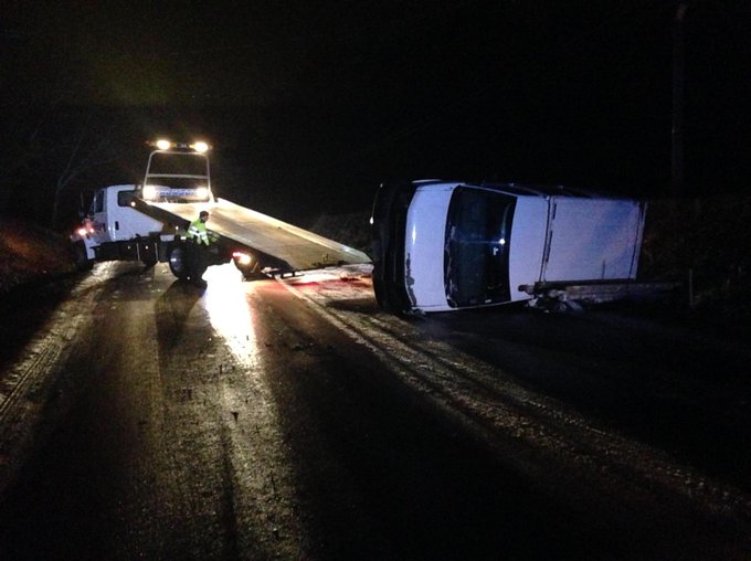
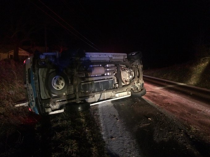
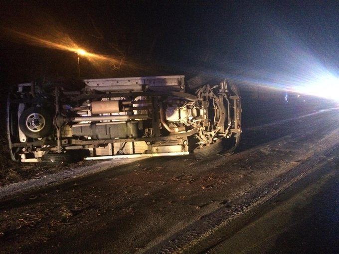
Travel reaching from St. Louis to Pittsburgh could be treacherous through Sunday morning as roads become slick. Multiple vehicle crashes and slide offs were reported across portions of Indiana, Mississippi, Tennessee and Alabama into Saturday morning. For previous storm impacts, archived reports can be found here.
RELATED:
Weekend Snow, Ice to Threaten an 1,800-Mile Corridor From Central to Eastern US
AccuWeather Winter Weather Center
More Arctic Cold to Flow Across Eastern US Through End of February
UPDATES: (All times are listed in EST)
11:00 p.m. EST Saturday: 11.5 inches of snow have fallen at Catawba, Virginia, an NWS spotter reported.
10:54 p.m. EST Saturday: Maryland officials continue working on snow removal.
10:46 p.m. EST Saturday:
NWS Taunton Skywarn @WX1BOX Follow
Hartford-Tolland County CT SKYWARN Net: KB1EHE-Farmington, CT: 4.5", K1PAI-Wethersfield, CT: 4.0", NC1J-Weatogue, CT: 3.5".
10:30 p.m. EST Saturday: Hazardous travel occurring in Massachusetts.
10:14 p.m. EST Saturday: 18 inches of snow have fallen at Tucker, West Virginia, while another 10 inches fell at Parsons, reports West Virginia DOT.
10:06 p.m. EST Saturday: Since Feb. 16, there have been 18 confirmed weather-related deaths in Tennessee, the Tennessee Emergency Management Agency reports.
10:00 p.m. EST Saturday:
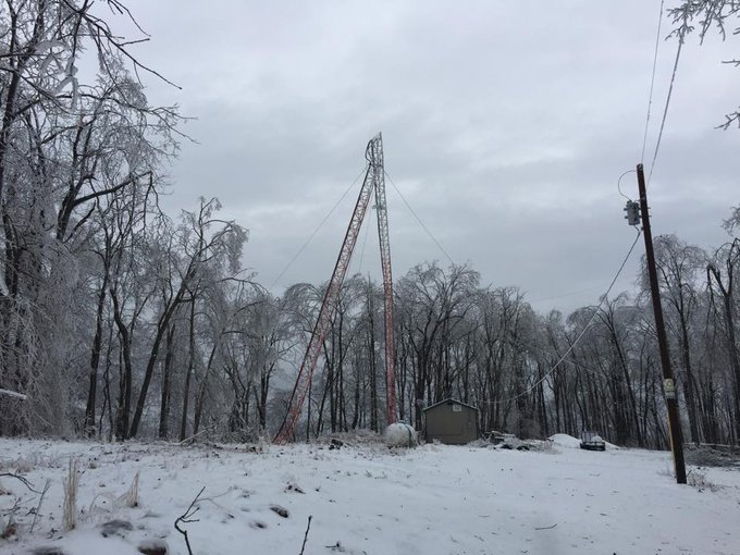
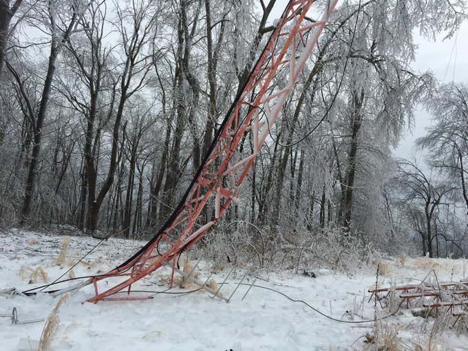
Possibly the craziest picture we've seen from the ice storm. A Crossville radio station's signal tower collapsed!
9:15 p.m. EST Saturday:
8:17 p.m. EST Saturday: View the latest snowfall forecast through Saturday night.
7:22 p.m. EST Saturday: Watch the 7 p.m. edition of AccuWeather LIVE.
NWS Boston ✔ @NWSBoston Follow
Boston 0.7" of new snow today through 7 pm today. Seasonal total now at 99.4", should break 100 inches by midnight!
This photo from Crossville, TN, was taken by Red Cross volunteer Lisa Brown. 50,000 are without power in the area.
Sister measured 13" near Harrisonburg, VA @breakingweather
@AccuRayno Interstate 83 into Baltimore. That's a lot of snow on a highway
4:35 p.m. EST Saturday: Snow is beginning to push into Maine.
4:19 p.m. EST Saturday: Five inches of snow reported in Troy, Ohio, a National Weather Service trained spotter said.
4:11 p.m. EST Saturday:
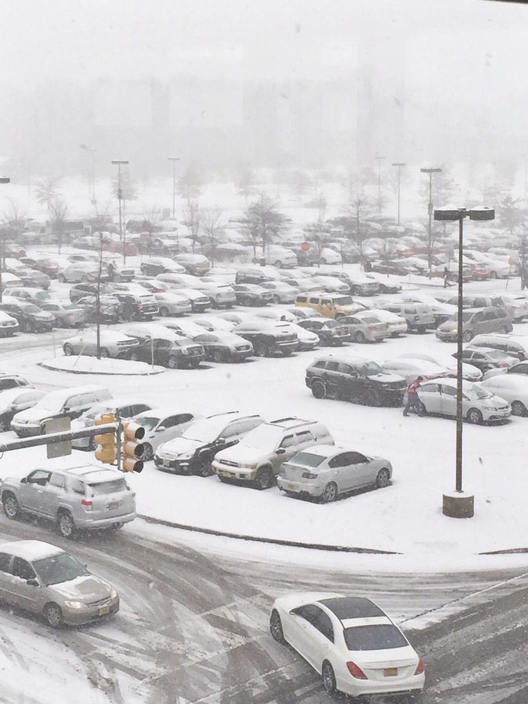
@breakingweather shot from top of Garden State Plaza NJ
NWS BUFFALO ✔ @NWSBUFFALO Follow
Woah, what a mess in DC and Baltimore! So many accidents due to the snow. Travel cautiously, if at all.
*Please retweet!* NON-EMERGENCY TRAVEL IS DISCOURAGED IN MARYLAND. Info: http://bddy.me/1FHPnrZ
2:18 p.m. EST Saturday:
1:45 p.m. EST Saturday: Snowfall was approaching 5 inches in some of the suburbs north of Washington, D.C., and west of Baltimore.
1:40 p.m. EST Saturday:
11:54 a.m. EST Saturday: As much as 8 inches of snow has fallen in Randolph County, West Virginia. 6.5 inches of snow was reported in Greenbriar County, according to the NWS.
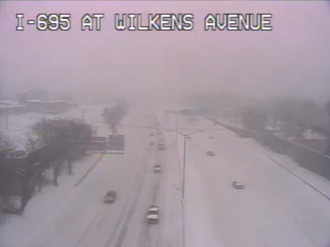
11:48 a.m. EST Saturday: Snow is rapidly falling throughout the greater Washington, D.C., area causing poor visibility.
11:29 a.m. EST Saturday: Inbound flights to Philadelphia International Airport are subject to a ground delay of more than two hours, FAA reports.
11:14 a.m. EST Saturday: Multiple accidents reported along I-95 in Hanover County, Virginia, according to local officials.
10:57 a.m. EST Saturday: The Pennsylvania Department of Transportation issued travel restrictions for I-80, I-79, I-70 and other highways in western Pennsylvania, reducing speed limits to 45 mph.
10:36 a.m. EST Saturday: More than 5,500 Appalachian Power customers in West Virginia are without power as the storm continues to cover the region with snow and ice.
10:21 a.m. EST Saturday:
9:40 a.m. EST Saturday: Numerous accidents reported across West Virginia highways according to the West Virginia Department of Transportation. Two of three lanes along I-77 southbound remain closed due to a vehicle accident.
9:12 a.m. EST Saturday: Roads in Southern Indiana are slippery and motorists are urged to take extreme caution if driving is necessary.
8:50 a.m. EST Saturday: Approximately half of the population of Fentress County, Tennessee, is without power due to heavy ice accumulation.
8:25 a.m. EST Saturday: Snow is slowing travel along Interstate 70 in Colorado from Georgetown to Vail.
8:15 a.m. EST Saturday: For current information on the storm, watch the latest edition of AccuWeather LIVE:
8:10 a.m. EST Saturday: 3 to 8 inches of snow has fallen on the Denver Metro area over the course of the storm.
8:00 a.m. EST Saturday: Up to three-quarters of an inch of freezing rain has downed scores of trees and power lines in Cumberland and Fentress counties in Tennessee.
7:20 a.m. EST Saturday: Nearly 2,000 homes and businesses are without power in the Charleston, West Virginia, area due to a heavy accumulation of freezing rain and wet snow.
7:00 a.m. EST Saturday: Indianapolis received 4 inches of snow in six hours with a storm total of 4.6 inches so far.
6:50 a.m. EST Saturday: Many roads are still covered with snow or ice across central and southern Illinois despite the heaviest precipitation shifting to the east, IDOT reports.
6:19 a.m. EST Saturday:
5:08 a.m. EST Saturday: Freezing rain in Hatfield, Kentucky, northern Pike County.
4:37 a.m. EST Saturday: Freezing rain continues to fall at White House, Tennessee, where an NWS spotter said three-tenths of an inch has already fallen.
4:34 a.m. EST Saturday: Flooded roads occurring in the Nashville area, TDOT reports.
4:30 a.m. EST Saturday: Snowy travel around the Indianapolis area, INDOT webcams show.
4:07 a.m. EST Saturday: 6.8 inches of snow has fallen 2 miles southwest of Springfield, Illinois, an NWS employee reported.
4:05 a.m. EST Saturday: More than 2,400 Tennessee power customers are without service, utilities report.
3:49 a.m. EST Saturday: A half inch of freezing rain has fallen in Portland, Tennessee, near the Kentucky border, an NWS spotter reported. Freezing rain continued to fall at the spotter's location.
3:40 a.m. EST Saturday: More than 700 LG&E, KU and ODP customers are without service in northern and central Kentucky, the utilities report.
2:55 a.m. EST Saturday: Over 1,000 Tennessee electric customers are without service at this hour, utilities report.
2:28 a.m. EST Saturday: Up to a half inch of freezing rain has fallen across Cumberland County, Tennessee, emergency management reports.
2:13 a.m. EST Saturday: Forsyth County Sheriff's deputies are reporting that they are observing freezing rain all along the west side of the county, northeast of Atlanta.
2:09 a.m. EST Saturday: Numerous tractor-trailers jackknife in Tennessee, TN511 said.
1:43 a.m. EST Saturday: "Very heavy snow with rates of 1 inch an hour will fall overnight from Springfield and Decatur in Illinois to Indianapolis, Indiana," AccuWeather.com Meteorologist Mike Doll said. "Travel will be hazardous with snow-covered and slippery roads."
1:22 a.m. EST Saturday: Difficult travel continues in Blount County, Alabama.
12:32 a.m. EST Saturday: Up to 1 inch of snow per hour may fall at Indianapolis as a snow band moves into the region, AccuWeather Meteorologist Brian Lada said.
12:12 a.m. EST Saturday: Icy travel in northern Georgia.








No comments:
Post a Comment