Published: July 10,2016
 Shelf cloud over Rushford, Minnesota, Sunday morning, July 10.
(Arlene and Gordon Johnson/Facebook)
The photo above, from Rushford, Minnesota, is like a scene straight out of a movie.
You probably understand why this is one of the most frequently-shared weather photos we get on our Facebook page and in our weather.com/photos gallery. Here's how it looked near Grundy Center, Iowa.
 Shelf cloud south of Grundy Center, Iowa, Sunday morning, July 10.
(Podunker/Twitter)
 Shelf cloud in Dike, Iowa, Sunday morning, July 10.
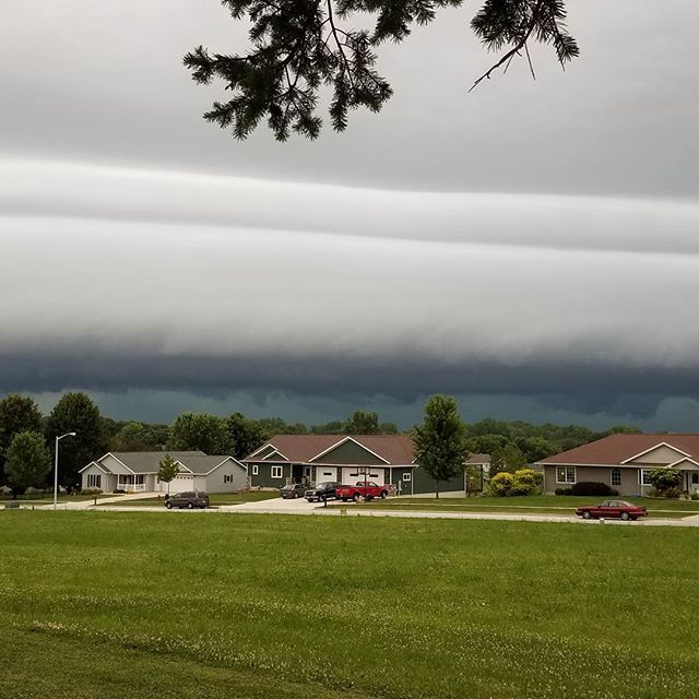 Shelf cloud in Parkersburg, Iowa, Sunday morning, July 10.
Shelf Cloud Science
A shelf cloud is the boundary between a downdraft and updraft of a thunderstorm or line of thunderstorms.(MORE: Incredible Shelf Cloud Wows Beachgoers on the Alabama Coast)
Rain-cooled air descends into a thunderstorm's downdraft, and then spreads out laterally when reaching Earth's surface. Warmer, more moist air is lifted at the leading edge, or "gust front," of this rain-cooled air.
 The meteorological factors behind the formation of a typical shelf cloud.
No comments:
Post a Comment