Published: December 18,2015
Colder winds blowing over the warmest mid-December Lake Erie waters in at least five years led to the development of a lake-effect snowband Friday afternoon, which will continue into Saturday.
Current Radar
This brought 0.1 inches of snow to the official observing site for the city as of 6:49 p.m., Buffalo - Niagara International Airport, enough to finally halt the record late first snow streak. As a reminder, 0.1 inch or more of snow is considered "measurable" by official National Weather Service standards.
(MAP: INTERACTIVE RADAR)
To the south, the snowband will produce much heavier snow for a brief time Friday night, with some snowfall rates over 2 inches per hour from the city's "Southtowns" southward, possibly accompanied by lightning. South of Buffalo, thundersnow was reported Friday afternoon in Hamburg, New York and as of 10 p.m. 8.2 inches of snow fell in Perrysburg, New York.
With winds expected to shift west or even west-northwest into Saturday, the heaviest total snowfall from the Lake Erie snowband should remain in southwest New York, well south of Buffalo.
Lake-Effect Snow Forecast
Accumulating snow is also expected in parts of the Lake Michigan and Lake Superior snowbelts into Saturday.
In fact, heavy snow contributed to a pileup of 40 to 50 cars near Grand Rapids, Michigan on Friday afternoon.
(INTERACTIVE: Winter Weather Alerts, Radar)
Unfortunately, if you're dreaming of a White Christmas in Buffalo, that looks unlikely. Another round of potentially record-smashing warmth is headed into western New York on Christmas week, with the vast majority of precipitation falling as rain.
(FORECAST: White Christmas Chances | The Next 10 Days)
Prior to this year, Buffalo's longest wait for the season's first measurable snow was in 1899, when the flakes didn't arrive until December 3.
In an average season, through December 17, the city would've had roughly 22 inches of snow so far. This is roughly six weeks later than the average first date of measurable snow, November 5.
(Data: National Weather Service)
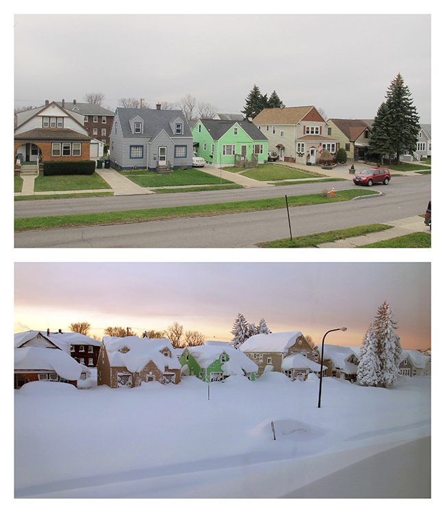
Last November, a multi-day lake-effect snowstorm paralyzed the Buffalo metro area with up to 88 inches of snow. Some snow piles created by dumping off excess snow in abandoned lots remained into the summer.
#Buffalo street Fri. vs. 11/19/14 (AP/Carolyn Thompson). How long will #snow drought last? http://wxch.nl/1TLgaIf
(MORE: El Niño and Seasonal Snow)
The other three strong El Niños were below average for snow, but the least snow in any of those periods, the 1982-83 season, finished with 52.4 inches at Buffalo, far from a snowless winter.
The least snowiest Decembers at Buffalo were 1889 and 1891, each with 1.1 inches. The winter of 1889-90 finished with just 22.4 inches, less snow than any other season on record. But 1891-92 finished with 80.9 inches, much closer to average.


No comments:
Post a Comment