By Katy Galimberti, AccuWeather.com Staff Writer
April 3,2015; 11:09PM,EDT
Update at 8:25 a.m. CDT Friday:
This blog is no longer live. Detailed reports of the severe weather can be found below.
Severe thunderstorms continue to batter the Ohio Valley after developing Thursday evening in the Plains.
Heavy rain continues to cause widespread flooding across Louisville, Kentucky, with some roadways covered in up to 12 inches of water. Tornadoes were reported into early Friday morning in Oklahoma, Kansas and Missouri as the storm barreled across the Plains.
As the storm continues, the greatest threat will be damaging wind gusts past 60 mph and hail as large as half dollars. Torrential rain will continue to pose a flooding threat for many in the storm's path.
RELATED:
Severe Storms to Eye Louisiana to Kentucky Friday; Flood Risk More Extensive
AccuWeather Severe Weather Center
Five Essential Safety Steps to Take Before Severe Weather Hits
UPDATES: (All times are listed in CDT)
6:46 a.m. CDT Friday: WSMV-TV reports a massive fire at GE Appliance Park in Louisville, Kentucky. Crews are on scene.
6:02 a.m. CDT Friday: "Storms, some containing damaging winds, are moving east through southeastern Missouri," AccuWeather.com Meteorologist Becky Elliot said. "Those storms will continue to weaken as they move into western Kentucky and western Tennessee."
"The main threat this morning is the ongoing flash flooding in northern Kentucky. The city has received more than 5 inches of rain since Thursday evening."
5:38 a.m. CDT Friday: Flooding in Louisville, Kentucky, is prompting water rescues across the area:
4:31 a.m. CDT Friday: Forty-two high water rescues have been reported so far Friday morning in Jefferson County, Kentucky, Louisville EMA/Metrosafe reports.
4:28 a.m. CDT Friday: Flooding causes a delay for the start of Louisville schools on Friday.
3:40 a.m. CDT Friday:
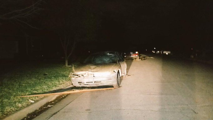
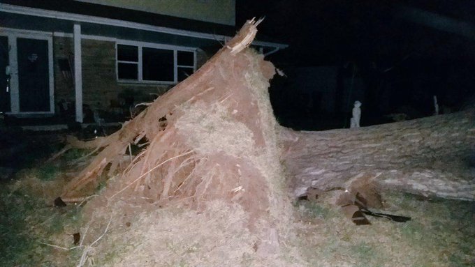
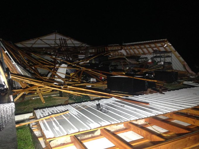
3:27 a.m. CDT Friday: Wichita, Kansas, storm damage.
Damages throughout Wichita from the storm. Many still without power. Street lights are slowly coming back on.
3:08 a.m. CDT Friday: Roof was torn off a house 8 miles north of Welch, Oklahoma, just south of the Kansas/Oklahoma border on Highway 59, trained spotter reports.
3:06 a.m. CDT Friday: Flash flooding occurring in Carbondale and Raleigh, Illinois, law enforcement reports.
2:51 a.m. CDT Friday: Tornado on the ground 3 miles southeast of Quapaw, Oklahoma, near Joplin, Missouri, trained spotters report.
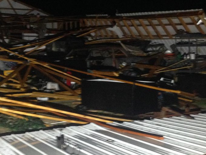
2:44 a.m. CDT Friday: Storm damage from Afton, Oklahoma.
2:27 a.m. CDT Friday: Baseball-sized hail at Altamont, Kansas, trained spotter reports.
2:24 a.m. CDT Friday: 1.51 inches of rain in two hours at Louisville, Kentucky, according to Mesonet.
2:18 a.m. CDT Friday: Flooding and a water rescue occurred in Jefferson County, Kentucky, the National Weather Service at Louisville reported.
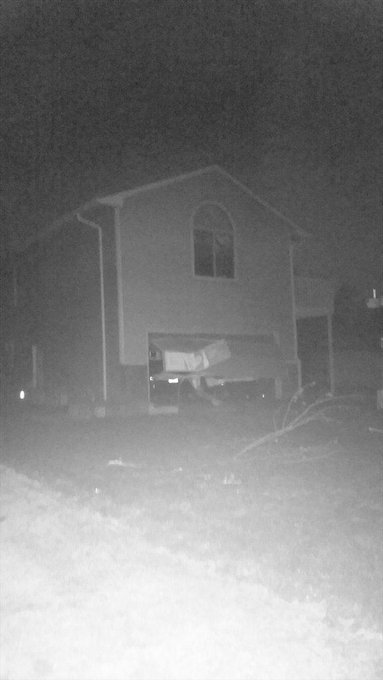
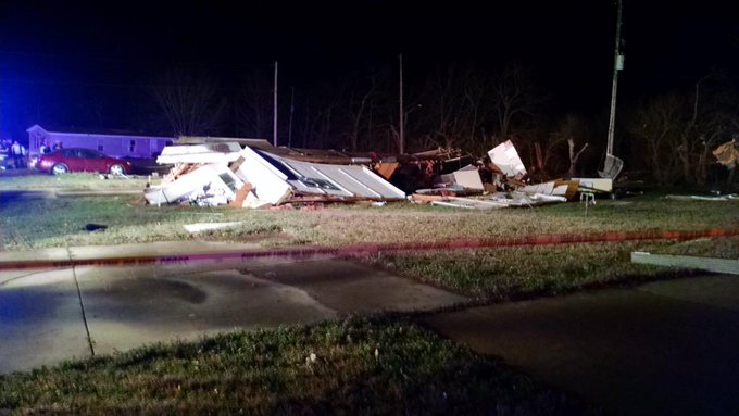
2:12 a.m. CDT Friday: Destroyed homes in Douglass, Kansas.
1:47 a.m. CDT Friday:
1:41 a.m. CDT Friday: 90 mph gust with tennis-ball-sized hail around Elk City, Kansas, trained spotters report.
1:16 a.m. CDT Friday: Golf-ball-sized hail fell at Moline, Kansas, emergency management reports.
1:13 a.m. CDT Friday: High winds destroy two homes in Douglass, Kansas, emergency management reports.
1:04 a.m. CDT Friday: More than 60,000 Kansas customers are without electricity at this time, utilities report.
12:55 a.m. CDT Friday:
12:40 a.m. CDT Friday: 80 mph gust with trees down at Vanzant, Missouri, emergency management reports.
12:37 a.m. CDT Friday: 74 mph gust at McConnell Air Force Base, Wichita, Kansas.
12:23 a.m. CDT Friday:
12:17 a.m. CDT Friday: Over 4,000 Westar Energy customers without power as storms hit Hutchinson, Kansas, the utility reports.
11:54 p.m. CDT Thursday: Wind gusts over 60 mph possible with storms approaching Wichita, Kansas, AccuWeather.com Meteorologist Brian Lada said.
11:48 p.m. CDT Thursday: 70 mph gusts and golf-ball-sized hail near Nickerson, Kansas, law enforcement and trained spotter report.
11:32 p.m. CDT Thursday: More than 1,300 Midwest Energy customers without power northwest of Wichita, Kansas, after storms strike the region, the utility reports.
11:26 p.m. CDT Thursday: 70 mph winds, Ping-pong-ball-sized hail and power outages at Sylvia, Kansas, emergency management reports.
11:19 p.m. CDT Thursday: Three large trees felled along with shed damage, 2 miles north of Waterloo, Illinois, trained spotter reports.
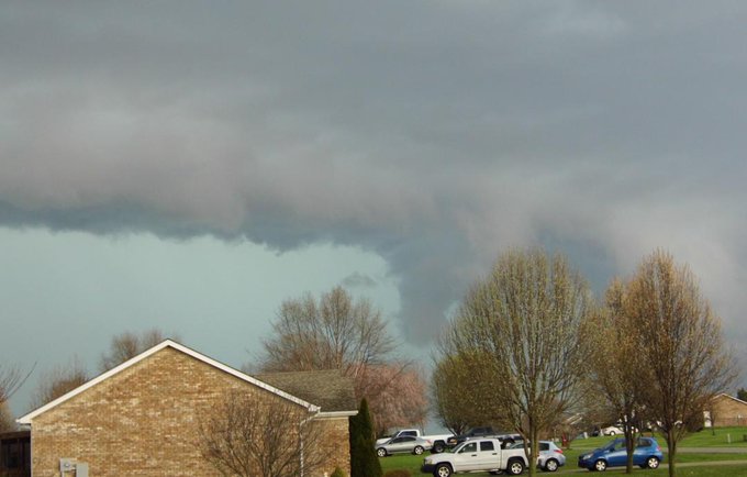
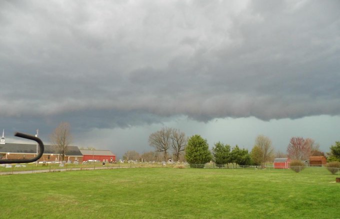
11:17 p.m. CDT Thursday: Thunderstorm at Rogersville in southwest Missouri.
10:59 p.m. CDT Thursday: Wind damage occurred 8 miles south of Leslie, Missouri, trained spotters report.
10:40 p.m. CDT Thursday: About 1,800 northeast Oklahoma electric customers without power as storms roll through, Public Service Co. of Oklahoma reports.
10:31 p.m. CDT Thursday:
10:23 p.m. CDT Thursday:
9:37 p.m. CDT Thursday: Over 1,000 customers without electricity after storms near Columbus, Kansas, utilities report.
9:16 p.m. CDT Thursday: Funnel clouds and strong rotation reported near Webb City, Missouri, near Joplin, the National Weather Service reported.
8:53 p.m. CDT Thursday: Several tornado touchdowns along Highway 126 near Golden City, Missouri, law enforcement reports.
8:51 p.m. CDT Thursday: Ping-pong-ball-sized hail at Carl Junction, Missouri, near Joplin, trained spotter reports.
8:42 p.m. CDT Thursday: Tornado near Jasper, Missouri, law enforcement reports.
8:30 p.m. CDT Thursday: Dangerous thunderstorm with a history of producing a tornado will be near Joplin, Missouri, in about 20-25 minutes, warned AccuWeather Enterprise Solutions meteorologists John Lavin and Rich Putnam.
8:26 p.m. CDT Thursday: Tornado touchdown near Hallowell, Kansas, emergency management reports.
8:24 p.m. CDT Thursday: Tornado on the ground near Jasper, Missouri, law enforcement reports.
8:17 p.m. CDT Thursday: Trained spotter reported tornado damaged a shed south of Mound Valley, Kansas.
8:12 p.m. CDT Thursday:
NWS Wichita ✔ @NWSWichita Follow
8:10pm: Sirens in Mound Valley and Altamont are being sounded according to the Labette county Emergency Manager #kswx
7:47 p.m. CDT Thursday: Tornado on the ground just north of Labette, Kansas, storm chaser reports.
7:42 p.m. CDT Thursday: More than 1,900 Empire District electric customers are without service in the Decatur/Gentry, Arkansas, area, the utility reports.
7:39 p.m. CDT Thursday: Storms continue to ramp up in the central U.S.
7:34 p.m. CDT Thursday: Brief touchdown of tornado 4 miles west-southwest of Parsons, Kansas, emergency management reports.
7:20 p.m. CDT Thursday: Baseball-sized hail 7 miles west of Potosi, Missouri, trained spotter reports.
7:14 p.m. CDT Thursday: Funnel cloud spotted 7 miles east of Cherryvale, Kansas, trained spotters report.
7:08 p.m. CDT Thursday: 1.53 inches of rain have fallen so far Thursday at the Lawrenceville Airport, Illinois, according to an automated rain gauge.
6:39 p.m. CDT Thursday: A barn caught fire after a lightning strike in Summit, Kentucky, the local 911 call center reports.
6:29 p.m. CDT Thursday: View the latest map showing the threat area for tornadoes.
6:14 p.m. CDT Thursday: Quarter-sized hail 9 miles northeast of Bloomington, Indiana, a National Weather Service trained spotter reports.
6:04 p.m. CDT Thursday:
4:45 p.m. CDT Thursday: Strong thunderstorms, with damaging winds up to 60 mph possible, are moving into the Nashville, Tennessee area. Residents in the area should take cover.
4:24 p.m. CDT Thursday:






No comments:
Post a Comment