Published: April 2,2015
After attaining rare March super typhoon status Tuesday, Typhoon Maysak is now feeling the influence of two weakening factors. Regardless, Maysak, called "Chedeng" in the Philippines, still poses a threat to the northern Philippines this weekend.
As of the Friday morning advisory (local time) issued by the National Weather Service in Guam, Maysak is now the equivalent of a Category 3 hurricane with winds of 115 mph. However, increasing wind shear - changing wind speed and/or direction with height - and impinging dry air has begun to weaken convection on the southwest side of the eyewall, according to the U.S. Joint Typhoon Warning Center.
Infrared Satellite: Maysak
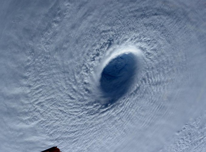
One clear sign of weakening is the much less distinct, more cloud-filled eye now compared to the classic eye seen earlier this week.
The combination of wind shear and dry air is expected to continue to weaken Maysak over the next day or so as it continues to track west-northwest.
However, a landfall in northern Luzon Island in the Philippines is still expected Sunday morning, local time. (Luzon is 13 hours ahead of U.S. Eastern daylight time.)
(FORECAST: Manila | Tacloban)
Given the weakening trend and a track potentially over northern Luzon, the Philippine capital of Manila should escape the worst impacts this weekend. However, any outer rainbands may trigger local flash flooding in the metro area, and a few strong wind gusts could lead to sporadic downed tree limbs or power outages.
Maysak's History
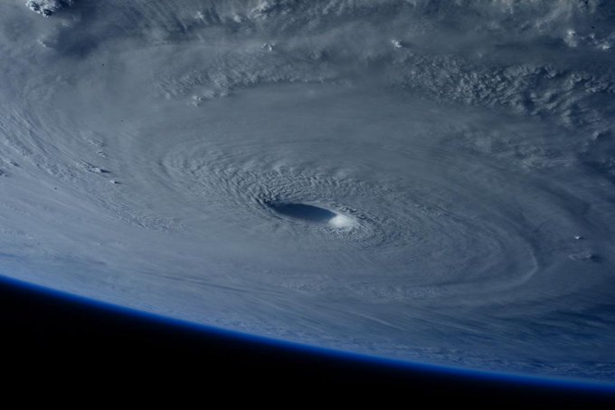
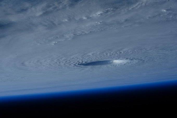
Early this week, Super Typhoon Maysak rapidly intensified into the equivalent of a Category 5 hurricane with maximum sustained winds of 160 mph. According to Weather Underground's Dr. Jeff Masters, Maysak is only the third super typhoon in reliable records dating to the 1940s with estimated winds that strong prior to April.(IMAGES: Maysak Wows Space Station Astronauts)
Prior to becoming a super typhoon, Maysak caused significant damage and killed at least five people in the Chuuk state of Micronesia, according to The Associated Press. Maysak's eye passed just north of Yap Island on Wednesday, local time. Winds gusted up to 48 mph at Yap International Airport.
Typhoon Maysak first impacted Chuuk State, a group of Micronesian islands about 1,000 kilometers (620 miles) southeast of Guam. Winds gusted as high as 71 mph Chuuk International Airport on Weno Island in the Chuuk State of Micronesian on Sunday, local time. (Chuuk is 14 hours ahead of eastern daylight time.)
Guampdn.com reported about 95 percent of tin houses were destroyed in Chuuk state. Communications were down in the islands Saturday, but were restored Sunday. Kane Faylim, airport manager for the Chuuk state government told the Associated Press airport employees had clear rocks deposited by large waves from the runway of Chuuk's airstrip Tuesday, which has now been reopened.
Sam Cristoforetti ✔ @AstroSamantha
(MORE: Maysak Latest News)
Maysak became the third typhoon of 2015, a record active early start to the year in the western Pacific, according to Weather Underground's director of meteorology, Dr. Jeff Masters.
Western Pacific Ocean tropical cyclones, called typhoons, can occur any time of the year, but typically hit a relative minimum in February and early March.
The name Maysak is Cambodian for a kind of tree.
Earlier in March, Tropical Cyclone Pam made a direct hit on the southern islands of Vanuatu in the south Pacific.
(PAM: Before/After Imagery | How You Can Help | Four Tropical Cyclones At Once)


No comments:
Post a Comment