By Renee Duff, AccuWeather.com Meteorologist
June 22,2016; 10:37PM,EDT
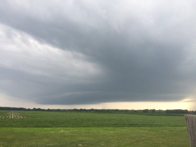
Violent thunderstorms will continue to track eastward across portions Illinois, Indiana, Ohio and Kentucky through Wednesday night.
"Thunderstorms capable of threatening lives and property will target parts of Illinois, Indiana, Ohio, Kentucky, West Virginia and western Pennsylvania through Wednesday night," AccuWeather Senior Meteorologist Kristina Pydynowski said.
As a result, the storms could lead to travel delays, property damage and power outages particularly around Chicago, Indianapolis, Detroit, Cincinnati and Pittsburgh.
People in these areas should take cover as storms approach as they will be capable of producing wind over 70 mph, hail as large as baseballs and damaging tornadoes.

RELATED:
Severe weather outbreak looms for midwestern US into Wednesday night
Interactive weather radar
Map: Current severe weather watches and warnings
UPDATES:
10:27 p.m. CDT Wednesday: 1.18 inches of rain fell in 30 minutes in La Porte, Indiana, according to a NWS spotter.
10:26 p.m. CDT Wednesday: A storm capable of producing a tornado was located near Eau Claire, Wisconsin.

10:15 p.m. CDT Wednesday: A confirmed tornado was located near Pontiac, Illinois, according to a NWS spotter.

9:54 p.m. CDT Wednesday: The Copa America match between Colombia and Chile at Soldier Field will kick off at 10:25 p.m. CDT after being delayed by storms.

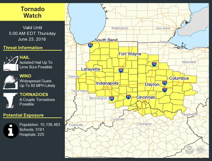
9:25 p.m. CDT Wednesday: A new tornado watch has been issued for portions of Ohio, Indiana and Kentucky. The watch includes the cities of Cincinnati and Indianapolis.
A tornado watch has been issued for parts of Indiana, Kentucky and Ohio until 5 AM EDT
9:15 p.m. CDT Wednesday: Lightning struck a store in Highland, Indiana, and started a fire, according to an amateur radio.
9:10 p.m. CDT Wednesday: Local fire departments responded to people trapped in a house in Seneca, Illinois, according to a NWS spotter. A tornado reportedly touched down in the city.
8:57 p.m. CDT Wednesday: Extreme meteorologist Reed Timmer captured footage of damaging winds near Earlville, Illinois:
8:30 p.m. CDT Wednesday A delay in play has been ordered at the Copa America match between Colombia and Chile at Soldier Field:
We are asking fans to Seek Shelter Immediately. Follow directives given on stadium PA system & videoboards #COLvCHI
8:22 p.m. CDT Wednesday: Due to thunderstorms some arriving flights are Chicago O'Hare International Airport are being delayed by an average of three hours, the FAA reports.
8:12 p.m. CDT Wednesday: A tornado was reported 1.5 miles northeast of Earlville, Illinois, according to a NWS spotter.
8:08 p.m. CDT Wednesday: Storms are getting closer to the downtown Chicago area:
7:04 p.m. CDT Wednesday: Extreme meteorologist Reed Timmer reports a funnel cloud near Dixon, Illinois:


No comments:
Post a Comment