By Renee Duff, AccuWeather.com Meteorologist
May 1,2016; 9:23PM,EDT
A stormy pattern will persist across the western Gulf Coast, threatening to trigger more flooding from Texas to Mississippi through at least Monday.
"The deluge of heavy rain will continue across the Gulf Coast as a slow-moving front drags eastward," according to AccuWeather Meteorologist Brett Rossio.
Locations from eastern Texas to Louisiana and Mississippi will contend with additional rounds of heavy rain falling on already saturated soil, which will enhance the risk for flash flooding.
"A moist, southerly flow from the Gulf of Mexico will converge with this front and ignite several rounds of heavy showers and thunderstorms along the Gulf Coast states into Monday night," Rossio added.

Cities that are at risk for flash flooding early this week include Beaumont, Houston and Galveston, Texas; Baton Rouge, Lafayette, Lake Charles and New Orleans, Louisiana; and Biloxi and Jackson, Mississippi. Residents of neighboring communities should also not let their guard down.
Rainfall amounts may exceed half a foot in some locations.
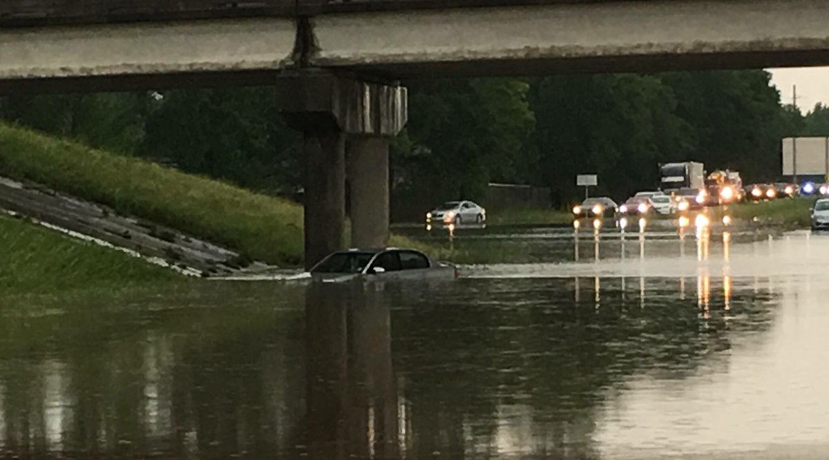
Torrential rain triggered flooding across southern Louisiana on Sunday, submerging streets and closing some highways. There are radar estimates of rainfall amounts in excess of 6 inches from Lake Charles to near Baton Rouge.
Thunderstorms on Sunday also forced the Lake Pontchartrain Causeway Bridge to be closed for a time.
This is not a safety first approach. Never a good idea to drive thru water. Hopefully everyone is okay.
Houston and New Orleans both received more than double their normal rainfall for the month of April.
Even a couple inches of rain in as many hours could cause flash flooding due to the saturated ground and high water levels in rivers, streams and bayous.
RELATED:
May to start on warm, muggy note in southeastern US
Goodbye Joaquin, Patricia and Erika: World Meteorological Organization retires 3 names from 2015 hurricane season
Weekly wrap-up: Severe storms rattle central US; UN seeks billions to offset El Nino's devastating blow to 60 million worldwide
Numerous rivers in southeastern Texas and southwestern Louisiana remain at or above flood stage. Any additional rainfall will cause water to quickly spill onto neighboring roads and lands.
"The flooding situation will only be exacerbated," Rossio warned.
Motorists are urged to turn around and find an alternate route if a flooded roadway is encountered. The water may be deeper than it appears and the roadway underneath could be compromised.

As is typical in springtime, any storms that erupt could quickly turn severe, adding an additional hazard to the area. Damaging winds and large hail will be the primary threats, but an isolated tornado or two could spin up.
The rain has suspended play enough at the PGA Zurich Classic in New Orleans that golfers will now be playing on Monday. Thunderstorms caused delays at the golf tournament on Thursday and Saturday, followed by another suspension on Sunday.
So you're telling us it rained here...
"High pressure will finally push the frontal boundary out of eastern Texas by Monday night," Rossio stated. "Drier air will push into New Orleans by Tuesday night."

The drier conditions and increasing amounts of sunshine will allow rivers and streams to gradually recede and the ground to begin to dry out.
The area of high pressure will keep rain away from the region into at least the early part of Mother's Day weekend.


No comments:
Post a Comment