Published: June 30,2016
The threat for heavy rain and flooding returns to the Plains into the Fourth of July weekend, and the rain could spread eastward and affect flood-ravaged West Virginia by Monday.
The National Weather Service has already hoisted flash flood watches in parts of the central Plains, including the Kansas City metro area.

Current Flood Alerts
Showers and thunderstorms will form along the stalled front each day, so the position of the front is key to where the heaviest rain sets up.

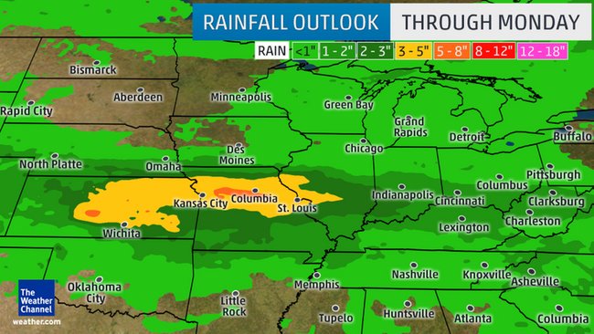
Heavy Rainfall Setup
During the Fourth of July weekend, parts of Kansas, Missouri and southern Illinois are the main areas at risk for heavy rain and flash flooding, though some thunderstorm clusters may also affect parts of neighboring states, as well.
(MORE: Why Summer's Thunderstorm Clusters are Both Important and Dangerous
By Sunday and Sunday night, the flood threat begins to spread eastward into parts of the Ohio Valley.
By the Fourth of July, the flood threat, unfortunately, sets up over the Mid-Atlantic, Appalachians and Ohio Valley, including West Virginia. This forecast will need to be monitored closely after the last week's third deadliest flood event in West Virginia's history.
(MORE: The Most Extreme Rainfall in All 50 States)

Rainfall Forecast
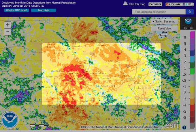
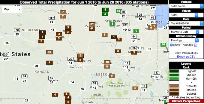
Interestingly, this part of the nation's heartland has been very dry in June. Some locations may end up with one of their top 10 driest Junes on record, according to the Southeast Regional Climate Center.
Grand Island, Nebraska, for instance, had only picked up a mere 0.05 inch of rain all month, through Wednesday, during what is typically the second wettest month of the year.Since this is a holiday weekend, travelers should be aware that flooding is a serious concern.
Weekend heavy rain threat targeting a recently dry area. Several cities in top 10 driest Junes, per @SERCC.
(MORE: At Least 234 People Have Been Killed By Flooding in the U.S. in Nearly 18 Months)
If you plan on traveling along Interstate 70 between Denver and Kansas City or from St. Louis to Indianapolis, be mindful that flooding is a possibility along this major highway.
For travelers heading back home on Monday, Interstate 79 could potentially be impacted in West Virginia between Morgantown and Charleston.
According to FEMA:
- 6 inches of water will reach the bottom of most passenger cars, causing loss of control and potential stalling.
- 1 foot of water will float many vehicles.
- 2 feet of rushing water will carry away most vehicles, including SUVs and pickups.
(MORE: Your Vehicle Can Be a Deadly Trap in a Flash Flood


No comments:
Post a Comment