More rounds of severe thunderstorms will pound parts of the storm-weary Midwest and south Wednesday following Tuesday's severe thunderstorms and tornadoes.
The main threats are large hail and strong, straight-line winds, in addition to the threat of local flash flooding.

Current Radar with Watches and Warnings

There were another 16 reports of tornadoes Tuesday, along with roughly another 150 reports of large hail and damaging winds mainly in three clusters: Kentucky, parts of north and central Texas, and parts of Nebraska and northern Kansas.
A tornado was reported Tuesday afternoon near Mayfield, Kentucky, injuring eight, but the injuries were non-life threatening.
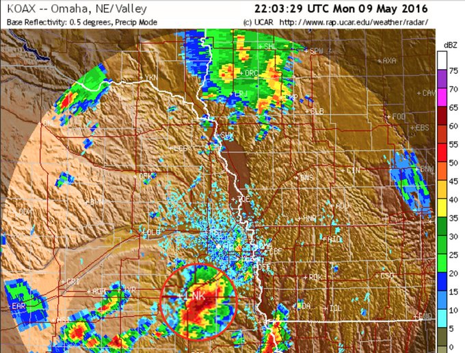
Early Wednesday morning, hail accumulated to a depth of 1 foot or more in parts of the Omaha metro, prompting snow plows to be called out.
Water rescues were required in parts of Trousdale County, and at least one vehicle was swept down a creek in Smith County. Over 5 inches of rain was reported in Sumner County as of Wednesday morning. No travel was advised in Macon County, with reports of homes surrounded by water.
(MORE: Flash Flood Emergency in Tennessee)
Below is our latest thinking on the forecast through Thursday.
Wednesday
- Forecast: A new jet-stream disturbance will swing through the Midwest, triggering more severe storms from parts of north-central Texas and Oklahoma into the mid-Mississippi Valley.
- Threats: Damaging wind gusts and large hail are the main concerns, but a few tornadoes are possible.
- Cities: Oklahoma City | Springfield, Missouri | Des Moines, Iowa

Wednesday's Thunderstorm Forecast
- Forecast: This system will slide eastward bringing the chance for a few severe thunderstorms from Tennessee to Michigan, Indiana and Ohio.
- Threats: Damaging wind gusts and large hail are the primary concerns.
- Cities: Memphis | Louisville, Kentucky | Cleveland

Thursday's Thunderstorm Forecast
Monday's Storm Reports
A large tornado was observed Monday afternoon near Katie, Oklahoma, with reports of one death and damage west of Interstate 35, with a house destroyed. Survey results have found EF4 damage from that tornado, making it the first EF4 rated tornado of 2016. Separate tornadoes near Sulphur, Oklahoma, and Bromide, Oklahoma, have been rated EF3.(LATEST NEWS: Storms Batter the Plains)
In all, eight tornadoes have been confirmed in Oklahoma on Monday by National Weather Service surveys.
 Preliminary reports of tornadoes on May 9, 2016. NWS storm surveys will determine final tornado counts in the next few days.
(NOAA/NWS/SPC)
Hail up to 4.25 inches in diameter was reported in Lincoln, Nebraska Monday evening, with damage to vehicles, homes, even a golf course. Farther south, grapefruit size hail, 4 inches in diameter, was observed near Wapanucka, Oklahoma Monday evening.
This massive #hail stone fell on SE side of Lincoln, NE earlier this evening. (Credit: Heather Meyer) #newx
Storm Reports From This Weekend
Sunday afternoon and evening tornadoes were reported in parts of Nebraska, Kansas, and Oklahoma, however there was no major damage. Hail as large as baseballs was reported in Hawley, Texas.(MORE: Severe Weather Impacts the Plains)
On Saturday evening, an EF2 rated tornado did damage and injured five people in northeast Colorado near the town of Wray. Another EF2 rated tornado touched down in Morgan County, Colorado, damaging motor homes and causing some minor injuries.
Snapped An Awesome Shot? Share Your Photo!
If you crave pictures of severe weather, you've found your home here. Upload your photos or video (taking care to only take photos and videos from a safe location) to us and share your experience!(PHOTO/VIDEO GALLERIES: Severe | Storms)


No comments:
Post a Comment