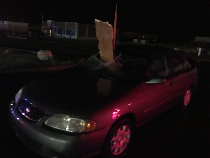
At least four tornadoes were reported across parts of north-central Illinois Wednesday evening, according to the National Weather Service office in Romeoville. Damage was reported in Pontiac, Marseilles, and Seneca.
Shard of wood penetrates car's windshield in Pontiac, IL. (Credit: @weatherchannel FB friend Kyle Piers) #tornado
The temporal and spatial distribution of those wind reports qualified the event as a low-end derecho, according to the criteria used in a 2005 study.
(MORE: What is a Derecho? | Summer's Derecho Alley)
For more on Wednesday and Wednesday night's storm reports, click here to read our impacts article.

Current Radar with Watches and Warnings

Below is our latest forecast thinking on the timing and magnitude of the severe threats through Friday.
Severe Weather Forecast
Thursday- Forecast: Scattered severe t-storms may fire up in the afternoon and early evening from the mid-Atlantic states and central Appalachians to the central High Plains of the Rockies.
- Threats: Damaging straight-line winds, some hail
- Cities: Cincinnati | Denver | Richmond, Virginia

Thursday's Thunderstorm Forecast
Storm Reports Recap
Wednesday
As mentioned earlier, severe thunderstorms first fired up Wednesday evening across northern Illinois, spawning at least four tornadoes. Damage surveys will be conducted Thursday by the National Weather Service to solidify tornado counts and harden up tornado paths and intensity estimates.The severe weather even disrupted a Copa America soccer tournament game at Chicago's Soldier Field.

Severe Weather Reports
Tuesday
Severe thunderstorms flared up in a broad zone from the mid-Atlantic states to the northern High Plains.For a complete recap of Tuesday and Tuesday night's severe weather impacts, click here to read the article.
Monday
Strong wind gusts took down trees and power lines in parts of Indiana, Illinois and Missouri on Monday afternoon. The threat shifted eastward by Monday evening, taking down additional trees and power lines in portions of Upstate New York. Additionally, some small hail was reported in places like Rochester, New York, late Monday evening.Father's Day Weekend
Hail as large as tennis balls, teacups and even grapefruits struck Minnesota Sunday evening as severe thunderstorms rolled through the state.(LATEST NEWS: Injuries Reported in Minnesota Storms)
The same cold front brought severe weather to northeast Montana on Saturday. Hailstones up to 4 inches in diameter were reported in Wolf Point. A few locations measured wind gusts in excess of 70 mph.
Snapped An Awesome Shot? Share Your Photo!
If you crave pictures of severe weather, you've found your home here. Upload your photos or video (taking care to only take photos and videos from a safe location) to us and share your experience!(PHOTO/VIDEO GALLERIES: Severe | Storms)


No comments:
Post a Comment