Winter Storm Decima – pronounced DEH-si-mah – will close out its cross-country journey in the East on Sunday.
(MORE: The Science Behind Naming Winter Storms | 2016-2017 Winter Storm Names)

Current Radar, Temperatures, Conditions
(INTERACTIVE: Winter Storm Decima Tracker)

Current Winter Alerts
(Latest News: Pileups on Icy Roads in the Mid-Atlantic)
Sunday's Forecast

Sunday's Forecast
- As the cold front slices into the East, any rain will change to a brief bout of light snow or a wintry mix in the Ohio Valley, Appalachians and parts of the interior Northeast well inland from Interstate 95.
- Near Interstate 95 from southern New England into Virginia, precipitation should end as mainly rain by late in the day Sunday.
- A few storms are possible across portions of the South with the trailing cold front.
- Wrap around winds may assist the Upper Great Lakes in producing lake-effect snow especially east of Lake Michigan.
- Cities: Pittsburgh | Albany | Boston | New York | Washington D.C.
Storm Recap
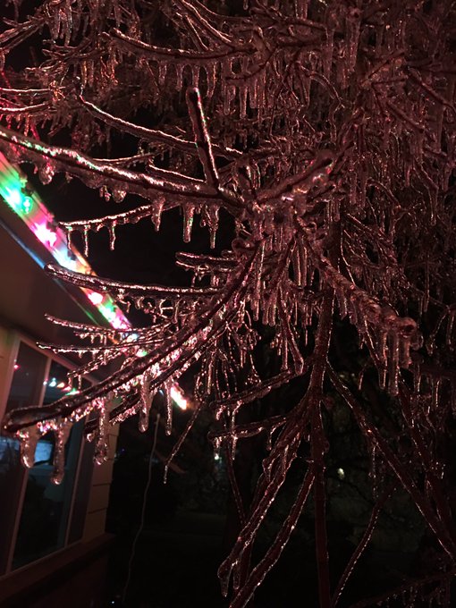
Decima delivered an ice storm to parts of Oregon's Willamette Valley, Wednesday. Up to 0.88 inches of accumulated ice lead to widespread tree damage, downed power lines and even some trees down on homes in Eugene.
@JimCantore some pics from Eugene or freezing rain lots of trees down and power outages.
A deadly accident, likely due to icy roads, occurred Saturday morning on I-95 northbound near Baltimore after a tanker truck fell off an Interstate 95 bridge and exploded. Both sides of the interstate were shut down due to this 55-car pileup.
(Earlier this Week: Winter Storm Decima Triggers Avalanche in Oregon, Cripples Evening Commute)
On Thursday, Decima produced wind gusts of 60-121 mph in some typically wind-prone and high-elevation locations near the California and Nevada border. A semi-truck was blown over by the high winds near Washoe City, Nevada.
Decima's snow and ice then spread through the Midwest and East Friday into Saturday.
Here are a few notable snow and ice reports from Decima by state, so far, as of Sunday morning:
- California: Kirkwood: 18 inches; Squaw Valley: 6 inches
- Colorado: Skyway: 33 inches; Mount Crested Butte: 23.5 inches; Breckenridge: 16.2 inches
- Connecticut: Norfolk: 8.0 inches; Weatogue: 7.3 inches
- Idaho: Ketchum: 35.4 inches; Mackay: 29.9 inches; Galena: 14.0 inches; Salmon: 7 inches
- Illinois: Near Nora: 4.6 inches
- Indiana: Jimtown: 3 inches
- Iowa: Ringsted: 9.0 inches; Lester: 7.3 inches; Superior: 7.0 inches
- Maine: South Paris: 8 inches; Bangor: 6.0 inches
- Massachusetts: Hardwick: 8.0 inches; Southwick: 7.8 inches; Boston (Logan): 4.3 inches
- Michigan: Near Negaunee: 14 inches
- Minnesota: Jackson: 10.0 inches
- Missouri: Trenton: 4.3 inches
- Montana: West Yellowstone: 33.6 inches; Big Timber: 19 inches; 13 inches near Stevensville; 11 inches in Billings
- Nebraska: Harrison: 9.0 inches
- Nevada: Near Kings River Valley: 9 inches
- New Hampshire: Waterville Valley: 9 inches; Peterborough: 7.0 inches; Nashua: 6.0 inches
- New Jersey: Montague: 5.0 inches
- New Mexico: Canon Plaza: 16 inches; Arroyo Seco: 14 inches
- New York: Saugerties: 8 inches; NYC - Central Park: 2.8 inches
- Ohio: Orwell: 6.0 inches
- Oklahoma: Beaver: 1.5 Inch
- Oregon: Near La Pine: 21 inches; Bend: 17 inches; Salem: up to 5 inches; Portland (NWS office): 2.3 inches
- Pennsylvania: Leonard Harrison: 3.5 inches
- Rhode Island: Burrilville: 5.0 inches
- South Dakota: Murdo: 10.0 inches
- Utah: Brighton Crest: 33.0 inches; Garden City: 20.8 inches; Powder Mountain: 9.0 inches
- Vermont: Harmonyville: 6.5 inches
- Washington: Goldendale: up to 7 inches; Walla Walla: up to 5 inches; Yakima: 3 inches
- Wisconsin: Cedar: 14.0 inches
- Wyoming: Driggs: 24.3 inches: Blind Bull Summit: 20 inches; Torington: 12 inches
Ice Reports
- Springfield, Oregon: 0.88 inches
- Eugene, Oregon: 0.80 inches
- Hidden Valley, Pennsylvania: 0.40 inches
- Hedgesville, West Virginia: 0.30 inches
- Moon Township, Pennsylvania: 0.30 inches
- OSU Airport: 0.30 inches
- Oakland, Maryland: 0.25 inches
- Near New Philadelphia, Ohio: 0.22 inches
- Ashburn, Virginia: 0.13 inches
- Alpine, Indiana: 0.12 inches
- Middletown, New Jersey: 0.10 inches
- Dulles International Airport, Virginia: 0.10 inches
- Near Lincoln and Springfield, Illinois: 0.10 inches
- New York City: 0.08 inches
- Emporia, Kansas: 0.06 inches
- Rocky Mount-Wilson Airport, North Carolina: 0.03 inches
- Numerous accidents in Indianapolis with 0.02 inches
- Light ice accumulations were reported across central Missouri.


No comments:
Post a Comment