By Kristina Pydynowski, AccuWeather senior meteorologist
January 12,2017, 1:49:30PM,EST
Winter will have a firm grip on the United Kingdom into at least Saturday as cold winds howl and snow showers stream over parts of the country.
The passage of the depression that spread rain and snow over southern England to end Thursday will open the door for a polar air mass to plunge across the U.K. by Friday.
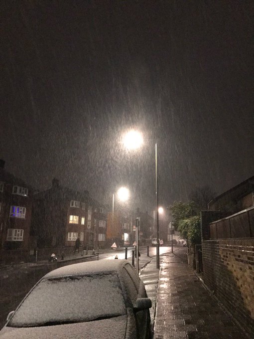
We have #londonsnow in Beckenham!! So wet it should be called #londonslush
At the same time, locally damaging winds and wintry weather will sweep from Scotland to eastern England. Disruptive snow will total 8-15 cm (3-6 inches) in the Scottish Highlands by the start of Friday.

All of the U.K. will have to endure blustery winds that will hold AccuWeather RealFeel® Temperatures to below freezing on Friday.
“Wind gusts across England can top out at 45 mph (72 km/h) with some gusts to 60 mph (95 km/h) along the eastern coast,” AccuWeather Meteorologist Courtney Spamer said.
Such winds will briefly buffet London in the morning, threatening to cause sporadic power outages and travel delays.
“It will remain breezy across England on Saturday, but a wintry shower will linger near the coasts,” Spamer said.
The winds will not be quite as harsh on Saturday, but the breeze will once again hold daytime RealFeels near to below freezing. Anyone with plans early this weekend will want to bundle up to avoid frostbite.
RELATED:
Interactive UK radar
MinuteCast® for your location
How rapid Arctic sea ice melt may alter global weather patterns
Spamer stated that showers will also continue across Scotland, Northern Ireland and northern England on Saturday. “Some showers will be wintry in the higher elevations.”
The most persistent snow showers in the hills of northern Scotland and Wales could leave a fresh several centimeters (a couple inches) on Friday and Saturday. Otherwise, locally heavier snow showers elsewhere could quickly whiten the ground and coat roads.
Snow will likely struggle to stick to most paved surfaces during the midday and afternoon hours in the lower elevations. However, any wet or slushy areas during the day would turn slick at night.
Relief from the cold snap will come to parts of the U.K. on Sunday following the passage of a warm front. Which communities see temperatures rebound the most will depend on the exact track the front takes across the U.K. Odds currently favor the greatest warming occurring over the northern U.K.
As the front moves across the U.K., there will be a period of rain that can start as or mix with snow at its onset.
High pressure building westward from Scandinavia should once again push cooler air into the U.K. early next week, but only across southern areas. Mild air is likely to flow around the high and into Northern Ireland and Scotland.


No comments:
Post a Comment