Published: December 6,2016
As arctic air invades the Lower-48 states and spreads eastward through the week, lake-effect snow showers and squalls will likely develop downwind of the Great Lakes beginning late Wednesday or Thursday.
An upper-level low-pressure system will set up over southern Canada, spinning bitterly cold west to northwest winds over the relatively warmer Great Lakes.
(MORE: First Arctic Blast of the Season Arriving)

The temperatures of the Great Lakes are currently in the 40s, and this incoming arctic air mass will be more than cold enough to irritate the mild lakes.
In fact, lake temperatures are running warmer than they have at this time each of the last five years, according to NOAA's Great Lakes Environmental Research Laboratory.
The cold, dry air will pick up moisture and heat from the lakes, which will condense into clouds and dump snow downwind of the lakes.
(MORE: The Science Behind Lake-Effect Snow)
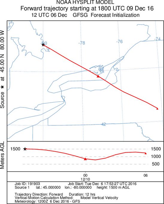
Some localized, intense snow bands may form, especially off Lakes Erie and Ontario, due to an upwind connection with the upper Great Lakes and possibly even the Hudson Bay at times.
Map shows
our air Fri/Sat will be coming across not only Lake Ontario but Georgian
Bay. This can lead to some of our heavier snows.

Snowfall Outlook
This may very well be the case late this week and into the first half of the weekend. Therefore, it is nearly impossible to accurately predict snowfall amounts this far out in time.
We do know, however, that with this type of setup, the heaviest snow will likely pile up east and southeast of the Great Lakes.
(FORECAST: Syracuse, New York | Buffalo, New York | Erie, Pennsylvania | Traverse City, Michigan)
Any lake-effect snow showers and flurries should gradually diminish Saturday, but a new weather system may bring a more widespread area of snow to the Great Lakes and Northeast Sunday into Monday.
Be sure to check back frequently with weather.com for updates on this busy weather pattern.


No comments:
Post a Comment